Property Record
1000 S Central St, Ferris, TX 75125
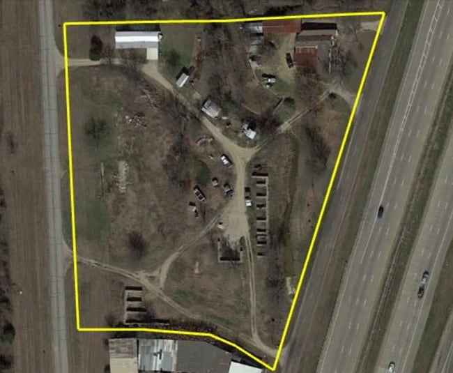

Property Detail
1000 S Central St
188933
824 MASON PHELPS 3.0552 ACRES
Commercialnec
Ellis
A Areas with a 1% annual chance of flooding and a 26% chance of flooding over the life of a 30-year mortgage.
Texas
2024
3.06 AC
2024
Ellis County
060104
Dallas/Ft Worth
600 SF
Dallas-Fort Worth-Arlington, TX
NEARBY LISTINGS FOR SALE OR LEASE
DEMOGRAPHICS near 1000 S Central St
1 mile
3 mile
5 mile
2025 Total Population
916
7,585
14,115
2030 Population
1,073
8,901
16,386
Pop Growth 2025-2030
+ 17.14%
+ 17.35%
+ 16.09%
Average Age
37
37
37
2025 Total Households
304
2,484
4,579
HH Growth 2025-2030
+ 17.11%
+ 17.43%
+ 16.23%
Median Household Inc
$63,261
$67,017
$72,743
Avg Household Size
3.00
3.00
3.10
2025 Avg HH Vehicles
2.00
2.00
2.00
Median Home Value
$172,033
$225,308
$250,319
Median Year Built
1976
1993
1995
Nearby Places
Map Layers
Map Styles
 Street
 Aerial
Layers
 Traffic
 Biking
Places
Listings with unknown addresses are not visible on the map
- Restaurants
- Banks
- Shops
- Fitness
- Groceries
PUBLIC TRANSPORTATION
AIRPORT
Dallas Love Field
Drive
Walk
Distance
Dallas Love Field
38 min
27.0 mi
Freight Ports
Port of Shreveport
Drive
Walk
Distance
Port of Shreveport
218 min
203.0 mi
SALE & LEASE HISTORY
LISTING DATE
SALE/LEASE

Dec 14, 2017
For Sale
Nearby Properties
Address
Land Use
TOTAL SIZE
Lot Size
Zoning
Address
Land Use
TOTAL SIZE
Lot Size
Zoning
62.41 AC
Z31
Address
Land Use
TOTAL SIZE
Lot Size
Zoning
266,199 SF
33.27 AC
Address
Land Use
TOTAL SIZE
Lot Size
Zoning
89,387 SF
29.86 AC
Address
Land Use
TOTAL SIZE
Lot Size
Zoning
12,444 SF
5 AC
Address
Land Use
TOTAL SIZE
Lot Size
Zoning
116,081 SF
19.03 AC
Address
Land Use
TOTAL SIZE
Lot Size
Zoning
1,400 SF
75.81 AC
Z05
Address
Land Use
TOTAL SIZE
Lot Size
Zoning
56,023 SF
7.52 AC
Address
Land Use
TOTAL SIZE
Lot Size
Zoning
70,799 SF
15.41 AC
Address
Land Use
TOTAL SIZE
Lot Size
Zoning
25,780 SF
100.30 AC
Z05
Address
Land Use
TOTAL SIZE
Lot Size
Zoning
42,384 SF
5.91 AC
Address
Land Use
TOTAL SIZE
Lot Size
Zoning
22,736 SF
9.03 AC
Address
Land Use
TOTAL SIZE
Lot Size
Zoning
49,320 SF
25.10 AC
Address
Land Use
TOTAL SIZE
Lot Size
Zoning
15,000 SF
133.63 AC
Address
Land Use
TOTAL SIZE
Lot Size
Zoning
12,711 SF
268.57 AC
Address
Land Use
TOTAL SIZE
Lot Size
Zoning
4,820.86 AC
Address
Land Use
TOTAL SIZE
Lot Size
Zoning
26,779 SF
11.29 AC
Address
Land Use
TOTAL SIZE
Lot Size
Zoning
17,175 SF
30.59 AC
Address
Land Use
TOTAL SIZE
Lot Size
Zoning
7,884 SF
1.15 AC
Address
Land Use
TOTAL SIZE
Lot Size
Zoning
17,698 SF
10.22 AC
Address
Land Use
TOTAL SIZE
Lot Size
Zoning
8,544 SF
1.65 AC
Address
Land Use
TOTAL SIZE
Lot Size
Zoning
17,030 SF
1.08 AC
Address
Land Use
TOTAL SIZE
Lot Size
Zoning
10,430 SF
1.71 AC
Address
Land Use
TOTAL SIZE
Lot Size
Zoning
27,850 SF
0.72 AC
Address
Land Use
TOTAL SIZE
Lot Size
Zoning
9,360 SF
1.25 AC
Address
Land Use
TOTAL SIZE
Lot Size
Zoning
11,386 SF
3.23 AC
Address
Land Use
TOTAL SIZE
Lot Size
Zoning
8,125 SF
0.86 AC
Address
Land Use
TOTAL SIZE
Lot Size
Zoning
44,644 SF
1.87 AC
Address
Land Use
TOTAL SIZE
Lot Size
Zoning
93,525 SF
5.47 AC
Address
Land Use
TOTAL SIZE
Lot Size
Zoning
51,664 SF
5.06 AC
Address
Land Use
TOTAL SIZE
Lot Size
Zoning
49.48 AC
The World's #1 Commercial Real Estate Marketplace
Connect with us
© 2026 CoStar Group
The information above has been obtained from sources believed reliable. While we do not doubt its accuracy we have not verified it and make no guarantee, warranty or representation about it. It is your responsibility to independently confirm its accuracy and completeness. Any projections, opinions, assumptions, or estimates used are for example only and do not represent the current or future performance of the property. The value of this transaction to you depends on tax and other factors which should be evaluated by your tax, financial, and legal advisors. You and your advisors should conduct a careful, independent investigation of the property to determine to your satisfaction the suitability of the property for your needs.