Property Record
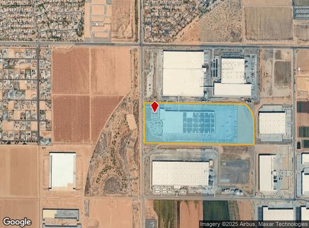
10001 N Reems Rd, Waddell, AZ 85355
NEARBY LISTINGS FOR SALE OR LEASE
Property Detail
10001 N Reems Rd
Phoenix-Mesa-Scottsdale, AZ
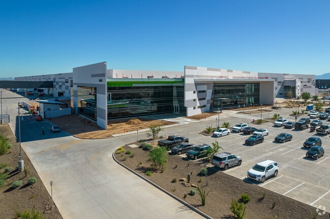
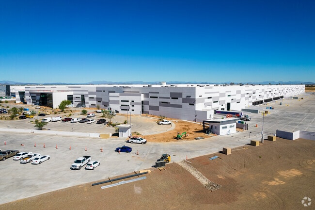
Red Bull North America
501-42-982
RED BULL NORTH AMERICA MCR 1532-27
Warehouse
Maricopa
X
Arizona
04013C1660L
1
2025
66.20 AC
2025
Glendale
061044
Phoenix
797,969 SF
DEMOGRAPHICS near 10001 N Reems Rd
1 Mile
3 Mile
5 Mile
2024 Total Population
3,282
41,933
176,123
2029 Population
3,534
46,073
192,108
Pop Growth 2024-2029
+ 7.68%
+ 9.87%
+ 9.08%
Average Age
35
36
36
2024 Total Households
915
12,869
55,771
HH Growth 2024-2029
+ 7.76%
+ 9.95%
+ 9.18%
Median Household Inc
$100,113
$102,548
$85,830
Avg Household Size
3.40
3.20
3.10
2024 Avg HH Vehicles
2.00
2.00
2.00
Median Home Value
$366,266
$377,224
$350,602
Median Year Built
2004
2006
2004
Nearby Places
Map Layers
Map Styles
 Street
 Aerial
- Restaurants
- Banks
- Shops
- Fitness
- Groceries
PUBLIC TRANSPORTATION
AIRPORT
Phoenix Sky Harbor International
DRIVE
WALK
Distance
Phoenix Sky Harbor International
46 min
32.4 mi
Freight Ports
Port of San Diego
DRIVE
WALK
Distance
Port of San Diego
384 min
343.8 mi
Nearby Properties
Address
Land Use
TOTAL SIZE
Lot Size
Zoning
Address
Land Use
TOTAL SIZE
Lot Size
Zoning
71.40 AC
Address
Land Use
TOTAL SIZE
Lot Size
Zoning
35.74 AC
Address
Land Use
TOTAL SIZE
Lot Size
Zoning
73.09 AC
Address
Land Use
TOTAL SIZE
Lot Size
Zoning
1,201,280 SF
74.43 AC
PAD
Address
Land Use
TOTAL SIZE
Lot Size
Zoning
1,758,410 SF
98.58 AC
PAD
Address
Land Use
TOTAL SIZE
Lot Size
Zoning
1,259,666 SF
71.73 AC
R-43
Address
Land Use
TOTAL SIZE
Lot Size
Zoning
1,200,140 SF
76.91 AC
Address
Land Use
TOTAL SIZE
Lot Size
Zoning
16,341 SF
174.45 AC
R-43
Address
Land Use
TOTAL SIZE
Lot Size
Zoning
1,109,869 SF
67.32 AC
R-43
Address
Land Use
TOTAL SIZE
Lot Size
Zoning
570,080 SF
36.76 AC
Address
Land Use
TOTAL SIZE
Lot Size
Zoning
1,178,814 SF
64.63 AC
Address
Land Use
TOTAL SIZE
Lot Size
Zoning
634,560 SF
36.84 AC
PAD
Address
Land Use
TOTAL SIZE
Lot Size
Zoning
294,360 SF
21.69 AC
EI
Address
Land Use
TOTAL SIZE
Lot Size
Zoning
455,936 SF
23.97 AC
Address
Land Use
TOTAL SIZE
Lot Size
Zoning
210,197 SF
19.40 AC
RH15
Address
Land Use
TOTAL SIZE
Lot Size
Zoning
364,700 SF
22.20 AC
Address
Land Use
TOTAL SIZE
Lot Size
Zoning
345,916 SF
30.97 AC
PAD
Address
Land Use
TOTAL SIZE
Lot Size
Zoning
67,417 SF
12.16 AC
PAD
Address
Land Use
TOTAL SIZE
Lot Size
Zoning
418,305 SF
24.06 AC
PAD
Address
Land Use
TOTAL SIZE
Lot Size
Zoning
38,400 SF
4.97 AC
I-2
Address
Land Use
TOTAL SIZE
Lot Size
Zoning
90,636 SF
13.27 AC
PAD
Address
Land Use
TOTAL SIZE
Lot Size
Zoning
90,387 SF
14.97 AC
PAD
Address
Land Use
TOTAL SIZE
Lot Size
Zoning
145,491 SF
37.61 AC
PAD
Address
Land Use
TOTAL SIZE
Lot Size
Zoning
104,619 SF
11.45 AC
PAD
Address
Land Use
TOTAL SIZE
Lot Size
Zoning
905,330 SF
88.90 AC
PAD
Address
Land Use
TOTAL SIZE
Lot Size
Zoning
154,628 SF
16.36 AC
PAD
Address
Land Use
TOTAL SIZE
Lot Size
Zoning
86,770 SF
18.26 AC
PAD
Address
Land Use
TOTAL SIZE
Lot Size
Zoning
340,420 SF
16.26 AC
The World's #1 Commercial Real Estate Marketplace
Connect with us
© 2025 CoStar Group
The information above has been obtained from sources believed reliable. While we do not doubt its accuracy we have not verified it and make no guarantee, warranty or representation about it. It is your responsibility to independently confirm its accuracy and completeness. Any projections, opinions, assumptions, or estimates used are for example only and do not represent the current or future performance of the property. The value of this transaction to you depends on tax and other factors which should be evaluated by your tax, financial, and legal advisors. You and your advisors should conduct a careful, independent investigation of the property to determine to your satisfaction the suitability of the property for your needs.