Property Record
1001 Summitview Ave, Yakima, WA 98902


NEARBY LISTINGS FOR SALE OR LEASE
Property Detail
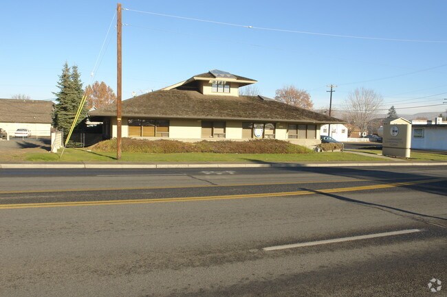
1001 Summitview Ave
Yakima, WA
Kers Villa
181324-24625
SECTION 24 TOWNSHIP 13 RANGE 18 QUARTER NW: BLACKS ADDITION TO NORTH YAKIMA (A-90); BLOCK 57 LOT 4 EX N 10 FT ALSO ALL LOTS 5 & 6 OF BLK 57 OF BLACKS ADDITION EX R/W FOR STR ALSO E 61.7 FT OF S 140 FT OF LOT 56 OF KERS VILLA LOTS (A-37) EX BEG SE COR
Commercialnec
Yakima
X
Washington
53077C1032D
4
2025
0.39 AC
2025
Greater Yakima
000700
Yakima
5,262 SF
DEMOGRAPHICS near 1001 Summitview Ave
1 Mile
3 Mile
5 Mile
2024 Total Population
18,730
84,443
130,920
2029 Population
18,738
84,807
131,906
Pop Growth 2024-2029
+ 0.04%
+ 0.43%
+ 0.75%
Average Age
34
36
37
2024 Total Households
6,473
30,414
47,806
HH Growth 2024-2029
(0.05%)
+ 0.46%
+ 0.74%
Median Household Inc
$41,542
$47,757
$57,936
Avg Household Size
2.70
2.60
2.60
2024 Avg HH Vehicles
2.00
2.00
2.00
Median Home Value
$214,956
$219,811
$260,104
Median Year Built
1953
1967
1973
Nearby Places
Map Layers
Map Styles
 Street
 Aerial
- Restaurants
- Banks
- Shops
- Fitness
- Groceries
PUBLIC TRANSPORTATION
AIRPORT
Yakima Air Trml/McAllister Field
DRIVE
WALK
Distance
Yakima Air Trml/McAllister Field
8 min
3.0 mi
Freight Ports
Port of Tacoma
DRIVE
WALK
Distance
Port of Tacoma
184 min
155.3 mi
Nearby Properties
Address
Land Use
TOTAL SIZE
Lot Size
Zoning
Address
Land Use
TOTAL SIZE
Lot Size
Zoning
331,736 SF
34.95 AC
R1
Address
Land Use
TOTAL SIZE
Lot Size
Zoning
390,527 SF
11.86 AC
R3
Address
Land Use
TOTAL SIZE
Lot Size
Zoning
409,453 SF
8.25 AC
R3
Address
Land Use
TOTAL SIZE
Lot Size
Zoning
326,323 SF
30.05 AC
R2
Address
Land Use
TOTAL SIZE
Lot Size
Zoning
499,230 SF
22.57 AC
M1
Address
Land Use
TOTAL SIZE
Lot Size
Zoning
193,955 SF
9.94 AC
C1
Address
Land Use
TOTAL SIZE
Lot Size
Zoning
474,587 SF
18.06 AC
M1
Address
Land Use
TOTAL SIZE
Lot Size
Zoning
87,068 SF
2.89 AC
CBD
Address
Land Use
TOTAL SIZE
Lot Size
Zoning
176,098 SF
1.67 AC
CBD
Address
Land Use
TOTAL SIZE
Lot Size
Zoning
235,222 SF
14.23 AC
M1
Address
Land Use
TOTAL SIZE
Lot Size
Zoning
106,878 SF
3.46 AC
RD
Address
Land Use
TOTAL SIZE
Lot Size
Zoning
298,360 SF
15.21 AC
M1
Address
Land Use
TOTAL SIZE
Lot Size
Zoning
329,388 SF
16.13 AC
M1
Address
Land Use
TOTAL SIZE
Lot Size
Zoning
501,270 SF
21.09 AC
M1
Address
Land Use
TOTAL SIZE
Lot Size
Zoning
82,436 SF
11 AC
RD
Address
Land Use
TOTAL SIZE
Lot Size
Zoning
65,606 SF
3.39 AC
R2
Address
Land Use
TOTAL SIZE
Lot Size
Zoning
100,992 SF
9.15 AC
RD
Address
Land Use
TOTAL SIZE
Lot Size
Zoning
91,856 SF
9.17 AC
RD
Address
Land Use
TOTAL SIZE
Lot Size
Zoning
132,213 SF
4 AC
R3
Address
Land Use
TOTAL SIZE
Lot Size
Zoning
162,216 SF
11 AC
M1
Address
Land Use
TOTAL SIZE
Lot Size
Zoning
56,505 SF
2.75 AC
C1
Address
Land Use
TOTAL SIZE
Lot Size
Zoning
57,009 SF
212.58 AC
AS
Address
Land Use
TOTAL SIZE
Lot Size
Zoning
105,756 SF
6.89 AC
R3
Address
Land Use
TOTAL SIZE
Lot Size
Zoning
327,890 SF
18.44 AC
M1
Address
Land Use
TOTAL SIZE
Lot Size
Zoning
197,263 SF
18.08 AC
C1
Address
Land Use
TOTAL SIZE
Lot Size
Zoning
128,789 SF
6.65 AC
R3
Address
Land Use
TOTAL SIZE
Lot Size
Zoning
162,933 SF
14.96 AC
SCC
Address
Land Use
TOTAL SIZE
Lot Size
Zoning
99,000 SF
5.44 AC
C1
Address
Land Use
TOTAL SIZE
Lot Size
Zoning
97,976 SF
3.98 AC
SCC
Address
Land Use
TOTAL SIZE
Lot Size
Zoning
196,486 SF
10.61 AC
M1
The World's #1 Commercial Real Estate Marketplace
Connect with us
© 2026 CoStar Group
The information above has been obtained from sources believed reliable. While we do not doubt its accuracy we have not verified it and make no guarantee, warranty or representation about it. It is your responsibility to independently confirm its accuracy and completeness. Any projections, opinions, assumptions, or estimates used are for example only and do not represent the current or future performance of the property. The value of this transaction to you depends on tax and other factors which should be evaluated by your tax, financial, and legal advisors. You and your advisors should conduct a careful, independent investigation of the property to determine to your satisfaction the suitability of the property for your needs.