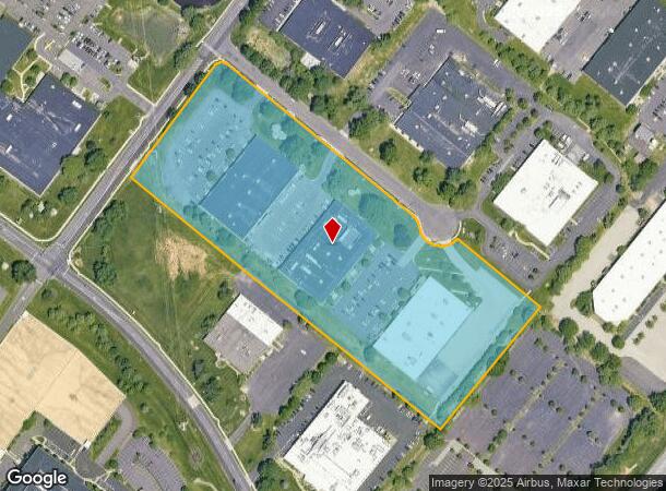
Property Record
131 Rock Rd, Horsham, PA 19044

Current Lease Availabilities
NEARBY LISTINGS FOR SALE OR LEASE
Property Detail
131 Rock Rd
36-00-10235-016
INC 360010235034/360010235052 U 27-28 L 14-17-20 U-27,28 CONVERTED TO OFFICE 1991
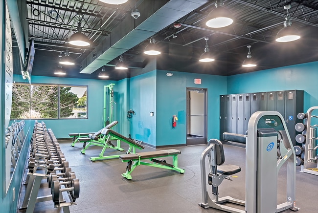
Officebuilding
Montgomery
X
Pennsylvania
42091C0292G
14-17
2024
10.38 AC
2025
East Montgomery Cty
200502
Philadelphia
114,156 SF
Philadelphia-Camden-Wilmington, PA-NJ-DE-MD
DEMOGRAPHICS near 131 Rock Rd
1 Mile
3 Mile
5 Mile
2024 Total Population
9,091
91,041
215,217
2029 Population
9,238
92,448
218,421
Pop Growth 2024-2029
+ 1.62%
+ 1.55%
+ 1.49%
Average Age
40
41
43
2024 Total Households
3,865
35,187
83,503
HH Growth 2024-2029
+ 1.89%
+ 1.64%
+ 1.54%
Median Household Inc
$80,998
$100,856
$99,971
Avg Household Size
2.30
2.50
2.50
2024 Avg HH Vehicles
2.00
2.00
2.00
Median Home Value
$318,716
$337,917
$365,157
Median Year Built
1970
1964
1965
Nearby Places
Map Layers
Map Styles
 Street
 Aerial
- Restaurants
- Banks
- Shops
- Fitness
- Groceries
PUBLIC TRANSPORTATION
COMMUTER RAIL
Willow Grove (R2 - Southeastern Pennsylvania Transportation Authority Regional Rail (SEPTA Regional Rail))
DRIVE
WALK
Distance
Willow Grove (R2 - Southeastern Pennsylvania Transportation Authority Regional Rail (SEPTA Regional Rail))
8 min
2.9 mi
Hatboro (R2 - Southeastern Pennsylvania Transportation Authority Regional Rail (SEPTA Regional Rail))
DRIVE
WALK
Distance
Hatboro (R2 - Southeastern Pennsylvania Transportation Authority Regional Rail (SEPTA Regional Rail))
9 min
2.9 mi
AIRPORT
Trenton Mercer
DRIVE
WALK
Distance
Trenton Mercer
41 min
27.1 mi
Philadelphia International
DRIVE
WALK
Distance
Philadelphia International
54 min
35.6 mi
Freight Ports
Port of Philadelphia
DRIVE
WALK
Distance
Port of Philadelphia
33 min
16.3 mi
Nearby Properties
Address
Land Use
TOTAL SIZE
Lot Size
Zoning
Address
Land Use
TOTAL SIZE
Lot Size
Zoning
1,006.32 AC
I1
Address
Land Use
TOTAL SIZE
Lot Size
Zoning
794,476 SF
30.14 AC
PB
Address
Land Use
TOTAL SIZE
Lot Size
Zoning
678,360 SF
67.10 AC
LIM
Address
Land Use
TOTAL SIZE
Lot Size
Zoning
368,495 SF
68.37 AC
PI
Address
Land Use
TOTAL SIZE
Lot Size
Zoning
368,492 SF
58.98 AC
I1
Address
Land Use
TOTAL SIZE
Lot Size
Zoning
335,203 SF
31.20 AC
C1
Address
Land Use
TOTAL SIZE
Lot Size
Zoning
377,044 SF
58.73 AC
INST
Address
Land Use
TOTAL SIZE
Lot Size
Zoning
752,716 SF
0.29 AC
OC
Address
Land Use
TOTAL SIZE
Lot Size
Zoning
571,213 SF
67.31 AC
M
Address
Land Use
TOTAL SIZE
Lot Size
Zoning
498,072 SF
5.39 AC
TC1
Address
Land Use
TOTAL SIZE
Lot Size
Zoning
272,344 SF
9.76 AC
I2
Address
Land Use
TOTAL SIZE
Lot Size
Zoning
343,852 SF
8.42 AC
I
Address
Land Use
TOTAL SIZE
Lot Size
Zoning
435,888 SF
16.35 AC
MD
Address
Land Use
TOTAL SIZE
Lot Size
Zoning
242,560 SF
1.40 AC
OC
Address
Land Use
TOTAL SIZE
Lot Size
Zoning
167,743 SF
20.70 AC
T
Address
Land Use
TOTAL SIZE
Lot Size
Zoning
287,030 SF
106.42 AC
INST
Address
Land Use
TOTAL SIZE
Lot Size
Zoning
248,795 SF
16.64 AC
PI
Address
Land Use
TOTAL SIZE
Lot Size
Zoning
251,935 SF
13.03 AC
TC1
Address
Land Use
TOTAL SIZE
Lot Size
Zoning
257,010 SF
34.12 AC
INST
Address
Land Use
TOTAL SIZE
Lot Size
Zoning
84,400 SF
4.70 AC
I
Address
Land Use
TOTAL SIZE
Lot Size
Zoning
236,808 SF
17.66 AC
PB
Address
Land Use
TOTAL SIZE
Lot Size
Zoning
388,525 SF
25.28 AC
OC
Address
Land Use
TOTAL SIZE
Lot Size
Zoning
309,264 SF
9.93 AC
I
Address
Land Use
TOTAL SIZE
Lot Size
Zoning
902,127 SF
89.67 AC
OC
Address
Land Use
TOTAL SIZE
Lot Size
Zoning
170,183 SF
46.63 AC
I1
Address
Land Use
TOTAL SIZE
Lot Size
Zoning
103,435 SF
41.35 AC
A
Address
Land Use
TOTAL SIZE
Lot Size
Zoning
256,679 SF
14 AC
MI
Address
Land Use
TOTAL SIZE
Lot Size
Zoning
115,961 SF
12.70 AC
OC
Address
Land Use
TOTAL SIZE
Lot Size
Zoning
209,417 SF
20.72 AC
C1
Address
Land Use
TOTAL SIZE
Lot Size
Zoning
420,736 SF
29.47 AC
LI
The World's #1 Commercial Real Estate Marketplace
Connect with us
© 2026 CoStar Group
The information above has been obtained from sources believed reliable. While we do not doubt its accuracy we have not verified it and make no guarantee, warranty or representation about it. It is your responsibility to independently confirm its accuracy and completeness. Any projections, opinions, assumptions, or estimates used are for example only and do not represent the current or future performance of the property. The value of this transaction to you depends on tax and other factors which should be evaluated by your tax, financial, and legal advisors. You and your advisors should conduct a careful, independent investigation of the property to determine to your satisfaction the suitability of the property for your needs.