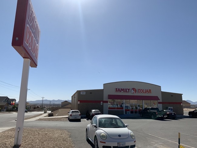
Property Record
101 Nonap Rd, El Paso, TX 79928


NEARBY LISTINGS FOR SALE OR LEASE
Property Detail
101 Nonap Rd
El Paso
Horizon Hills Estates
El Paso, TX
BLK 28 HORIZON HILLS ESTATES REPLAT C LOT 1
H767-000-0280-0100
El Paso
Commercialnec
Texas
2024
1
2025
1 AC
010362
East
8,320 SF
DEMOGRAPHICS near 101 Nonap Rd
1 mile
3 mile
5 mile
2024 Total Population
6,287
58,477
159,829
2029 Population
6,352
59,779
162,560
Pop Growth 2024-2029
+ 1.03%
+ 2.23%
+ 1.71%
Average Age
31
33
35
2024 Total Households
1,858
17,269
49,176
HH Growth 2024-2029
+ 0.97%
+ 2.25%
+ 1.70%
Median Household Inc
$55,068
$66,210
$55,097
Avg Household Size
3.30
3.30
3.20
2024 Avg HH Vehicles
2.00
2.00
2.00
Median Home Value
$155,166
$169,756
$148,846
Median Year Built
2010
2007
2000
Nearby Places
Map Layers
Map Styles
 Street
 Aerial
Transit
 Traffic
 Biking
Places
Listings with unknown addresses are not visible on the map
- Restaurants
- Banks
- Shops
- Fitness
- Groceries
PUBLIC TRANSPORTATION
AIRPORT
El Paso International
Drive
Walk
Distance
El Paso International
29 min
15.2 mi
SALE & LEASE HISTORY
LISTING DATE
SALE/LEASE

Aug 26, 2019
For Sale
Nearby Properties
Address
Land Use
TOTAL SIZE
Lot Size
Zoning
Address
Land Use
TOTAL SIZE
Lot Size
Zoning
2,562,545 SF
62.04 AC
Address
Land Use
TOTAL SIZE
Lot Size
Zoning
770,870 SF
44.65 AC
Address
Land Use
TOTAL SIZE
Lot Size
Zoning
799,095 SF
52.29 AC
Address
Land Use
TOTAL SIZE
Lot Size
Zoning
800,449 SF
50.57 AC
Address
Land Use
TOTAL SIZE
Lot Size
Zoning
688,100 SF
33.40 AC
Address
Land Use
TOTAL SIZE
Lot Size
Zoning
296,914 SF
15.02 AC
Address
Land Use
TOTAL SIZE
Lot Size
Zoning
109,039 SF
25.07 AC
Address
Land Use
TOTAL SIZE
Lot Size
Zoning
366,600 SF
21.24 AC
Address
Land Use
TOTAL SIZE
Lot Size
Zoning
400,929 SF
30.05 AC
Address
Land Use
TOTAL SIZE
Lot Size
Zoning
264,803 SF
11.01 AC
Address
Land Use
TOTAL SIZE
Lot Size
Zoning
172,368 SF
10 AC
NZ
Address
Land Use
TOTAL SIZE
Lot Size
Zoning
196,368 SF
20.10 AC
C2
Address
Land Use
TOTAL SIZE
Lot Size
Zoning
652,080 SF
32.64 AC
Address
Land Use
TOTAL SIZE
Lot Size
Zoning
127,840 SF
17.66 AC
Address
Land Use
TOTAL SIZE
Lot Size
Zoning
334,161 SF
20.28 AC
Address
Land Use
TOTAL SIZE
Lot Size
Zoning
274,580 SF
13.86 AC
C4S
Address
Land Use
TOTAL SIZE
Lot Size
Zoning
125,804 SF
24.92 AC
Address
Land Use
TOTAL SIZE
Lot Size
Zoning
253,144 SF
3 AC
C2
Address
Land Use
TOTAL SIZE
Lot Size
Zoning
180,139 SF
24.81 AC
Address
Land Use
TOTAL SIZE
Lot Size
Zoning
246,136 SF
14.33 AC
Address
Land Use
TOTAL SIZE
Lot Size
Zoning
246,136 SF
15.68 AC
Address
Land Use
TOTAL SIZE
Lot Size
Zoning
110,080 SF
10.36 AC
Address
Land Use
TOTAL SIZE
Lot Size
Zoning
214,346 SF
11.20 AC
Address
Land Use
TOTAL SIZE
Lot Size
Zoning
214,346 SF
11.49 AC
Address
Land Use
TOTAL SIZE
Lot Size
Zoning
214,346 SF
11.43 AC
Address
Land Use
TOTAL SIZE
Lot Size
Zoning
214,346 SF
11.90 AC
Address
Land Use
TOTAL SIZE
Lot Size
Zoning
85,650 SF
16 AC
R9
Address
Land Use
TOTAL SIZE
Lot Size
Zoning
40,954 SF
7.76 AC
C2
Address
Land Use
TOTAL SIZE
Lot Size
Zoning
356,377 SF
25.46 AC
C4S
Address
Land Use
TOTAL SIZE
Lot Size
Zoning
357,090 SF
20 AC
C4
The World's #1 Commercial Real Estate Marketplace
Connect with us
© 2026 CoStar Group
The information above has been obtained from sources believed reliable. While we do not doubt its accuracy we have not verified it and make no guarantee, warranty or representation about it. It is your responsibility to independently confirm its accuracy and completeness. Any projections, opinions, assumptions, or estimates used are for example only and do not represent the current or future performance of the property. The value of this transaction to you depends on tax and other factors which should be evaluated by your tax, financial, and legal advisors. You and your advisors should conduct a careful, independent investigation of the property to determine to your satisfaction the suitability of the property for your needs.