Property Record
10100 N 151St Ave, Waddell, AZ 85355


NEARBY LISTINGS FOR SALE OR LEASE
Property Detail
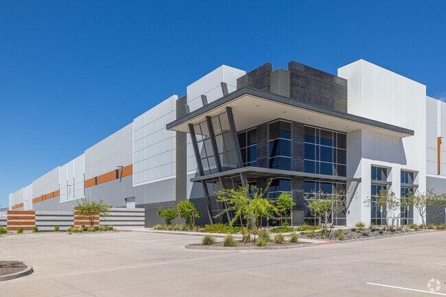
10100 N 151St Ave
Phoenix
Merit Woolf Logistics
Phoenix-Mesa-Scottsdale, AZ
MERIT WOOLF LOGISTICS MCR 1721-14
501-42-988
Maricopa
Warehouse
Arizona
2025
1
2025
22.20 AC
061044
Glendale
364,700 SF
DEMOGRAPHICS near 10100 N 151St Ave
1 Mile
3 Mile
5 Mile
2024 Total Population
2,270
42,651
184,157
2029 Population
2,442
46,623
200,741
Pop Growth 2024-2029
+ 7.58%
+ 9.31%
+ 9.01%
Average Age
35
36
37
2024 Total Households
633
13,020
58,921
HH Growth 2024-2029
+ 7.74%
+ 9.40%
+ 9.11%
Median Household Inc
$93,313
$101,028
$83,192
Avg Household Size
3.40
3.20
3.00
2024 Avg HH Vehicles
2.00
2.00
2.00
Median Home Value
$364,627
$371,150
$341,709
Median Year Built
2003
2006
2004
Nearby Places
Map Layers
Map Styles
 Street
 Aerial
- Restaurants
- Banks
- Shops
- Fitness
- Groceries
PUBLIC TRANSPORTATION
AIRPORT
Phoenix Sky Harbor International
DRIVE
WALK
Distance
Phoenix Sky Harbor International
47 min
32.4 mi
Freight Ports
Port of San Diego
DRIVE
WALK
Distance
Port of San Diego
385 min
344.8 mi
SALE & LEASE HISTORY
LISTING DATE
SALE/LEASE

Sep 13, 2023
For Lease
Nov 05, 2021
For Sale
Apr 28, 2021
For Lease
Nearby Properties
Address
Land Use
TOTAL SIZE
Lot Size
Zoning
Address
Land Use
TOTAL SIZE
Lot Size
Zoning
138.98 AC
Address
Land Use
TOTAL SIZE
Lot Size
Zoning
71.40 AC
Address
Land Use
TOTAL SIZE
Lot Size
Zoning
35.74 AC
Address
Land Use
TOTAL SIZE
Lot Size
Zoning
1,188,764 SF
631.19 AC
AP
Address
Land Use
TOTAL SIZE
Lot Size
Zoning
1,433,378 SF
317.58 AC
AP
Address
Land Use
TOTAL SIZE
Lot Size
Zoning
1,201,280 SF
74.43 AC
PAD
Address
Land Use
TOTAL SIZE
Lot Size
Zoning
1,758,410 SF
98.58 AC
PAD
Address
Land Use
TOTAL SIZE
Lot Size
Zoning
1,259,666 SF
71.73 AC
R-43
Address
Land Use
TOTAL SIZE
Lot Size
Zoning
1,200,140 SF
76.91 AC
Address
Land Use
TOTAL SIZE
Lot Size
Zoning
16,341 SF
174.45 AC
R-43
Address
Land Use
TOTAL SIZE
Lot Size
Zoning
510,342 SF
51.45 AC
LUKEAFB
Address
Land Use
TOTAL SIZE
Lot Size
Zoning
570,080 SF
36.76 AC
Address
Land Use
TOTAL SIZE
Lot Size
Zoning
351,775 SF
53.72 AC
AP
Address
Land Use
TOTAL SIZE
Lot Size
Zoning
1,178,814 SF
64.63 AC
Address
Land Use
TOTAL SIZE
Lot Size
Zoning
634,560 SF
36.84 AC
PAD
Address
Land Use
TOTAL SIZE
Lot Size
Zoning
294,360 SF
21.69 AC
EI
Address
Land Use
TOTAL SIZE
Lot Size
Zoning
225,457 SF
70.07 AC
PAD
Address
Land Use
TOTAL SIZE
Lot Size
Zoning
455,936 SF
23.97 AC
Address
Land Use
TOTAL SIZE
Lot Size
Zoning
345,916 SF
30.97 AC
PAD
Address
Land Use
TOTAL SIZE
Lot Size
Zoning
67,417 SF
12.16 AC
PAD
Address
Land Use
TOTAL SIZE
Lot Size
Zoning
418,305 SF
24.06 AC
PAD
Address
Land Use
TOTAL SIZE
Lot Size
Zoning
38,400 SF
4.97 AC
I-2
Address
Land Use
TOTAL SIZE
Lot Size
Zoning
247,178 SF
33.92 AC
PAD
Address
Land Use
TOTAL SIZE
Lot Size
Zoning
90,636 SF
13.27 AC
PAD
Address
Land Use
TOTAL SIZE
Lot Size
Zoning
90,387 SF
14.97 AC
PAD
Address
Land Use
TOTAL SIZE
Lot Size
Zoning
797,969 SF
66.20 AC
PAD
Address
Land Use
TOTAL SIZE
Lot Size
Zoning
187,815 SF
160 AC
AP
Address
Land Use
TOTAL SIZE
Lot Size
Zoning
145,491 SF
37.61 AC
PAD
The World's #1 Commercial Real Estate Marketplace
Connect with us
© 2025 CoStar Group
The information above has been obtained from sources believed reliable. While we do not doubt its accuracy we have not verified it and make no guarantee, warranty or representation about it. It is your responsibility to independently confirm its accuracy and completeness. Any projections, opinions, assumptions, or estimates used are for example only and do not represent the current or future performance of the property. The value of this transaction to you depends on tax and other factors which should be evaluated by your tax, financial, and legal advisors. You and your advisors should conduct a careful, independent investigation of the property to determine to your satisfaction the suitability of the property for your needs.