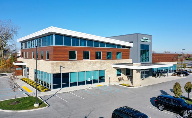
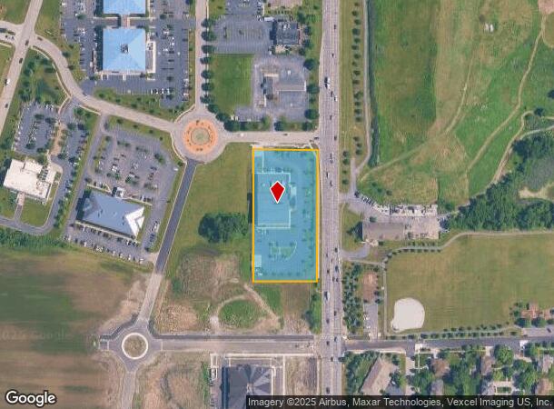
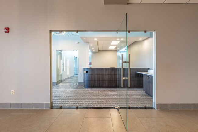
Property Record
10120 Calumet Ave, Munster, IN 46321

Current Lease Availabilities
NEARBY LISTINGS FOR SALE OR LEASE
Property Detail
10120 Calumet Ave
45-06-36-426-006.000-027
PT. E.1/2 SE.1/4 S.36 T.36 R.10 (205.31X424.34FT) 2.06AC
Medicalbuilding
Lake
X
Indiana
18089C0119E
2.06 AC
2024
Indiana
2025
Chicago
040402
Chicago-Naperville-Elgin, IL-IN-WI
25,910 SF
DEMOGRAPHICS near 10120 Calumet Ave
1 Mile
3 Mile
5 Mile
2024 Total Population
6,815
67,165
186,129
2029 Population
6,789
66,180
183,696
Pop Growth 2024-2029
(0.38%)
(1.47%)
(1.31%)
Average Age
44
43
41
2024 Total Households
2,528
27,172
72,569
HH Growth 2024-2029
(0.44%)
(1.55%)
(1.41%)
Median Household Inc
$115,379
$82,774
$69,670
Avg Household Size
2.60
2.40
2.50
2024 Avg HH Vehicles
2.00
2.00
2.00
Median Home Value
$328,084
$236,206
$196,647
Median Year Built
1989
1977
1970
Nearby Places
Map Layers
Map Styles
 Street
 Aerial
- Restaurants
- Banks
- Shops
- Fitness
- Groceries
PUBLIC TRANSPORTATION
COMMUTER RAIL
DRIVE
WALK
Distance
4 min
1.4 mi
Hammond Station (South Shore Line - Northern Indiana Commuter Transportation District (South Shore Line))
DRIVE
WALK
Distance
Hammond Station (South Shore Line - Northern Indiana Commuter Transportation District (South Shore Line))
16 min
7.8 mi
AIRPORT
Chicago Midway International
DRIVE
WALK
Distance
Chicago Midway International
43 min
28.9 mi
Nearby Properties
Address
Land Use
TOTAL SIZE
Lot Size
Zoning
Address
Land Use
TOTAL SIZE
Lot Size
Zoning
879,191 SF
13.93 AC
Address
Land Use
TOTAL SIZE
Lot Size
Zoning
308,022 SF
31.99 AC
R33
Address
Land Use
TOTAL SIZE
Lot Size
Zoning
552,813 SF
26.48 AC
Address
Land Use
TOTAL SIZE
Lot Size
Zoning
168,766 SF
19.16 AC
Address
Land Use
TOTAL SIZE
Lot Size
Zoning
296,588 SF
36.83 AC
R33
Address
Land Use
TOTAL SIZE
Lot Size
Zoning
125,938 SF
13.32 AC
Address
Land Use
TOTAL SIZE
Lot Size
Zoning
125,938 SF
12.86 AC
Address
Land Use
TOTAL SIZE
Lot Size
Zoning
350,110 SF
24.01 AC
R33
Address
Land Use
TOTAL SIZE
Lot Size
Zoning
454,750 SF
21.15 AC
Address
Land Use
TOTAL SIZE
Lot Size
Zoning
130,558 SF
9.89 AC
R33
Address
Land Use
TOTAL SIZE
Lot Size
Zoning
668,326 SF
26.90 AC
Address
Land Use
TOTAL SIZE
Lot Size
Zoning
190,457 SF
10.63 AC
Address
Land Use
TOTAL SIZE
Lot Size
Zoning
668,326 SF
28.87 AC
Address
Land Use
TOTAL SIZE
Lot Size
Zoning
81,622 SF
9.20 AC
Address
Land Use
TOTAL SIZE
Lot Size
Zoning
197,080 SF
R33
Address
Land Use
TOTAL SIZE
Lot Size
Zoning
214,752 SF
10.41 AC
R3
Address
Land Use
TOTAL SIZE
Lot Size
Zoning
153,073 SF
4.88 AC
Address
Land Use
TOTAL SIZE
Lot Size
Zoning
246,302 SF
13.08 AC
Address
Land Use
TOTAL SIZE
Lot Size
Zoning
97,046 SF
3.36 AC
Address
Land Use
TOTAL SIZE
Lot Size
Zoning
80,444 SF
13.41 AC
R3
Address
Land Use
TOTAL SIZE
Lot Size
Zoning
64,855 SF
5 AC
Address
Land Use
TOTAL SIZE
Lot Size
Zoning
70,017 SF
11 AC
R33
Address
Land Use
TOTAL SIZE
Lot Size
Zoning
140,360 SF
15 AC
R33
Address
Land Use
TOTAL SIZE
Lot Size
Zoning
233,769 SF
29.04 AC
R3
Address
Land Use
TOTAL SIZE
Lot Size
Zoning
135,617 SF
7.80 AC
Address
Land Use
TOTAL SIZE
Lot Size
Zoning
87,836 SF
14.12 AC
R33
Address
Land Use
TOTAL SIZE
Lot Size
Zoning
134,623 SF
7.08 AC
Address
Land Use
TOTAL SIZE
Lot Size
Zoning
217,104 SF
10.45 AC
Address
Land Use
TOTAL SIZE
Lot Size
Zoning
251,700 SF
19.86 AC
Address
Land Use
TOTAL SIZE
Lot Size
Zoning
62,026 SF
9.70 AC
The World's #1 Commercial Real Estate Marketplace
Connect with us
© 2026 CoStar Group
The information above has been obtained from sources believed reliable. While we do not doubt its accuracy we have not verified it and make no guarantee, warranty or representation about it. It is your responsibility to independently confirm its accuracy and completeness. Any projections, opinions, assumptions, or estimates used are for example only and do not represent the current or future performance of the property. The value of this transaction to you depends on tax and other factors which should be evaluated by your tax, financial, and legal advisors. You and your advisors should conduct a careful, independent investigation of the property to determine to your satisfaction the suitability of the property for your needs.