Property Record
10155 Colima Rd, Whittier, CA 90603


Property Detail
10155 Colima Rd
8151-008-021
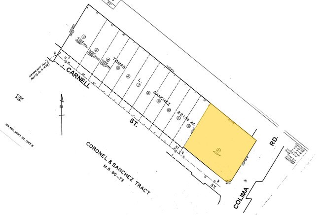
*TR=CORONEL AND SANCHEZ TR*LOT COM N 31 50 E 415.14 FT AND S 50 19 E 600 FT AND N 31 59 E 30 FT FROM MOST S COR OF TR NO 16722 TH N 31 59 E 191.57 FT TH S 50 19 E TO NW LINE OF COLIMA RD TH SE POR OF THOMAS L SANCHEZ 221.9 AC ALLOT
Officebuilding
Los Angeles
WHCO-R1P*
California
B and X Area of moderate flood hazard, usually the area between the limits of the 100-year and 500-year floods.
0.95 AC
2024
Southeast Los Angeles
2025
Los Angeles
503301
Los Angeles-Long Beach-Glendale, CA
38,221 SF
NEARBY LISTINGS FOR SALE OR LEASE
DEMOGRAPHICS near 10155 Colima Rd
1 mile
3 mile
5 mile
2025 Total Population
23,342
172,262
424,743
2030 Population
23,073
170,606
419,961
Pop Growth 2025-2030
(1.15%)
(0.96%)
(1.13%)
Average Age
40
40
41
2025 Total Households
7,180
52,645
129,085
HH Growth 2025-2030
(1.38%)
(1.18%)
(1.37%)
Median Household Inc
$100,674
$101,953
$102,301
Avg Household Size
3.20
3.10
3.20
2025 Avg HH Vehicles
2.00
2.00
2.00
Median Home Value
$754,303
$769,691
$774,372
Median Year Built
1955
1958
1960
Nearby Places
Map Layers
Map Styles
 Street
 Aerial
Transit
 Traffic
 Biking
Places
Listings with unknown addresses are not visible on the map
- Restaurants
- Banks
- Shops
- Fitness
- Groceries
PUBLIC TRANSPORTATION
COMMUTER RAIL
Norwalk/Santa Fe Springs (91 Line - Southern California Regional Rail Authority (Metrolink), Orange County Line - Southern California Regional Rail Authority (Metrolink))
Drive
Walk
Distance
Norwalk/Santa Fe Springs (91 Line - Southern California Regional Rail Authority (Metrolink), Orange County Line - Southern California Regional Rail Authority (Metrolink))
8 min
3.7 mi
Buena Park (91 Line - Southern California Regional Rail Authority (Metrolink), Orange County Line - Southern California Regional Rail Authority (Metrolink))
Drive
Walk
Distance
Buena Park (91 Line - Southern California Regional Rail Authority (Metrolink), Orange County Line - Southern California Regional Rail Authority (Metrolink))
11 min
5.4 mi
AIRPORT
Long Beach (Daugherty Field)
Drive
Walk
Distance
Long Beach (Daugherty Field)
30 min
18.0 mi
John Wayne/Orange County
Drive
Walk
Distance
John Wayne/Orange County
34 min
24.3 mi
Los Angeles International
Drive
Walk
Distance
Los Angeles International
38 min
25.6 mi
Freight Ports
Port of Long Beach
Drive
Walk
Distance
Port of Long Beach
37 min
23.8 mi
Nearby Properties
Address
Land Use
TOTAL SIZE
Lot Size
Zoning
Address
Land Use
TOTAL SIZE
Lot Size
Zoning
519,516 SF
25.37 AC
WHR3*
Address
Land Use
TOTAL SIZE
Lot Size
Zoning
1,100,900 SF
22.36 AC
SSM2*
Address
Land Use
TOTAL SIZE
Lot Size
Zoning
150,561 SF
65.24 AC
LMPUD
Address
Land Use
TOTAL SIZE
Lot Size
Zoning
10.49 AC
Address
Land Use
TOTAL SIZE
Lot Size
Zoning
322,048 SF
15.54 AC
SSM2-M1*
Address
Land Use
TOTAL SIZE
Lot Size
Zoning
128,481 SF
19.42 AC
LMR1*
Address
Land Use
TOTAL SIZE
Lot Size
Zoning
300,148 SF
13.01 AC
SSM2*
Address
Land Use
TOTAL SIZE
Lot Size
Zoning
176,103 SF
SSM2YY
Address
Land Use
TOTAL SIZE
Lot Size
Zoning
10.49 AC
Address
Land Use
TOTAL SIZE
Lot Size
Zoning
89,899 SF
SSM2*
Address
Land Use
TOTAL SIZE
Lot Size
Zoning
89,514 SF
21.28 AC
WHC2*
Address
Land Use
TOTAL SIZE
Lot Size
Zoning
85,245 SF
7.44 AC
WHT*
Address
Land Use
TOTAL SIZE
Lot Size
Zoning
425,816 SF
30.02 AC
SSM2*
Address
Land Use
TOTAL SIZE
Lot Size
Zoning
320,030 SF
8.81 AC
WHM2*
Address
Land Use
TOTAL SIZE
Lot Size
Zoning
184,230 SF
4.55 AC
SSM2*
Address
Land Use
TOTAL SIZE
Lot Size
Zoning
161,861 SF
17.50 AC
SSC4PD*
Address
Land Use
TOTAL SIZE
Lot Size
Zoning
268,536 SF
12.25 AC
SSM2*
Address
Land Use
TOTAL SIZE
Lot Size
Zoning
916,869 SF
21.34 AC
SSM2*
Address
Land Use
TOTAL SIZE
Lot Size
Zoning
108,296 SF
8.81 AC
WHM2*
Address
Land Use
TOTAL SIZE
Lot Size
Zoning
216,952 SF
23.54 AC
WHR4*
Address
Land Use
TOTAL SIZE
Lot Size
Zoning
96,802 SF
4.93 AC
Address
Land Use
TOTAL SIZE
Lot Size
Zoning
393,696 SF
12.73 AC
WHM2*
Address
Land Use
TOTAL SIZE
Lot Size
Zoning
41,430 SF
5.85 AC
Address
Land Use
TOTAL SIZE
Lot Size
Zoning
67,692 SF
2.34 AC
WHC2*
Address
Land Use
TOTAL SIZE
Lot Size
Zoning
13.60 AC
Address
Land Use
TOTAL SIZE
Lot Size
Zoning
138,400 SF
3.49 AC
SSM2*
Address
Land Use
TOTAL SIZE
Lot Size
Zoning
151,618 SF
7.70 AC
WHM1*
Address
Land Use
TOTAL SIZE
Lot Size
Zoning
69,056 SF
2.25 AC
WHM1*
Address
Land Use
TOTAL SIZE
Lot Size
Zoning
117,159 SF
1.50 AC
WHC2UD*
Address
Land Use
TOTAL SIZE
Lot Size
Zoning
192,740 SF
10.18 AC
The World's #1 Commercial Real Estate Marketplace
Connect with us
© 2026 CoStar Group
The information above has been obtained from sources believed reliable. While we do not doubt its accuracy we have not verified it and make no guarantee, warranty or representation about it. It is your responsibility to independently confirm its accuracy and completeness. Any projections, opinions, assumptions, or estimates used are for example only and do not represent the current or future performance of the property. The value of this transaction to you depends on tax and other factors which should be evaluated by your tax, financial, and legal advisors. You and your advisors should conduct a careful, independent investigation of the property to determine to your satisfaction the suitability of the property for your needs.