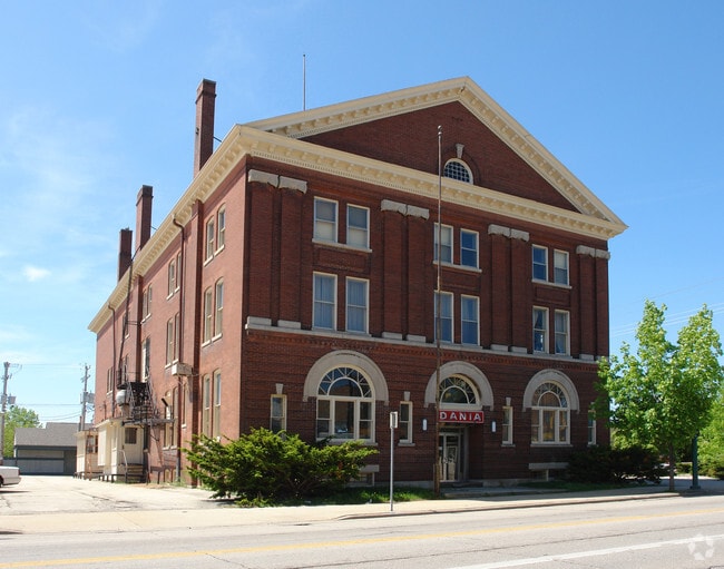
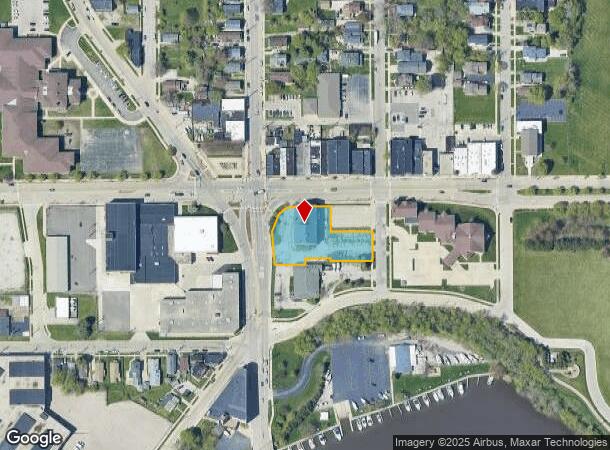
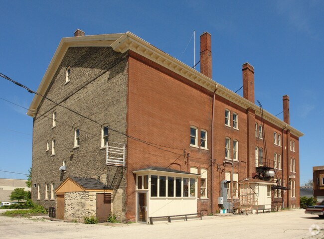
Property Record
1019 State St, Racine, WI 53404
NEARBY LISTINGS FOR SALE OR LEASE
Property Detail
1019 State St
Racine, WI
Sages
276-000002853000
BLK 24 SAGES ADD LOTS 3, 4, S 75 FT LOTS 1 + 2, LOT 5 EXC PT FOR ST + EXC PT DESC VOL 2238 RECS PGS 700- 701 + LOTS 6 + 7 EXC
Commercialnec
Racine
X
Wisconsin
55101C0231E
3
2024
0.81 AC
2024
Racine East
000400
Milwaukee/Madison
13,424 SF
DEMOGRAPHICS near 1019 State St
1 Mile
3 Mile
5 Mile
2024 Total Population
18,571
80,041
118,055
2029 Population
18,545
79,451
117,087
Pop Growth 2024-2029
(0.14%)
(0.74%)
(0.82%)
Average Age
35
38
40
2024 Total Households
7,262
32,372
48,328
HH Growth 2024-2029
(0.17%)
(0.79%)
(0.87%)
Median Household Inc
$34,797
$51,722
$59,889
Avg Household Size
2.40
2.40
2.40
2024 Avg HH Vehicles
1.00
2.00
2.00
Median Home Value
$94,514
$151,605
$179,103
Median Year Built
1947
1953
1961
Nearby Places
Map Layers
Map Styles
 Street
 Aerial
- Restaurants
- Banks
- Shops
- Fitness
- Groceries
PUBLIC TRANSPORTATION
COMMUTER RAIL
Sturtevant Amtrak Station (Hiawatha Service - Amtrak)
DRIVE
WALK
Distance
Sturtevant Amtrak Station (Hiawatha Service - Amtrak)
13 min
7.6 mi
AIRPORT
General Mitchell International
DRIVE
WALK
Distance
General Mitchell International
33 min
19.2 mi
Freight Ports
Port Milwaukee
DRIVE
WALK
Distance
Port Milwaukee
39 min
25.2 mi
Nearby Properties
Address
Land Use
TOTAL SIZE
Lot Size
Zoning
Address
Land Use
TOTAL SIZE
Lot Size
Zoning
61,744 SF
42.23 AC
OI
Address
Land Use
TOTAL SIZE
Lot Size
Zoning
14.11 AC
I2
Address
Land Use
TOTAL SIZE
Lot Size
Zoning
180,831 SF
1.49 AC
B4
Address
Land Use
TOTAL SIZE
Lot Size
Zoning
24.48 AC
Address
Land Use
TOTAL SIZE
Lot Size
Zoning
9,982 SF
0.39 AC
B4
Address
Land Use
TOTAL SIZE
Lot Size
Zoning
9.18 AC
Address
Land Use
TOTAL SIZE
Lot Size
Zoning
98.81 AC
Address
Land Use
TOTAL SIZE
Lot Size
Zoning
Address
Land Use
TOTAL SIZE
Lot Size
Zoning
3.54 AC
B4
Address
Land Use
TOTAL SIZE
Lot Size
Zoning
22.72 AC
Address
Land Use
TOTAL SIZE
Lot Size
Zoning
58,485 SF
19.71 AC
I2
Address
Land Use
TOTAL SIZE
Lot Size
Zoning
Address
Land Use
TOTAL SIZE
Lot Size
Zoning
Address
Land Use
TOTAL SIZE
Lot Size
Zoning
Address
Land Use
TOTAL SIZE
Lot Size
Zoning
23.15 AC
I2
Address
Land Use
TOTAL SIZE
Lot Size
Zoning
44,439 SF
1.75 AC
B4
Address
Land Use
TOTAL SIZE
Lot Size
Zoning
91,381 SF
6.62 AC
B2
Address
Land Use
TOTAL SIZE
Lot Size
Zoning
122,640 SF
8.27 AC
R4
Address
Land Use
TOTAL SIZE
Lot Size
Zoning
8.08 AC
Address
Land Use
TOTAL SIZE
Lot Size
Zoning
5.04 AC
B-3
Address
Land Use
TOTAL SIZE
Lot Size
Zoning
71,184 SF
1.05 AC
B4
Address
Land Use
TOTAL SIZE
Lot Size
Zoning
12.10 AC
I2
Address
Land Use
TOTAL SIZE
Lot Size
Zoning
78,748 SF
0.88 AC
I2
Address
Land Use
TOTAL SIZE
Lot Size
Zoning
5.53 AC
R4
Address
Land Use
TOTAL SIZE
Lot Size
Zoning
Address
Land Use
TOTAL SIZE
Lot Size
Zoning
93,000 SF
3.58 AC
R4
Address
Land Use
TOTAL SIZE
Lot Size
Zoning
6.77 AC
I2IP
Address
Land Use
TOTAL SIZE
Lot Size
Zoning
209,664 SF
2.82 AC
B5
Address
Land Use
TOTAL SIZE
Lot Size
Zoning
Address
Land Use
TOTAL SIZE
Lot Size
Zoning
21.66 AC
I2
The World's #1 Commercial Real Estate Marketplace
Connect with us
© 2025 CoStar Group
The information above has been obtained from sources believed reliable. While we do not doubt its accuracy we have not verified it and make no guarantee, warranty or representation about it. It is your responsibility to independently confirm its accuracy and completeness. Any projections, opinions, assumptions, or estimates used are for example only and do not represent the current or future performance of the property. The value of this transaction to you depends on tax and other factors which should be evaluated by your tax, financial, and legal advisors. You and your advisors should conduct a careful, independent investigation of the property to determine to your satisfaction the suitability of the property for your needs.