Property Record
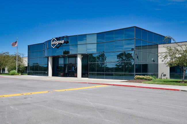
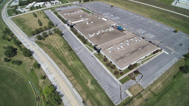
1020 E 1St St, Papillion, NE 68046


Property Detail
1020 E 1St St
Omaha, NE-IA
LOT 1 PAPILLION BUSINESS & TECHNOLOGY PARK
011343044
Sarpy
Commercialnec
Nebraska
AE The base floodplain where base flood elevations are provided. AE Zones are now used on new format FIRMs instead of A1-A30 Zones.
1
2024
2.98 AC
2025
Southeast Omaha
010617
Omaha/Council Bluffs
176,033 SF
NEARBY LISTINGS FOR SALE OR LEASE
DEMOGRAPHICS near 1020 E 1St St
1 mile
3 mile
5 mile
2025 Total Population
9,113
69,998
167,681
2030 Population
9,580
74,256
176,467
Pop Growth 2025-2030
+ 5.12%
+ 6.08%
+ 5.24%
Average Age
39
39
38
2025 Total Households
3,222
26,246
64,023
HH Growth 2025-2030
+ 5.37%
+ 6.32%
+ 5.34%
Median Household Inc
$108,637
$102,272
$88,728
Avg Household Size
2.80
2.60
2.60
2025 Avg HH Vehicles
2.00
2.00
2.00
Median Home Value
$285,085
$325,056
$280,557
Median Year Built
1981
1993
1985
Nearby Places
Map Layers
Map Styles
 Street
 Aerial
Layers
 Traffic
 Biking
Places
Listings with unknown addresses are not visible on the map
- Restaurants
- Banks
- Shops
- Fitness
- Groceries
PUBLIC TRANSPORTATION
AIRPORT
Eppley Airfield
Drive
Walk
Distance
Eppley Airfield
28 min
15.5 mi
Freight Ports
Tulsa Port Of Catoosa
Drive
Walk
Distance
Tulsa Port Of Catoosa
462 min
416.0 mi
SALE & LEASE HISTORY
LISTING DATE
SALE/LEASE

Aug 12, 2020
For Lease
Aug 10, 2020
For Sale
Nearby Properties
Address
Land Use
TOTAL SIZE
Lot Size
Zoning
Address
Land Use
TOTAL SIZE
Lot Size
Zoning
483,925 SF
42.06 AC
Address
Land Use
TOTAL SIZE
Lot Size
Zoning
28,401 SF
27.31 AC
Address
Land Use
TOTAL SIZE
Lot Size
Zoning
25,204 SF
2.34 AC
R4
Address
Land Use
TOTAL SIZE
Lot Size
Zoning
28,820 SF
16.81 AC
Address
Land Use
TOTAL SIZE
Lot Size
Zoning
317,277 SF
20.12 AC
Address
Land Use
TOTAL SIZE
Lot Size
Zoning
46,886 SF
19.29 AC
Address
Land Use
TOTAL SIZE
Lot Size
Zoning
3,906 SF
13.62 AC
RG20
Address
Land Use
TOTAL SIZE
Lot Size
Zoning
28,913 SF
2.04 AC
Address
Land Use
TOTAL SIZE
Lot Size
Zoning
294,672 SF
15.06 AC
Address
Land Use
TOTAL SIZE
Lot Size
Zoning
13,930 SF
1.04 AC
Address
Land Use
TOTAL SIZE
Lot Size
Zoning
88,545 SF
9.58 AC
Address
Land Use
TOTAL SIZE
Lot Size
Zoning
2,610 SF
9.96 AC
Address
Land Use
TOTAL SIZE
Lot Size
Zoning
37,196 SF
13.96 AC
MU
Address
Land Use
TOTAL SIZE
Lot Size
Zoning
18,484 SF
5.47 AC
Address
Land Use
TOTAL SIZE
Lot Size
Zoning
11,244 SF
6.91 AC
Address
Land Use
TOTAL SIZE
Lot Size
Zoning
217,511 SF
25.06 AC
Address
Land Use
TOTAL SIZE
Lot Size
Zoning
149,713 SF
10.46 AC
Address
Land Use
TOTAL SIZE
Lot Size
Zoning
11,889 SF
5.58 AC
Address
Land Use
TOTAL SIZE
Lot Size
Zoning
196,746 SF
10.22 AC
Address
Land Use
TOTAL SIZE
Lot Size
Zoning
96,970 SF
9.68 AC
Address
Land Use
TOTAL SIZE
Lot Size
Zoning
6,472 SF
4.58 AC
Address
Land Use
TOTAL SIZE
Lot Size
Zoning
170,665 SF
10.94 AC
Address
Land Use
TOTAL SIZE
Lot Size
Zoning
130,245 SF
6.93 AC
Address
Land Use
TOTAL SIZE
Lot Size
Zoning
7,448 SF
4.71 AC
Address
Land Use
TOTAL SIZE
Lot Size
Zoning
7,448 SF
2.89 AC
Address
Land Use
TOTAL SIZE
Lot Size
Zoning
200,793 SF
20.66 AC
Address
Land Use
TOTAL SIZE
Lot Size
Zoning
92,567 SF
2.43 AC
Address
Land Use
TOTAL SIZE
Lot Size
Zoning
34,104 SF
6.55 AC
Address
Land Use
TOTAL SIZE
Lot Size
Zoning
135,252 SF
7.07 AC
Address
Land Use
TOTAL SIZE
Lot Size
Zoning
0.01 AC
The World's #1 Commercial Real Estate Marketplace
Connect with us
© 2026 CoStar Group
The information above has been obtained from sources believed reliable. While we do not doubt its accuracy we have not verified it and make no guarantee, warranty or representation about it. It is your responsibility to independently confirm its accuracy and completeness. Any projections, opinions, assumptions, or estimates used are for example only and do not represent the current or future performance of the property. The value of this transaction to you depends on tax and other factors which should be evaluated by your tax, financial, and legal advisors. You and your advisors should conduct a careful, independent investigation of the property to determine to your satisfaction the suitability of the property for your needs.