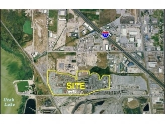
Property Record
1010 W 600 S, Lindon, UT 84042
NEARBY LISTINGS FOR SALE OR LEASE
Property Detail
1010 W 600 S
Salt Lake City
Eastlake @ Geneva Industrial Business Pr
Provo-Orem, UT
PARCEL D, EASTLAKE AT GENEVA INDUSTRIAL BUS PK PH 2 AMD 2 SUBDV. AREA 0.277 AC.
38-425-0002
Utah
Vacantlandnec
Utah
0
0.36 AC
2025
Utah County
DEMOGRAPHICS near 1010 W 600 S
1 Mile
3 Mile
5 Mile
2024 Total Population
389
72,319
187,892
2029 Population
467
84,750
219,445
Pop Growth 2024-2029
+ 20.05%
+ 17.19%
+ 16.79%
Average Age
34
31
32
2024 Total Households
119
22,903
56,853
HH Growth 2024-2029
+ 20.17%
+ 17.81%
+ 17.28%
Median Household Inc
$71,562
$77,846
$80,709
Avg Household Size
3.30
3.10
3.20
2024 Avg HH Vehicles
2.00
2.00
2.00
Median Home Value
$475,999
$417,324
$440,184
Median Year Built
2010
2005
1996
Nearby Places
- Restaurants
- Banks
- Shops
- Fitness
- Groceries
PUBLIC TRANSPORTATION
COMMUTER RAIL
Vineyard Station (FrontRunner - Utah Transit Authority (UTA))
DRIVE
WALK
Distance
Vineyard Station (FrontRunner - Utah Transit Authority (UTA))
3 min
2.0 mi
Orem Central Station (FrontRunner - Utah Transit Authority (UTA))
DRIVE
WALK
Distance
Orem Central Station (FrontRunner - Utah Transit Authority (UTA))
7 min
3.8 mi
AIRPORT
Provo Municipal
DRIVE
WALK
Distance
Provo Municipal
15 min
10.6 mi
Freight Ports
Port of Stockton
DRIVE
WALK
Distance
Port of Stockton
747 min
731.2 mi
Nearby Properties
Address
Land Use
TOTAL SIZE
Lot Size
Zoning
Address
Land Use
TOTAL SIZE
Lot Size
Zoning
587,192 SF
48.27 AC
Address
Land Use
TOTAL SIZE
Lot Size
Zoning
206,178 SF
16.64 AC
Address
Land Use
TOTAL SIZE
Lot Size
Zoning
472,365 SF
15.90 AC
Address
Land Use
TOTAL SIZE
Lot Size
Zoning
296,420 SF
19.66 AC
Address
Land Use
TOTAL SIZE
Lot Size
Zoning
287,823 SF
8.96 AC
Address
Land Use
TOTAL SIZE
Lot Size
Zoning
201,081 SF
17.96 AC
Address
Land Use
TOTAL SIZE
Lot Size
Zoning
21,510 SF
6.66 AC
Address
Land Use
TOTAL SIZE
Lot Size
Zoning
291,932 SF
8.10 AC
Address
Land Use
TOTAL SIZE
Lot Size
Zoning
194,977 SF
8.18 AC
Address
Land Use
TOTAL SIZE
Lot Size
Zoning
326,355 SF
15.12 AC
Address
Land Use
TOTAL SIZE
Lot Size
Zoning
233,302 SF
15.03 AC
Address
Land Use
TOTAL SIZE
Lot Size
Zoning
333,719 SF
11.99 AC
Address
Land Use
TOTAL SIZE
Lot Size
Zoning
230,702 SF
11.85 AC
Address
Land Use
TOTAL SIZE
Lot Size
Zoning
171,905 SF
6.62 AC
Address
Land Use
TOTAL SIZE
Lot Size
Zoning
327,092 SF
14.61 AC
Address
Land Use
TOTAL SIZE
Lot Size
Zoning
144,310 SF
6.85 AC
Address
Land Use
TOTAL SIZE
Lot Size
Zoning
144,456 SF
5.55 AC
Address
Land Use
TOTAL SIZE
Lot Size
Zoning
333,724 SF
13.12 AC
Address
Land Use
TOTAL SIZE
Lot Size
Zoning
Address
Land Use
TOTAL SIZE
Lot Size
Zoning
154,800 SF
9.14 AC
Address
Land Use
TOTAL SIZE
Lot Size
Zoning
364,248 SF
22.77 AC
Address
Land Use
TOTAL SIZE
Lot Size
Zoning
269,768 SF
14.94 AC
Address
Land Use
TOTAL SIZE
Lot Size
Zoning
194,852 SF
10.03 AC
Address
Land Use
TOTAL SIZE
Lot Size
Zoning
213,863 SF
11.71 AC
Address
Land Use
TOTAL SIZE
Lot Size
Zoning
141,635 SF
10.58 AC
Address
Land Use
TOTAL SIZE
Lot Size
Zoning
212,466 SF
25.89 AC
Address
Land Use
TOTAL SIZE
Lot Size
Zoning
139,462 SF
3.93 AC
Address
Land Use
TOTAL SIZE
Lot Size
Zoning
141,204 SF
11.96 AC
Address
Land Use
TOTAL SIZE
Lot Size
Zoning
194,483 SF
10.66 AC
Address
Land Use
TOTAL SIZE
Lot Size
Zoning
72,761 SF
5.92 AC
The World's #1 Commercial Real Estate Marketplace
Connect with us
© 2025 CoStar Group
The information above has been obtained from sources believed reliable. While we do not doubt its accuracy we have not verified it and make no guarantee, warranty or representation about it. It is your responsibility to independently confirm its accuracy and completeness. Any projections, opinions, assumptions, or estimates used are for example only and do not represent the current or future performance of the property. The value of this transaction to you depends on tax and other factors which should be evaluated by your tax, financial, and legal advisors. You and your advisors should conduct a careful, independent investigation of the property to determine to your satisfaction the suitability of the property for your needs.