Property Record
1026 Cocoa Ave, Hershey, PA 17033
NEARBY LISTINGS FOR SALE OR LEASE
Property Detail
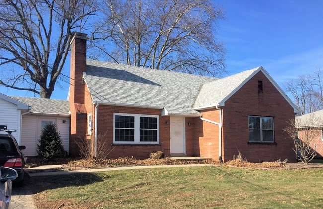
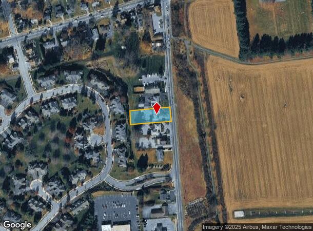
1026 Cocoa Ave
24-045-030
Emma J Hess
Officebuilding
Dauphin
X
Pennsylvania
42043C0369D
0.37 AC
2025
Harrisburg Area East
2025
Philadelphia
024300
Harrisburg-Carlisle, PA
1,135 SF
DEMOGRAPHICS near 1026 Cocoa Ave
1 Mile
3 Mile
5 Mile
2024 Total Population
7,821
24,902
63,415
2029 Population
8,037
25,437
64,444
Pop Growth 2024-2029
+ 2.76%
+ 2.15%
+ 1.62%
Average Age
43
41
42
2024 Total Households
3,174
10,051
25,575
HH Growth 2024-2029
+ 2.87%
+ 2.23%
+ 1.70%
Median Household Inc
$76,352
$77,146
$81,371
Avg Household Size
2.20
2.30
2.40
2024 Avg HH Vehicles
2.00
2.00
2.00
Median Home Value
$307,387
$295,862
$279,283
Median Year Built
1966
1975
1978
Nearby Places
Map Layers
Map Styles
 Street
 Aerial
- Restaurants
- Banks
- Shops
- Fitness
- Groceries
PUBLIC TRANSPORTATION
COMMUTER RAIL
Middletown (Keystone Service - Amtrak)
DRIVE
WALK
Distance
Middletown (Keystone Service - Amtrak)
19 min
9.5 mi
Elizabethtown Amtrak Station (Keystone Service - Amtrak, Pennsylvanian - Amtrak)
DRIVE
WALK
Distance
Elizabethtown Amtrak Station (Keystone Service - Amtrak, Pennsylvanian - Amtrak)
17 min
9.9 mi
AIRPORT
Harrisburg International
DRIVE
WALK
Distance
Harrisburg International
21 min
11.7 mi
Freight Ports
Port of Baltimore
DRIVE
WALK
Distance
Port of Baltimore
126 min
92.6 mi
SALE & LEASE HISTORY
LISTING DATE
SALE/LEASE

Jan 24, 2019
For Sale
Nearby Properties
Address
Land Use
TOTAL SIZE
Lot Size
Zoning
Address
Land Use
TOTAL SIZE
Lot Size
Zoning
1,414,742 SF
216.49 AC
Address
Land Use
TOTAL SIZE
Lot Size
Zoning
1,740 SF
2,638.65 AC
Address
Land Use
TOTAL SIZE
Lot Size
Zoning
8,765 SF
345.74 AC
Address
Land Use
TOTAL SIZE
Lot Size
Zoning
2,106 SF
458.45 AC
Address
Land Use
TOTAL SIZE
Lot Size
Zoning
57,016 SF
43.70 AC
Address
Land Use
TOTAL SIZE
Lot Size
Zoning
150,330 SF
39.35 AC
Address
Land Use
TOTAL SIZE
Lot Size
Zoning
1,619 SF
125.81 AC
Address
Land Use
TOTAL SIZE
Lot Size
Zoning
157,968 SF
Address
Land Use
TOTAL SIZE
Lot Size
Zoning
137,886 SF
241.91 AC
Address
Land Use
TOTAL SIZE
Lot Size
Zoning
247,060 SF
102.86 AC
Address
Land Use
TOTAL SIZE
Lot Size
Zoning
188,919 SF
193.39 AC
Address
Land Use
TOTAL SIZE
Lot Size
Zoning
3,135 SF
51.95 AC
Address
Land Use
TOTAL SIZE
Lot Size
Zoning
44,410 SF
5.91 AC
Address
Land Use
TOTAL SIZE
Lot Size
Zoning
9,335 SF
39.62 AC
Address
Land Use
TOTAL SIZE
Lot Size
Zoning
87,556 SF
136.11 AC
Address
Land Use
TOTAL SIZE
Lot Size
Zoning
19,194 SF
17.80 AC
Address
Land Use
TOTAL SIZE
Lot Size
Zoning
22,500 SF
33.67 AC
Address
Land Use
TOTAL SIZE
Lot Size
Zoning
239,046 SF
23 AC
Address
Land Use
TOTAL SIZE
Lot Size
Zoning
61,567 SF
17.93 AC
Address
Land Use
TOTAL SIZE
Lot Size
Zoning
162,931 SF
50.90 AC
Address
Land Use
TOTAL SIZE
Lot Size
Zoning
121,119 SF
17.01 AC
Address
Land Use
TOTAL SIZE
Lot Size
Zoning
29,000 SF
4.64 AC
Address
Land Use
TOTAL SIZE
Lot Size
Zoning
95,192 SF
52.43 AC
Address
Land Use
TOTAL SIZE
Lot Size
Zoning
32.09 AC
Address
Land Use
TOTAL SIZE
Lot Size
Zoning
77,280 SF
9.60 AC
Address
Land Use
TOTAL SIZE
Lot Size
Zoning
32,782 SF
5.42 AC
Address
Land Use
TOTAL SIZE
Lot Size
Zoning
13,050 SF
4.46 AC
Address
Land Use
TOTAL SIZE
Lot Size
Zoning
53,988 SF
334.47 AC
Address
Land Use
TOTAL SIZE
Lot Size
Zoning
111,546 SF
2.76 AC
Address
Land Use
TOTAL SIZE
Lot Size
Zoning
170.34 AC
The World's #1 Commercial Real Estate Marketplace
Connect with us
© 2025 CoStar Group
The information above has been obtained from sources believed reliable. While we do not doubt its accuracy we have not verified it and make no guarantee, warranty or representation about it. It is your responsibility to independently confirm its accuracy and completeness. Any projections, opinions, assumptions, or estimates used are for example only and do not represent the current or future performance of the property. The value of this transaction to you depends on tax and other factors which should be evaluated by your tax, financial, and legal advisors. You and your advisors should conduct a careful, independent investigation of the property to determine to your satisfaction the suitability of the property for your needs.