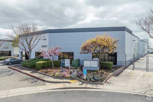
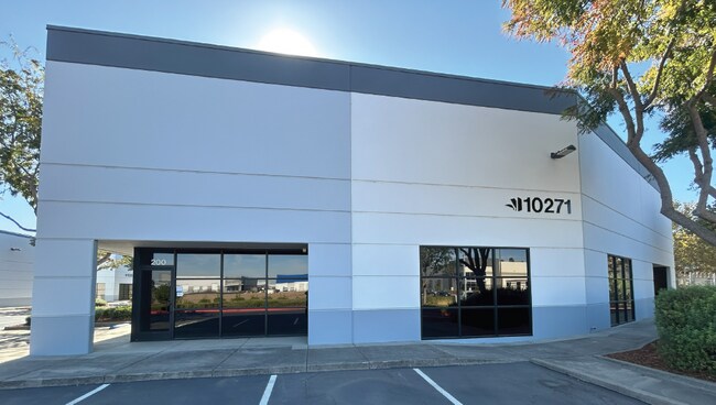
Property Record
10271 Iron Rock Way, Elk Grove, CA 95624


NEARBY LISTINGS FOR SALE OR LEASE
Property Detail
10271 Iron Rock Way
Sacramento-Roseville-Folsom, CA
Iron Rock Industrial Park
134-0630-056
PARCEL MAP IRON ROCK INDUSTRIAL PARK, LOT A
Lightindustrial
Sacramento
X
California
06067C0338H
a
2024
0.63 AC
2025
Elk Grove/Laguna
009310
Sacramento
9,375 SF
DEMOGRAPHICS near 10271 Iron Rock Way
1 Mile
3 Mile
5 Mile
2024 Total Population
4,818
49,582
142,409
2029 Population
4,866
50,389
143,763
Pop Growth 2024-2029
+ 1.00%
+ 1.63%
+ 0.95%
Average Age
38
39
39
2024 Total Households
1,484
15,377
43,220
HH Growth 2024-2029
+ 0.94%
+ 1.57%
+ 0.91%
Median Household Inc
$109,349
$112,171
$108,857
Avg Household Size
3.20
3.10
3.20
2024 Avg HH Vehicles
2.00
2.00
2.00
Median Home Value
$485,662
$604,355
$570,783
Median Year Built
1994
1999
2000
Nearby Places
Map Layers
Map Styles
 Street
 Aerial
- Restaurants
- Banks
- Shops
- Fitness
- Groceries
PUBLIC TRANSPORTATION
AIRPORT
Sacramento International
DRIVE
WALK
Distance
Sacramento International
42 min
29.4 mi
Stockton Metro
DRIVE
WALK
Distance
Stockton Metro
51 min
38.6 mi
SALE & LEASE HISTORY
LISTING DATE
SALE/LEASE

Jun 10, 2025
For Lease
Jan 11, 2022
For Lease
Nearby Properties
Address
Land Use
TOTAL SIZE
Lot Size
Zoning
Address
Land Use
TOTAL SIZE
Lot Size
Zoning
43.54 AC
LI
Address
Land Use
TOTAL SIZE
Lot Size
Zoning
7.65 AC
RD-20
Address
Land Use
TOTAL SIZE
Lot Size
Zoning
43.06 AC
LRSPA
Address
Land Use
TOTAL SIZE
Lot Size
Zoning
221,556 SF
20.10 AC
HI
Address
Land Use
TOTAL SIZE
Lot Size
Zoning
9.02 AC
SPASEPA
Address
Land Use
TOTAL SIZE
Lot Size
Zoning
64,579 SF
5.41 AC
LRSPA
Address
Land Use
TOTAL SIZE
Lot Size
Zoning
111,489 SF
4.96 AC
MP
Address
Land Use
TOTAL SIZE
Lot Size
Zoning
76,090 SF
3.32 AC
RD-25
Address
Land Use
TOTAL SIZE
Lot Size
Zoning
102,526 SF
4.06 AC
MP
Address
Land Use
TOTAL SIZE
Lot Size
Zoning
100 SF
50.85 AC
LRSPA
Address
Land Use
TOTAL SIZE
Lot Size
Zoning
5.38 AC
SC
Address
Land Use
TOTAL SIZE
Lot Size
Zoning
63,550 SF
5.53 AC
AC
Address
Land Use
TOTAL SIZE
Lot Size
Zoning
21.18 AC
HI
Address
Land Use
TOTAL SIZE
Lot Size
Zoning
53,949 SF
5.33 AC
AC
Address
Land Use
TOTAL SIZE
Lot Size
Zoning
15.50 AC
LRSPA
Address
Land Use
TOTAL SIZE
Lot Size
Zoning
1.99 AC
GC
Address
Land Use
TOTAL SIZE
Lot Size
Zoning
14.46 AC
LRSPA
Address
Land Use
TOTAL SIZE
Lot Size
Zoning
13.28 AC
LRSPA
Address
Land Use
TOTAL SIZE
Lot Size
Zoning
125,640 SF
10.25 AC
SC
Address
Land Use
TOTAL SIZE
Lot Size
Zoning
150,210 SF
6.25 AC
LI
Address
Land Use
TOTAL SIZE
Lot Size
Zoning
94,365 SF
6.49 AC
RD-20
Address
Land Use
TOTAL SIZE
Lot Size
Zoning
3.71 AC
RD-20
Address
Land Use
TOTAL SIZE
Lot Size
Zoning
56,892 SF
6.18 AC
AC
Address
Land Use
TOTAL SIZE
Lot Size
Zoning
62,002 SF
7.44 AC
AC
Address
Land Use
TOTAL SIZE
Lot Size
Zoning
45,543 SF
8.20 AC
AC
Address
Land Use
TOTAL SIZE
Lot Size
Zoning
1,595 SF
4.01 AC
RD-25
Address
Land Use
TOTAL SIZE
Lot Size
Zoning
104,812 SF
6.13 AC
SPAEGF
Address
Land Use
TOTAL SIZE
Lot Size
Zoning
128,325 SF
9.71 AC
RD-18 O
Address
Land Use
TOTAL SIZE
Lot Size
Zoning
54,977 SF
3.94 AC
LI
Address
Land Use
TOTAL SIZE
Lot Size
Zoning
3.07 AC
GC
The World's #1 Commercial Real Estate Marketplace
Connect with us
© 2026 CoStar Group
The information above has been obtained from sources believed reliable. While we do not doubt its accuracy we have not verified it and make no guarantee, warranty or representation about it. It is your responsibility to independently confirm its accuracy and completeness. Any projections, opinions, assumptions, or estimates used are for example only and do not represent the current or future performance of the property. The value of this transaction to you depends on tax and other factors which should be evaluated by your tax, financial, and legal advisors. You and your advisors should conduct a careful, independent investigation of the property to determine to your satisfaction the suitability of the property for your needs.