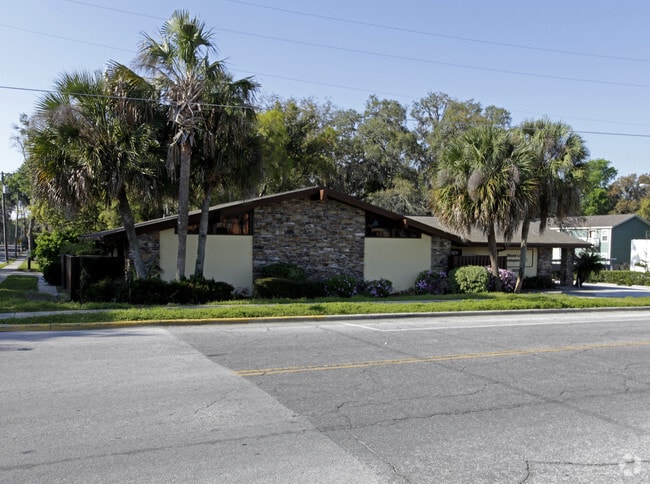
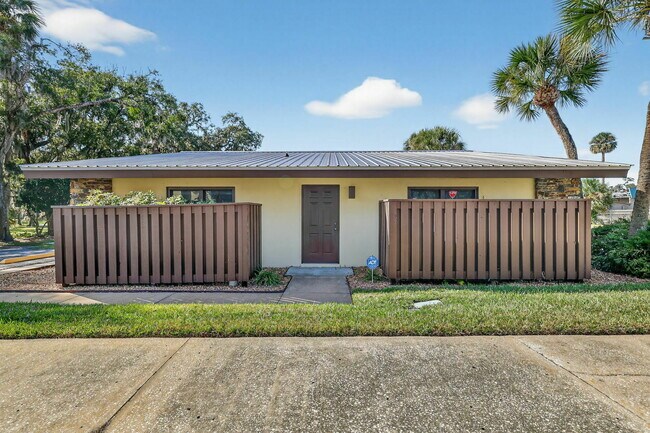
Property Record
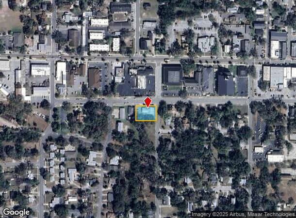
1029 W Magnolia St, Leesburg, FL 34748

This Property Is For Sale
NEARBY LISTINGS FOR SALE OR LEASE
Property Detail
1029 W Magnolia St
Orlando-Kissimmee-Sanford, FL
Leesburg
26-19-24-3900-031-00101
LEESBURG E 1/2 OF LOT 1 BLK 31--LESS R/W OF MAGNOLIA ST--PB 2 PG 19 ORB 3922 PG 1882
Officebuilding
Lake
X
Florida
12069C0317E
1
2024
0.35 AC
2026
Lake County
030602
Orlando
2,788 SF
DEMOGRAPHICS near 1029 W Magnolia St
1 Mile
3 Mile
5 Mile
2024 Total Population
6,233
30,343
55,238
2029 Population
7,284
35,702
64,950
Pop Growth 2024-2029
+ 16.86%
+ 17.66%
+ 17.58%
Average Age
40
43
48
2024 Total Households
2,554
12,958
24,788
HH Growth 2024-2029
+ 16.76%
+ 17.72%
+ 17.60%
Median Household Inc
$33,655
$38,312
$48,913
Avg Household Size
2.30
2.30
2.20
2024 Avg HH Vehicles
1.00
1.00
2.00
Median Home Value
$142,057
$151,179
$196,555
Median Year Built
1966
1980
1986
Nearby Places
- Restaurants
- Banks
- Shops
- Fitness
- Groceries
Nearby Properties
Address
Land Use
TOTAL SIZE
Lot Size
Zoning
Address
Land Use
TOTAL SIZE
Lot Size
Zoning
3,531 SF
23.43 AC
P
Address
Land Use
TOTAL SIZE
Lot Size
Zoning
63,584 SF
22.24 AC
PUD
Address
Land Use
TOTAL SIZE
Lot Size
Zoning
131,225 SF
12.61 AC
Address
Land Use
TOTAL SIZE
Lot Size
Zoning
97,310 SF
154.74 AC
Address
Land Use
TOTAL SIZE
Lot Size
Zoning
290,514 SF
50.14 AC
PUD
Address
Land Use
TOTAL SIZE
Lot Size
Zoning
126,140 SF
11.24 AC
C3
Address
Land Use
TOTAL SIZE
Lot Size
Zoning
2,000 SF
57.83 AC
P
Address
Land Use
TOTAL SIZE
Lot Size
Zoning
299,920 SF
7.45 AC
PUD
Address
Land Use
TOTAL SIZE
Lot Size
Zoning
79,305 SF
17.45 AC
C3
Address
Land Use
TOTAL SIZE
Lot Size
Zoning
100,330 SF
11.81 AC
A
Address
Land Use
TOTAL SIZE
Lot Size
Zoning
94,707 SF
16.79 AC
C3
Address
Land Use
TOTAL SIZE
Lot Size
Zoning
96,507 SF
3.45 AC
C1
Address
Land Use
TOTAL SIZE
Lot Size
Zoning
147,624 SF
5.99 AC
Address
Land Use
TOTAL SIZE
Lot Size
Zoning
190,537 SF
10.36 AC
C3
Address
Land Use
TOTAL SIZE
Lot Size
Zoning
35,820 SF
3.71 AC
R3
Address
Land Use
TOTAL SIZE
Lot Size
Zoning
79,456 SF
9.44 AC
C3
Address
Land Use
TOTAL SIZE
Lot Size
Zoning
17,141 SF
113.94 AC
R1
Address
Land Use
TOTAL SIZE
Lot Size
Zoning
147,000 SF
9.04 AC
M1
Address
Land Use
TOTAL SIZE
Lot Size
Zoning
144,336 SF
18.32 AC
R3
Address
Land Use
TOTAL SIZE
Lot Size
Zoning
35,040 SF
5.36 AC
C3
Address
Land Use
TOTAL SIZE
Lot Size
Zoning
154,635 SF
11.75 AC
C3
Address
Land Use
TOTAL SIZE
Lot Size
Zoning
5,886 SF
19.13 AC
R2
Address
Land Use
TOTAL SIZE
Lot Size
Zoning
35,116 SF
3.18 AC
C3
Address
Land Use
TOTAL SIZE
Lot Size
Zoning
2,000 SF
31.75 AC
PUD
Address
Land Use
TOTAL SIZE
Lot Size
Zoning
75,356 SF
8.43 AC
C3
Address
Land Use
TOTAL SIZE
Lot Size
Zoning
81,060 SF
8.66 AC
C2
Address
Land Use
TOTAL SIZE
Lot Size
Zoning
40,811 SF
2.56 AC
CIP
Address
Land Use
TOTAL SIZE
Lot Size
Zoning
146,773 SF
5.05 AC
P
Address
Land Use
TOTAL SIZE
Lot Size
Zoning
59,664 SF
2.33 AC
C3
Address
Land Use
TOTAL SIZE
Lot Size
Zoning
2,000 SF
41.73 AC
R2
The World's #1 Commercial Real Estate Marketplace
Connect with us
© 2025 CoStar Group
The information above has been obtained from sources believed reliable. While we do not doubt its accuracy we have not verified it and make no guarantee, warranty or representation about it. It is your responsibility to independently confirm its accuracy and completeness. Any projections, opinions, assumptions, or estimates used are for example only and do not represent the current or future performance of the property. The value of this transaction to you depends on tax and other factors which should be evaluated by your tax, financial, and legal advisors. You and your advisors should conduct a careful, independent investigation of the property to determine to your satisfaction the suitability of the property for your needs.