Property Record
1030 London Dr, Birmingham, AL 35211

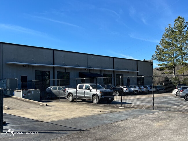
This Property Is For Sale
NEARBY LISTINGS FOR SALE OR LEASE
Property Detail
1030 London Dr
Birmingham-Hoover, AL
Lakeshore Crossings Res
29-00-29-4-001-001.004
THAT PART OF LOT 2A LAKESHORE CROSSINGS RESURVEY NO.2 PB 209 PG 65 THAT LIES IN THE SE 1/4 OF SEC 29 TSP 18 R 3W FT SW 180 FT TO POB
Vacantlandnec
Jefferson
X
Alabama
01073C0553G
2a
2023
0.40 AC
2024
Vulcan/Oxmoor
0143021013
Birmingham
DEMOGRAPHICS near 1030 London Dr
1 Mile
3 Mile
5 Mile
2024 Total Population
2,371
43,836
162,237
2029 Population
2,311
43,039
160,681
Pop Growth 2024-2029
(2.53%)
(1.82%)
(0.96%)
Average Age
36
39
39
2024 Total Households
1,212
19,303
68,601
HH Growth 2024-2029
(2.81%)
(1.85%)
(0.98%)
Median Household Inc
$46,570
$50,141
$49,376
Avg Household Size
1.90
2.20
2.20
2024 Avg HH Vehicles
2.00
2.00
2.00
Median Home Value
$212,114
$188,204
$218,343
Median Year Built
2008
1972
1969
Nearby Places
Map Layers
Map Styles
 Street
 Aerial
- Restaurants
- Banks
- Shops
- Fitness
- Groceries
PUBLIC TRANSPORTATION
COMMUTER RAIL
DRIVE
WALK
Distance
15 min
8.8 mi
AIRPORT
Birmingham-Shuttlesworth International
DRIVE
WALK
Distance
Birmingham-Shuttlesworth International
23 min
13.9 mi
Nearby Properties
Address
Land Use
TOTAL SIZE
Lot Size
Zoning
Address
Land Use
TOTAL SIZE
Lot Size
Zoning
242,746 SF
20.96 AC
MXDE
Address
Land Use
TOTAL SIZE
Lot Size
Zoning
334,805 SF
32.50 AC
MXD/
Address
Land Use
TOTAL SIZE
Lot Size
Zoning
209,765 SF
19.20 AC
I-3
Address
Land Use
TOTAL SIZE
Lot Size
Zoning
186,070 SF
16.60 AC
QB2
Address
Land Use
TOTAL SIZE
Lot Size
Zoning
197,717 SF
19.02 AC
PUD
Address
Land Use
TOTAL SIZE
Lot Size
Zoning
321,783 SF
19.40 AC
MXD
Address
Land Use
TOTAL SIZE
Lot Size
Zoning
92,332 SF
8.40 AC
Address
Land Use
TOTAL SIZE
Lot Size
Zoning
133,396 SF
19 AC
QR6
Address
Land Use
TOTAL SIZE
Lot Size
Zoning
149,299 SF
15.70 AC
PUD
Address
Land Use
TOTAL SIZE
Lot Size
Zoning
285,719 SF
18 AC
R-4
Address
Land Use
TOTAL SIZE
Lot Size
Zoning
180,412 SF
14.89 AC
R6
Address
Land Use
TOTAL SIZE
Lot Size
Zoning
1.77 AC
QO&I
Address
Land Use
TOTAL SIZE
Lot Size
Zoning
313,404 SF
19 AC
PMUD
Address
Land Use
TOTAL SIZE
Lot Size
Zoning
120,238 SF
10 AC
I3
Address
Land Use
TOTAL SIZE
Lot Size
Zoning
267,289 SF
18.40 AC
L1
Address
Land Use
TOTAL SIZE
Lot Size
Zoning
517,500 SF
29 AC
I1
Address
Land Use
TOTAL SIZE
Lot Size
Zoning
189,182 SF
23.40 AC
PMUD
Address
Land Use
TOTAL SIZE
Lot Size
Zoning
246,696 SF
13.89 AC
R4
Address
Land Use
TOTAL SIZE
Lot Size
Zoning
199,445 SF
27 AC
PMUD
Address
Land Use
TOTAL SIZE
Lot Size
Zoning
224,856 SF
15 AC
R5
Address
Land Use
TOTAL SIZE
Lot Size
Zoning
96,446 SF
10 AC
I3
Address
Land Use
TOTAL SIZE
Lot Size
Zoning
222,131 SF
31 AC
I3
Address
Land Use
TOTAL SIZE
Lot Size
Zoning
146,358 SF
13.70 AC
R6
Address
Land Use
TOTAL SIZE
Lot Size
Zoning
51,572 SF
494.91 AC
I3
Address
Land Use
TOTAL SIZE
Lot Size
Zoning
230,308 SF
11 AC
R5
Address
Land Use
TOTAL SIZE
Lot Size
Zoning
98,217 SF
13.20 AC
Address
Land Use
TOTAL SIZE
Lot Size
Zoning
202,775 SF
10.40 AC
I3
Address
Land Use
TOTAL SIZE
Lot Size
Zoning
203,466 SF
12 AC
R5
The World's #1 Commercial Real Estate Marketplace
Connect with us
© 2026 CoStar Group
The information above has been obtained from sources believed reliable. While we do not doubt its accuracy we have not verified it and make no guarantee, warranty or representation about it. It is your responsibility to independently confirm its accuracy and completeness. Any projections, opinions, assumptions, or estimates used are for example only and do not represent the current or future performance of the property. The value of this transaction to you depends on tax and other factors which should be evaluated by your tax, financial, and legal advisors. You and your advisors should conduct a careful, independent investigation of the property to determine to your satisfaction the suitability of the property for your needs.