Property Record
10310 Montana Ave, El Paso, TX 79925


NEARBY LISTINGS FOR SALE OR LEASE
Property Detail
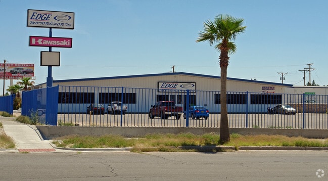
10310 Montana Ave
El Paso
Montana Building Supply
El Paso, TX
1 MONTANA BUILDING SUPPLY LOT 1 (151197.88 SQ FT)
M639-999-0010-0100
El Paso
Commercialnec
Texas
2024
1
2025
3.47 AC
004310
East
27,146 SF
DEMOGRAPHICS near 10310 Montana Ave
1 Mile
3 Mile
5 Mile
2024 Total Population
10,830
84,088
209,191
2029 Population
10,866
84,776
210,793
Pop Growth 2024-2029
+ 0.33%
+ 0.82%
+ 0.77%
Average Age
39
39
38
2024 Total Households
3,996
31,586
73,884
HH Growth 2024-2029
+ 0.33%
+ 0.82%
+ 0.75%
Median Household Inc
$56,283
$55,259
$50,103
Avg Household Size
2.60
2.60
2.70
2024 Avg HH Vehicles
2.00
2.00
2.00
Median Home Value
$151,813
$160,954
$148,894
Median Year Built
1973
1976
1980
Nearby Places
Map Layers
Map Styles
 Street
 Aerial
- Restaurants
- Banks
- Shops
- Fitness
- Groceries
PUBLIC TRANSPORTATION
AIRPORT
El Paso International
DRIVE
WALK
Distance
El Paso International
13 min
4.6 mi
Nearby Properties
Address
Land Use
TOTAL SIZE
Lot Size
Zoning
Address
Land Use
TOTAL SIZE
Lot Size
Zoning
753,996 SF
23.50 AC
C4
Address
Land Use
TOTAL SIZE
Lot Size
Zoning
1,527,480 SF
201.94 AC
Address
Land Use
TOTAL SIZE
Lot Size
Zoning
1,122,782 SF
55.24 AC
C4
Address
Land Use
TOTAL SIZE
Lot Size
Zoning
380,811 SF
22.75 AC
M1
Address
Land Use
TOTAL SIZE
Lot Size
Zoning
343,190 SF
31.84 AC
C4
Address
Land Use
TOTAL SIZE
Lot Size
Zoning
259,926 SF
250.23 AC
M1
Address
Land Use
TOTAL SIZE
Lot Size
Zoning
289.07 AC
Address
Land Use
TOTAL SIZE
Lot Size
Zoning
135,639 SF
211.63 AC
C4
Address
Land Use
TOTAL SIZE
Lot Size
Zoning
273.45 AC
M1
Address
Land Use
TOTAL SIZE
Lot Size
Zoning
377,168 SF
8.40 AC
C1
Address
Land Use
TOTAL SIZE
Lot Size
Zoning
195,101 SF
15.45 AC
C1
Address
Land Use
TOTAL SIZE
Lot Size
Zoning
201.94 AC
Address
Land Use
TOTAL SIZE
Lot Size
Zoning
435.51 AC
Address
Land Use
TOTAL SIZE
Lot Size
Zoning
196,860 SF
10.15 AC
C4
Address
Land Use
TOTAL SIZE
Lot Size
Zoning
272,601 SF
14.97 AC
AO
Address
Land Use
TOTAL SIZE
Lot Size
Zoning
197,902 SF
30 AC
R4
Address
Land Use
TOTAL SIZE
Lot Size
Zoning
259,968 SF
10.54 AC
AO
Address
Land Use
TOTAL SIZE
Lot Size
Zoning
184,016 SF
14.17 AC
C4
Address
Land Use
TOTAL SIZE
Lot Size
Zoning
235,213 SF
11.98 AC
A3O
Address
Land Use
TOTAL SIZE
Lot Size
Zoning
333,673 SF
15 AC
AO
Address
Land Use
TOTAL SIZE
Lot Size
Zoning
170,528 SF
9.05 AC
C3S
Address
Land Use
TOTAL SIZE
Lot Size
Zoning
186,950 SF
14.30 AC
C1
Address
Land Use
TOTAL SIZE
Lot Size
Zoning
189,234 SF
10.01 AC
AO
Address
Land Use
TOTAL SIZE
Lot Size
Zoning
54,062 SF
4.92 AC
R4
Address
Land Use
TOTAL SIZE
Lot Size
Zoning
163,540 SF
18.75 AC
C3
Address
Land Use
TOTAL SIZE
Lot Size
Zoning
23,760 SF
124.65 AC
Address
Land Use
TOTAL SIZE
Lot Size
Zoning
107,215 SF
4.05 AC
GM
Address
Land Use
TOTAL SIZE
Lot Size
Zoning
226,736 SF
12 AC
A2
Address
Land Use
TOTAL SIZE
Lot Size
Zoning
139,470 SF
11.33 AC
C3
Address
Land Use
TOTAL SIZE
Lot Size
Zoning
153,159 SF
11.86 AC
C1
The World's #1 Commercial Real Estate Marketplace
Connect with us
© 2026 CoStar Group
The information above has been obtained from sources believed reliable. While we do not doubt its accuracy we have not verified it and make no guarantee, warranty or representation about it. It is your responsibility to independently confirm its accuracy and completeness. Any projections, opinions, assumptions, or estimates used are for example only and do not represent the current or future performance of the property. The value of this transaction to you depends on tax and other factors which should be evaluated by your tax, financial, and legal advisors. You and your advisors should conduct a careful, independent investigation of the property to determine to your satisfaction the suitability of the property for your needs.