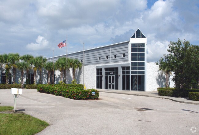
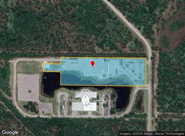
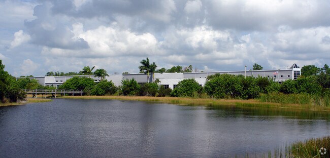
Property Record
10315 102Nd Ter, Sebastian, FL 32958

NEARBY LISTINGS FOR SALE OR LEASE
-
-
View all Sebastian listings for sale on LoopNet.com
Property Detail
10315 102Nd Ter
30-38-00-00003-0000-00001.0
Waldo Development (A Of E)
Lightindustrial
WALDO DEVELOPMENT (A OF E) OR 2274/1711 PARCEL A
A
Indian River
12061C0093J
Florida
2025
7.51 AC
2025
Fort Pierce/Port St Lucie
050903
Other Market Areas
62,376 SF
Sebastian-Vero Beach-West Vero Corridor, FL
DEMOGRAPHICS near 10315 102Nd Ter
1 Mile
3 Mile
5 Mile
2024 Total Population
11
13,631
37,684
2029 Population
12
15,063
41,583
Pop Growth 2024-2029
+ 9.09%
+ 10.51%
+ 10.35%
Average Age
47
45
46
2024 Total Households
4
5,260
14,981
HH Growth 2024-2029
+ 25.00%
+ 10.02%
+ 9.83%
Median Household Inc
$59,999
$65,213
$58,544
Avg Household Size
2.00
2.50
2.50
2024 Avg HH Vehicles
2.00
2.00
2.00
Median Home Value
$374,999
$246,384
$238,784
Median Year Built
2007
2000
1994
Nearby Places
Map Layers
Map Styles
 Street
 Aerial
- Restaurants
- Banks
- Shops
- Fitness
- Groceries
PUBLIC TRANSPORTATION
AIRPORT
Melbourne Orlando International
DRIVE
WALK
Distance
Melbourne Orlando International
43 min
28.2 mi
Freight Ports
Port Canaveral
DRIVE
WALK
Distance
Port Canaveral
75 min
61.4 mi
SALE & LEASE HISTORY
LISTING DATE
SALE/LEASE

Mar 27, 2022
For Sale
Nearby Properties
Address
Land Use
TOTAL SIZE
Lot Size
Zoning
Address
Land Use
TOTAL SIZE
Lot Size
Zoning
54,658 SF
78.18 AC
RS-3
Address
Land Use
TOTAL SIZE
Lot Size
Zoning
73,838 SF
31 AC
A-1
Address
Land Use
TOTAL SIZE
Lot Size
Zoning
85,595 SF
40 AC
A-1
Address
Land Use
TOTAL SIZE
Lot Size
Zoning
59,535 SF
6.10 AC
CG
Address
Land Use
TOTAL SIZE
Lot Size
Zoning
2,527 SF
2,021.55 AC
CON-1
Address
Land Use
TOTAL SIZE
Lot Size
Zoning
54,940 SF
7.97 AC
PUD-R
Address
Land Use
TOTAL SIZE
Lot Size
Zoning
1,353 SF
290.25 AC
CON-1
Address
Land Use
TOTAL SIZE
Lot Size
Zoning
25,895 SF
3.12 AC
PS
Address
Land Use
TOTAL SIZE
Lot Size
Zoning
681 SF
5.29 AC
CG
Address
Land Use
TOTAL SIZE
Lot Size
Zoning
2,900 SF
762.12 AC
CON-1
Address
Land Use
TOTAL SIZE
Lot Size
Zoning
11,165 SF
4.80 AC
IL
Address
Land Use
TOTAL SIZE
Lot Size
Zoning
2,519 SF
78.57 AC
RS-3
Address
Land Use
TOTAL SIZE
Lot Size
Zoning
39,546 SF
5.20 AC
IL
Address
Land Use
TOTAL SIZE
Lot Size
Zoning
736.63 AC
CON-1
Address
Land Use
TOTAL SIZE
Lot Size
Zoning
50,464 SF
5.81 AC
IL
Address
Land Use
TOTAL SIZE
Lot Size
Zoning
18,900 SF
4.67 AC
CG
Address
Land Use
TOTAL SIZE
Lot Size
Zoning
12,980 SF
1.94 AC
CL
Address
Land Use
TOTAL SIZE
Lot Size
Zoning
9,089 SF
31 AC
A-1
Address
Land Use
TOTAL SIZE
Lot Size
Zoning
101,164 SF
618.68 AC
CON-1
Address
Land Use
TOTAL SIZE
Lot Size
Zoning
956 SF
51.72 AC
A-1
Address
Land Use
TOTAL SIZE
Lot Size
Zoning
1,684 SF
603.50 AC
CON-1
Address
Land Use
TOTAL SIZE
Lot Size
Zoning
600 AC
CON-1
Address
Land Use
TOTAL SIZE
Lot Size
Zoning
15,734 SF
1.84 AC
PUD-R
Address
Land Use
TOTAL SIZE
Lot Size
Zoning
17,810 SF
22.04 AC
IL
Address
Land Use
TOTAL SIZE
Lot Size
Zoning
5,400 SF
5.79 AC
RS-1
Address
Land Use
TOTAL SIZE
Lot Size
Zoning
2,504 SF
38.02 AC
RS-10
Address
Land Use
TOTAL SIZE
Lot Size
Zoning
51.80 AC
PDD
Address
Land Use
TOTAL SIZE
Lot Size
Zoning
1,120 SF
4.16 AC
C-2
Address
Land Use
TOTAL SIZE
Lot Size
Zoning
2,750 SF
2.10 AC
C-2
The World's #1 Commercial Real Estate Marketplace
Connect with us
© 2026 CoStar Group
The information above has been obtained from sources believed reliable. While we do not doubt its accuracy we have not verified it and make no guarantee, warranty or representation about it. It is your responsibility to independently confirm its accuracy and completeness. Any projections, opinions, assumptions, or estimates used are for example only and do not represent the current or future performance of the property. The value of this transaction to you depends on tax and other factors which should be evaluated by your tax, financial, and legal advisors. You and your advisors should conduct a careful, independent investigation of the property to determine to your satisfaction the suitability of the property for your needs.