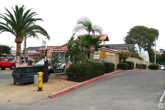
Property Record
1033 N Vulcan Ave, Encinitas, CA 92024


Property Detail
1033 N Vulcan Ave
254-324-60
BLK 1 LOT 14 DOC02-0773034 IN LOT 13&IN TR 001776
Multifamilydwelling
San Diego
R11
California
B and X Area of moderate flood hazard, usually the area between the limits of the 100-year and 500-year floods.
14,13
2024
0.62 AC
2025
Cardiff/Encinitas
017701
San Diego
1,650 SF
San Diego-Chula Vista-Carlsbad, CA
NEARBY LISTINGS FOR SALE OR LEASE
DEMOGRAPHICS near 1033 N Vulcan Ave
1 mile
3 mile
5 mile
2025 Total Population
10,999
57,077
126,450
2030 Population
11,130
57,572
127,099
Pop Growth 2025-2030
+ 1.19%
+ 0.87%
+ 0.51%
Average Age
43
44
43
2025 Total Households
4,676
22,902
49,008
HH Growth 2025-2030
+ 1.22%
+ 0.86%
+ 0.49%
Median Household Inc
$159,104
$159,822
$166,296
Avg Household Size
2.30
2.40
2.50
2025 Avg HH Vehicles
2.00
2.00
2.00
Median Home Value
$1,123,440
$1,110,590
$1,109,210
Median Year Built
1977
1983
1984
Nearby Places
Map Layers
Map Styles
 Street
 Aerial
Layers
 Traffic
 Biking
Places
Listings with unknown addresses are not visible on the map
- Restaurants
- Banks
- Shops
- Fitness
- Groceries
PUBLIC TRANSPORTATION
COMMUTER RAIL
Encinitas (Coaster - San Diego North County Transit District (Coaster/Sprinter/Breeze))
Drive
Walk
Distance
Encinitas (Coaster - San Diego North County Transit District (Coaster/Sprinter/Breeze))
5 min
1.8 mi
Carlsbad Poinsettia (Coaster - San Diego North County Transit District (Coaster/Sprinter/Breeze))
Drive
Walk
Distance
Carlsbad Poinsettia (Coaster - San Diego North County Transit District (Coaster/Sprinter/Breeze))
9 min
4.4 mi
AIRPORT
San Diego International
Drive
Walk
Distance
San Diego International
33 min
25.7 mi
Freight Ports
Port of San Diego
Drive
Walk
Distance
Port of San Diego
39 min
30.2 mi
Nearby Properties
Address
Land Use
TOTAL SIZE
Lot Size
Zoning
Address
Land Use
TOTAL SIZE
Lot Size
Zoning
55.06 AC
P-C
Address
Land Use
TOTAL SIZE
Lot Size
Zoning
18.19 AC
P-C
Address
Land Use
TOTAL SIZE
Lot Size
Zoning
13.11 AC
P/SP
Address
Land Use
TOTAL SIZE
Lot Size
Zoning
30.88 AC
P-C
Address
Land Use
TOTAL SIZE
Lot Size
Zoning
12.62 AC
P-C
Address
Land Use
TOTAL SIZE
Lot Size
Zoning
4.32 AC
N-LVSC
Address
Land Use
TOTAL SIZE
Lot Size
Zoning
21.15 AC
P-C
Address
Land Use
TOTAL SIZE
Lot Size
Zoning
17.80 AC
GC
Address
Land Use
TOTAL SIZE
Lot Size
Zoning
12.44 AC
P/SP
Address
Land Use
TOTAL SIZE
Lot Size
Zoning
4.77 AC
ER-MU1
Address
Land Use
TOTAL SIZE
Lot Size
Zoning
5.45 AC
C-T
Address
Land Use
TOTAL SIZE
Lot Size
Zoning
91,431 SF
8.69 AC
C-2
Address
Land Use
TOTAL SIZE
Lot Size
Zoning
6.61 AC
P-C
Address
Land Use
TOTAL SIZE
Lot Size
Zoning
11 AC
GC
Address
Land Use
TOTAL SIZE
Lot Size
Zoning
74,583 SF
5.61 AC
R11
Address
Land Use
TOTAL SIZE
Lot Size
Zoning
62,682 SF
7.36 AC
GC
Address
Land Use
TOTAL SIZE
Lot Size
Zoning
66,540 SF
6.35 AC
R11
Address
Land Use
TOTAL SIZE
Lot Size
Zoning
6.25 AC
P-C
Address
Land Use
TOTAL SIZE
Lot Size
Zoning
88,188 SF
1.95 AC
N-R3
Address
Land Use
TOTAL SIZE
Lot Size
Zoning
62,357 SF
4.38 AC
R11
Address
Land Use
TOTAL SIZE
Lot Size
Zoning
71,962 SF
5.33 AC
P/SP
Address
Land Use
TOTAL SIZE
Lot Size
Zoning
53,017 SF
2.08 AC
R11
Address
Land Use
TOTAL SIZE
Lot Size
Zoning
10.76 AC
GC
Address
Land Use
TOTAL SIZE
Lot Size
Zoning
97,263 SF
7.73 AC
GC
Address
Land Use
TOTAL SIZE
Lot Size
Zoning
8,000 SF
9.20 AC
RD-M
Address
Land Use
TOTAL SIZE
Lot Size
Zoning
32,742 SF
5.91 AC
GC
Address
Land Use
TOTAL SIZE
Lot Size
Zoning
94,704 SF
4.21 AC
R25
Address
Land Use
TOTAL SIZE
Lot Size
Zoning
14.26 AC
P-C
Address
Land Use
TOTAL SIZE
Lot Size
Zoning
55,772 SF
4.54 AC
P-C
Address
Land Use
TOTAL SIZE
Lot Size
Zoning
5.58 AC
RD-M
The World's #1 Commercial Real Estate Marketplace
Connect with us
© 2026 CoStar Group
The information above has been obtained from sources believed reliable. While we do not doubt its accuracy we have not verified it and make no guarantee, warranty or representation about it. It is your responsibility to independently confirm its accuracy and completeness. Any projections, opinions, assumptions, or estimates used are for example only and do not represent the current or future performance of the property. The value of this transaction to you depends on tax and other factors which should be evaluated by your tax, financial, and legal advisors. You and your advisors should conduct a careful, independent investigation of the property to determine to your satisfaction the suitability of the property for your needs.