Property Record
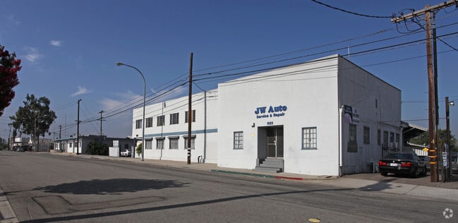
1035 Westminster Ave, Alhambra, CA 91803


Property Detail
1035 Westminster Ave
5342-034-052
P M 397-47-52 THAT POR IN TRA 1809 LOT 1
Lightindustrial
LOS ANGELES
ALMPD*
California
B and X Area of moderate flood hazard, usually the area between the limits of the 100-year and 500-year floods.
1
2025
5.59 AC
2025
Lower San Gabriel Valley
480903
Los Angeles
121,733 SF
Los Angeles-Long Beach-Glendale, CA
NEARBY LISTINGS FOR SALE OR LEASE
DEMOGRAPHICS near 1035 Westminster Ave
1 mile
3 mile
5 mile
2025 Total Population
28,358
260,801
714,729
2030 Population
28,026
257,854
704,879
Pop Growth 2025-2030
(1.17%)
(1.13%)
(1.38%)
Average Age
41
41
41
2025 Total Households
9,146
88,995
234,659
HH Growth 2025-2030
(1.43%)
(1.33%)
(1.52%)
Median Household Inc
$87,809
$90,120
$86,209
Avg Household Size
3.00
2.80
2.90
2025 Avg HH Vehicles
2.00
2.00
2.00
Median Home Value
$804,498
$865,616
$879,449
Median Year Built
1949
1958
1956
Nearby Places
Map Layers
Map Styles
 Street
 Aerial
Layers
 Traffic
 Biking
Places
Listings with unknown addresses are not visible on the map
- Restaurants
- Banks
- Shops
- Fitness
- Groceries
PUBLIC TRANSPORTATION
COMMUTER RAIL
Union Station (91 Line - Southern California Regional Rail Authority (Metrolink), Antelope Valley Line - Southern California Regional Rail Authority (Metrolink), Orange County Line - Southern California Regional Rail Authority (Metrolink), Riverside Line - Southern California Regional Rail Authority (Metrolink), San Bernardino Line - Southern California Regional Rail Authority (Metrolink), Ventura County Line - Southern California Regional Rail Authority (Metrolink))
Drive
Walk
Distance
Union Station (91 Line - Southern California Regional Rail Authority (Metrolink), Antelope Valley Line - Southern California Regional Rail Authority (Metrolink), Orange County Line - Southern California Regional Rail Authority (Metrolink), Riverside Line - Southern California Regional Rail Authority (Metrolink), San Bernardino Line - Southern California Regional Rail Authority (Metrolink), Ventura County Line - Southern California Regional Rail Authority (Metrolink))
13 min
7.0 mi
AIRPORT
Bob Hope
Drive
Walk
Distance
Bob Hope
30 min
21.4 mi
Long Beach (Daugherty Field)
Drive
Walk
Distance
Long Beach (Daugherty Field)
31 min
21.6 mi
Los Angeles International
Drive
Walk
Distance
Los Angeles International
36 min
22.9 mi
Freight Ports
Port of Long Beach
Drive
Walk
Distance
Port of Long Beach
33 min
24.4 mi
Nearby Properties
Address
Land Use
TOTAL SIZE
Lot Size
Zoning
Address
Land Use
TOTAL SIZE
Lot Size
Zoning
513,825 SF
4.28 AC
LAC2
Address
Land Use
TOTAL SIZE
Lot Size
Zoning
534,225 SF
Address
Land Use
TOTAL SIZE
Lot Size
Zoning
460,590 SF
23.95 AC
ALMPD*
Address
Land Use
TOTAL SIZE
Lot Size
Zoning
11,590 SF
14.43 AC
PSC*
Address
Land Use
TOTAL SIZE
Lot Size
Zoning
354,299 SF
2.18 AC
LAC2
Address
Land Use
TOTAL SIZE
Lot Size
Zoning
150,608 SF
0.88 AC
LAC2
Address
Land Use
TOTAL SIZE
Lot Size
Zoning
516,474 SF
4.37 AC
ALCBD/DRD*
Address
Land Use
TOTAL SIZE
Lot Size
Zoning
151,450 SF
6.59 AC
MPSP*
Address
Land Use
TOTAL SIZE
Lot Size
Zoning
220,717 SF
2.14 AC
MPSP*
Address
Land Use
TOTAL SIZE
Lot Size
Zoning
252,559 SF
2.87 AC
LAC2
Address
Land Use
TOTAL SIZE
Lot Size
Zoning
172,072 SF
1.82 AC
LAC2
Address
Land Use
TOTAL SIZE
Lot Size
Zoning
198,958 SF
7.50 AC
LCM2*
Address
Land Use
TOTAL SIZE
Lot Size
Zoning
116,109 SF
0.92 AC
LACM
Address
Land Use
TOTAL SIZE
Lot Size
Zoning
116,480 SF
11.81 AC
MPC2
Address
Land Use
TOTAL SIZE
Lot Size
Zoning
77,778 SF
2.87 AC
ALRPD*
Address
Land Use
TOTAL SIZE
Lot Size
Zoning
87,236 SF
2.62 AC
SPP*
Address
Land Use
TOTAL SIZE
Lot Size
Zoning
85,890 SF
2.33 AC
MPR2SCH*
Address
Land Use
TOTAL SIZE
Lot Size
Zoning
296,309 SF
5.29 AC
LAM1
Address
Land Use
TOTAL SIZE
Lot Size
Zoning
130,189 SF
6.59 AC
MPOPCD*
Address
Land Use
TOTAL SIZE
Lot Size
Zoning
146,264 SF
1.87 AC
LAMR1
Address
Land Use
TOTAL SIZE
Lot Size
Zoning
288,700 SF
6.19 AC
MPOP*
Address
Land Use
TOTAL SIZE
Lot Size
Zoning
155,339 SF
3.99 AC
LAMR1
Address
Land Use
TOTAL SIZE
Lot Size
Zoning
92,530 SF
3.16 AC
LARD1.5
Address
Land Use
TOTAL SIZE
Lot Size
Zoning
203,860 SF
1.92 AC
MPSP*
Address
Land Use
TOTAL SIZE
Lot Size
Zoning
48,018 SF
2.64 AC
SLC3*
Address
Land Use
TOTAL SIZE
Lot Size
Zoning
119,883 SF
5.93 AC
MPOP*
Address
Land Use
TOTAL SIZE
Lot Size
Zoning
435,600 SF
10.57 AC
LACM
Address
Land Use
TOTAL SIZE
Lot Size
Zoning
82,188 SF
1.20 AC
ALCBD/DRD*
Address
Land Use
TOTAL SIZE
Lot Size
Zoning
41,761 SF
3.25 AC
ALCPD-R1*
The World's #1 Commercial Real Estate Marketplace
Connect with us
© 2026 CoStar Group
The information above has been obtained from sources believed reliable. While we do not doubt its accuracy we have not verified it and make no guarantee, warranty or representation about it. It is your responsibility to independently confirm its accuracy and completeness. Any projections, opinions, assumptions, or estimates used are for example only and do not represent the current or future performance of the property. The value of this transaction to you depends on tax and other factors which should be evaluated by your tax, financial, and legal advisors. You and your advisors should conduct a careful, independent investigation of the property to determine to your satisfaction the suitability of the property for your needs.