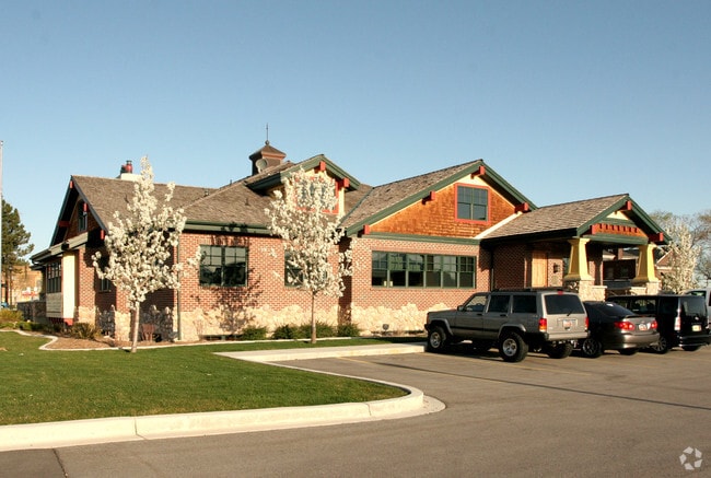
Property Record
10393 S Temple Dr, South Jordan, UT 84095

NEARBY LISTINGS FOR SALE OR LEASE
Property Detail
10393 S Temple Dr
Salt Lake City, UT
BEG E 198.19 FT & N 8.447 FT FR SW COR OF N 1/2 OF NW 1/4 SEC 14, T 3S, R 1W, SLM; N 123.553 FT; E 148.49 FT M OR L; S132 FT; W 10.245 FT; WLY ALG A 2099.74 FT RADIUS CURVE TO L56.6 FT; N 86^4506 W 81.97 FT TO BEG. 0.44 AC M OR L. 5426-1798 6409-1893
27-14-103-015-0000
Salt Lake
Officebuilding
Utah
X
56
49035C0441G
0.20 AC
2024
Southwest Valley
2025
Salt Lake City
113012
DEMOGRAPHICS near 10393 S Temple Dr
1 Mile
3 Mile
5 Mile
2024 Total Population
8,955
99,230
316,275
2029 Population
9,097
100,545
320,400
Pop Growth 2024-2029
+ 1.59%
+ 1.33%
+ 1.30%
Average Age
43
37
36
2024 Total Households
3,025
32,708
101,405
HH Growth 2024-2029
+ 1.59%
+ 1.42%
+ 1.28%
Median Household Inc
$108,486
$94,205
$95,293
Avg Household Size
2.90
3.00
3.00
2024 Avg HH Vehicles
2.00
2.00
2.00
Median Home Value
$638,542
$524,805
$472,807
Median Year Built
2000
1997
1995
Nearby Places
Map Layers
Map Styles
 Street
 Aerial
- Restaurants
- Banks
- Shops
- Fitness
- Groceries
PUBLIC TRANSPORTATION
COMMUTER RAIL
South Jordan Station (FrontRunner - Utah Transit Authority (UTA))
DRIVE
WALK
Distance
South Jordan Station (FrontRunner - Utah Transit Authority (UTA))
4 min
1.9 mi
Draper Station (FrontRunner - Utah Transit Authority (UTA))
DRIVE
WALK
Distance
Draper Station (FrontRunner - Utah Transit Authority (UTA))
11 min
4.6 mi
AIRPORT
Salt Lake City International
DRIVE
WALK
Distance
Salt Lake City International
27 min
21.2 mi
Provo Municipal
DRIVE
WALK
Distance
Provo Municipal
44 min
32.9 mi
Freight Ports
Port of Stockton
DRIVE
WALK
Distance
Port of Stockton
727 min
705.5 mi
Nearby Properties
Address
Land Use
TOTAL SIZE
Lot Size
Zoning
Address
Land Use
TOTAL SIZE
Lot Size
Zoning
733,215 SF
58.65 AC
M-1
Address
Land Use
TOTAL SIZE
Lot Size
Zoning
258,000 SF
13.25 AC
1D
Address
Land Use
TOTAL SIZE
Lot Size
Zoning
198,801 SF
8.36 AC
R-3-20
Address
Land Use
TOTAL SIZE
Lot Size
Zoning
153,245 SF
27.10 AC
PUD137
Address
Land Use
TOTAL SIZE
Lot Size
Zoning
566,327 SF
7.02 AC
CBD-O
Address
Land Use
TOTAL SIZE
Lot Size
Zoning
458,458 SF
6.05 AC
MU
Address
Land Use
TOTAL SIZE
Lot Size
Zoning
224,049 SF
5.29 AC
MU
Address
Land Use
TOTAL SIZE
Lot Size
Zoning
372,355 SF
13.80 AC
C-F
Address
Land Use
TOTAL SIZE
Lot Size
Zoning
106,318 SF
4.46 AC
CBD-O
Address
Land Use
TOTAL SIZE
Lot Size
Zoning
186,651 SF
35.87 AC
C-R
Address
Land Use
TOTAL SIZE
Lot Size
Zoning
280,668 SF
12 AC
CBD
Address
Land Use
TOTAL SIZE
Lot Size
Zoning
81,865 SF
19.46 AC
Z-C-FF
Address
Land Use
TOTAL SIZE
Lot Size
Zoning
34,872 SF
11.59 AC
c-f
Address
Land Use
TOTAL SIZE
Lot Size
Zoning
379,911 SF
5.78 AC
mu
Address
Land Use
TOTAL SIZE
Lot Size
Zoning
192,626 SF
5.72 AC
CF
Address
Land Use
TOTAL SIZE
Lot Size
Zoning
398,447 SF
11.04 AC
BMHU
Address
Land Use
TOTAL SIZE
Lot Size
Zoning
551,648 SF
31.71 AC
C B D
Address
Land Use
TOTAL SIZE
Lot Size
Zoning
101,790 SF
5.69 AC
PUD(16
Address
Land Use
TOTAL SIZE
Lot Size
Zoning
198,479 SF
2.52 AC
MU
Address
Land Use
TOTAL SIZE
Lot Size
Zoning
120,929 SF
7.23 AC
PC
Address
Land Use
TOTAL SIZE
Lot Size
Zoning
200,922 SF
3.82 AC
2000
Address
Land Use
TOTAL SIZE
Lot Size
Zoning
118,400 SF
7.82 AC
I F
Address
Land Use
TOTAL SIZE
Lot Size
Zoning
279,829 SF
18.28 AC
CSD-LP
Address
Land Use
TOTAL SIZE
Lot Size
Zoning
36,708 SF
12.83 AC
R-3-16
Address
Land Use
TOTAL SIZE
Lot Size
Zoning
276,600 SF
8.15 AC
TOD-MU
Address
Land Use
TOTAL SIZE
Lot Size
Zoning
105,956 SF
37.60 AC
4180
Address
Land Use
TOTAL SIZE
Lot Size
Zoning
328,268 SF
13.37 AC
SDJHS
Address
Land Use
TOTAL SIZE
Lot Size
Zoning
470,856 SF
10.74 AC
CBDO
Address
Land Use
TOTAL SIZE
Lot Size
Zoning
146,280 SF
0.01 AC
CBD
Address
Land Use
TOTAL SIZE
Lot Size
Zoning
118.74 AC
4180
The World's #1 Commercial Real Estate Marketplace
Connect with us
© 2025 CoStar Group
The information above has been obtained from sources believed reliable. While we do not doubt its accuracy we have not verified it and make no guarantee, warranty or representation about it. It is your responsibility to independently confirm its accuracy and completeness. Any projections, opinions, assumptions, or estimates used are for example only and do not represent the current or future performance of the property. The value of this transaction to you depends on tax and other factors which should be evaluated by your tax, financial, and legal advisors. You and your advisors should conduct a careful, independent investigation of the property to determine to your satisfaction the suitability of the property for your needs.