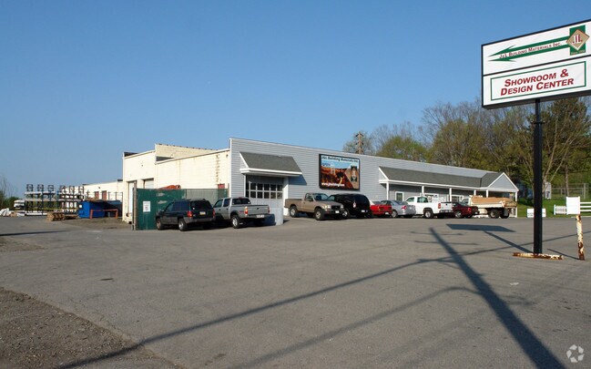
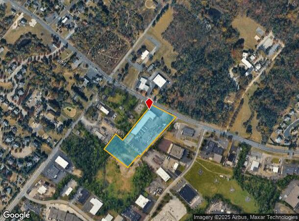
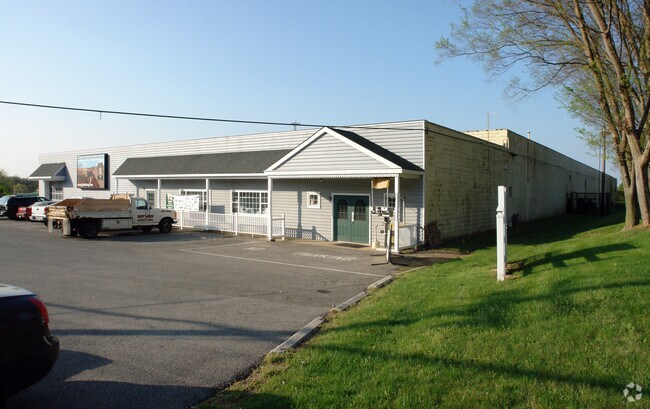
Property Record
1044 W Germantown Pike, Norristown, PA 19403

NEARBY LISTINGS FOR SALE OR LEASE
Property Detail
1044 W Germantown Pike
Philadelphia-Camden-Wilmington, PA-NJ-DE-MD
Howmet Corp
33-00-02899-002
ASSESSOR BLOCK-UNIT NUMBER 2A-17
Warehouse
Montgomery
X
Pennsylvania
42091C0261G
17
2024
2.99 AC
2025
East Montgomery Cty
203302
Philadelphia
26,968 SF
DEMOGRAPHICS near 1044 W Germantown Pike
1 Mile
3 Mile
5 Mile
2024 Total Population
5,545
62,706
165,728
2029 Population
5,625
63,686
168,681
Pop Growth 2024-2029
+ 1.44%
+ 1.56%
+ 1.78%
Average Age
43
42
41
2024 Total Households
2,099
23,980
63,769
HH Growth 2024-2029
+ 1.48%
+ 1.60%
+ 1.80%
Median Household Inc
$116,820
$83,404
$95,964
Avg Household Size
2.50
2.40
2.50
2024 Avg HH Vehicles
2.00
2.00
2.00
Median Home Value
$371,885
$302,096
$357,091
Median Year Built
1981
1969
1972
Nearby Places
Map Layers
Map Styles
 Street
 Aerial
- Restaurants
- Banks
- Shops
- Fitness
- Groceries
PUBLIC TRANSPORTATION
COMMUTER RAIL
Main Street (Norristown) (R6 - Southeastern Pennsylvania Transportation Authority Regional Rail (SEPTA Regional Rail))
DRIVE
WALK
Distance
Main Street (Norristown) (R6 - Southeastern Pennsylvania Transportation Authority Regional Rail (SEPTA Regional Rail))
10 min
4.4 mi
Elm Street (Norristown) (R6 - Southeastern Pennsylvania Transportation Authority Regional Rail (SEPTA Regional Rail))
DRIVE
WALK
Distance
Elm Street (Norristown) (R6 - Southeastern Pennsylvania Transportation Authority Regional Rail (SEPTA Regional Rail))
10 min
4.8 mi
AIRPORT
Philadelphia International
DRIVE
WALK
Distance
Philadelphia International
51 min
32.0 mi
Freight Ports
Port of Philadelphia
DRIVE
WALK
Distance
Port of Philadelphia
43 min
23.8 mi
Nearby Properties
Address
Land Use
TOTAL SIZE
Lot Size
Zoning
Address
Land Use
TOTAL SIZE
Lot Size
Zoning
1,807,465 SF
120.12 AC
R2
Address
Land Use
TOTAL SIZE
Lot Size
Zoning
365,348 SF
80.44 AC
IN
Address
Land Use
TOTAL SIZE
Lot Size
Zoning
124,789 SF
155.99 AC
INO
Address
Land Use
TOTAL SIZE
Lot Size
Zoning
972,935 SF
20.51 AC
INO
Address
Land Use
TOTAL SIZE
Lot Size
Zoning
422,975 SF
92.05 AC
RA
Address
Land Use
TOTAL SIZE
Lot Size
Zoning
348,190 SF
68 AC
R1
Address
Land Use
TOTAL SIZE
Lot Size
Zoning
199,873 SF
71.47 AC
INO
Address
Land Use
TOTAL SIZE
Lot Size
Zoning
367,115 SF
62.90 AC
AGR
Address
Land Use
TOTAL SIZE
Lot Size
Zoning
273,724 SF
8.05 AC
INO
Address
Land Use
TOTAL SIZE
Lot Size
Zoning
416,392 SF
26.56 AC
HR
Address
Land Use
TOTAL SIZE
Lot Size
Zoning
208,680 SF
4.54 AC
LCI
Address
Land Use
TOTAL SIZE
Lot Size
Zoning
311,784 SF
21.82 AC
A
Address
Land Use
TOTAL SIZE
Lot Size
Zoning
211,739 SF
14.14 AC
CR
Address
Land Use
TOTAL SIZE
Lot Size
Zoning
305,760 SF
22.50 AC
R2
Address
Land Use
TOTAL SIZE
Lot Size
Zoning
133,012 SF
32.23 AC
IN
Address
Land Use
TOTAL SIZE
Lot Size
Zoning
252,272 SF
18.86 AC
A
Address
Land Use
TOTAL SIZE
Lot Size
Zoning
276,284 SF
3.87 AC
INO
Address
Land Use
TOTAL SIZE
Lot Size
Zoning
284,250 SF
17.10 AC
A
Address
Land Use
TOTAL SIZE
Lot Size
Zoning
234,091 SF
53.94 AC
PBO
Address
Land Use
TOTAL SIZE
Lot Size
Zoning
207,668 SF
4.96 AC
INO
Address
Land Use
TOTAL SIZE
Lot Size
Zoning
334,104 SF
10.24 AC
GA
Address
Land Use
TOTAL SIZE
Lot Size
Zoning
207,668 SF
4.13 AC
INO
Address
Land Use
TOTAL SIZE
Lot Size
Zoning
85,446 SF
14.60 AC
PF
Address
Land Use
TOTAL SIZE
Lot Size
Zoning
639,430 SF
68.33 AC
R2
Address
Land Use
TOTAL SIZE
Lot Size
Zoning
69,060 SF
18.68 AC
R1
Address
Land Use
TOTAL SIZE
Lot Size
Zoning
112,515 SF
3.23 AC
GC
Address
Land Use
TOTAL SIZE
Lot Size
Zoning
119,340 SF
10.91 AC
GC
Address
Land Use
TOTAL SIZE
Lot Size
Zoning
234,139 SF
3.12 AC
CR
Address
Land Use
TOTAL SIZE
Lot Size
Zoning
73,692 SF
1.20 AC
IN
Address
Land Use
TOTAL SIZE
Lot Size
Zoning
137,681 SF
39.94 AC
LCI
The World's #1 Commercial Real Estate Marketplace
Connect with us
© 2025 CoStar Group
The information above has been obtained from sources believed reliable. While we do not doubt its accuracy we have not verified it and make no guarantee, warranty or representation about it. It is your responsibility to independently confirm its accuracy and completeness. Any projections, opinions, assumptions, or estimates used are for example only and do not represent the current or future performance of the property. The value of this transaction to you depends on tax and other factors which should be evaluated by your tax, financial, and legal advisors. You and your advisors should conduct a careful, independent investigation of the property to determine to your satisfaction the suitability of the property for your needs.