Property Record
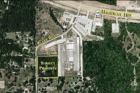
1053 Blake Rd, Conroe, TX 77304

Property Detail
1053 Blake Rd
9503-00-00900
S950300 - WESTWOOD HILLS, LOT 9 (AKA BLAKE ROAD BUSINESS PARK NO 2 #2015012551), ACRES 3.386
Commercialnec
MONTGOMERY
1
Texas
B and X Area of moderate flood hazard, usually the area between the limits of the 100-year and 500-year floods.
9
2024
3.39 AC
2025
Outlying Montgomery Cnty
694401
Houston
61,102 SF
Houston-Pasadena-The Woodlands, TX
NEARBY LISTINGS FOR SALE OR LEASE
DEMOGRAPHICS near 1053 Blake Rd
1 mile
3 mile
5 mile
2024 Total Population
2,111
18,340
79,749
2029 Population
2,500
21,780
94,693
Pop Growth 2024-2029
+ 18.43%
+ 18.76%
+ 18.74%
Average Age
38
41
41
2024 Total Households
824
7,198
31,562
HH Growth 2024-2029
+ 18.93%
+ 19.24%
+ 19.20%
Median Household Inc
$83,900
$101,054
$95,037
Avg Household Size
2.60
2.50
2.50
2024 Avg HH Vehicles
2.00
2.00
2.00
Median Home Value
$278,306
$401,143
$393,418
Median Year Built
2011
2010
2010
Nearby Places
Map Layers
Map Styles
 Street
 Aerial
Transit
 Traffic
 Biking
Places
Listings with unknown addresses are not visible on the map
- Restaurants
- Banks
- Shops
- Fitness
- Groceries
PUBLIC TRANSPORTATION
AIRPORT
George Bush Intcntl/Houston
Drive
Walk
Distance
George Bush Intcntl/Houston
47 min
37.1 mi
Freight Ports
Port of Houston
Drive
Walk
Distance
Port of Houston
70 min
52.8 mi
Nearby Properties
Address
Land Use
TOTAL SIZE
Lot Size
Zoning
Address
Land Use
TOTAL SIZE
Lot Size
Zoning
229,345 SF
12.36 AC
1
Address
Land Use
TOTAL SIZE
Lot Size
Zoning
134,621 SF
26.37 AC
Address
Land Use
TOTAL SIZE
Lot Size
Zoning
313,974 SF
25.03 AC
1
Address
Land Use
TOTAL SIZE
Lot Size
Zoning
287,364 SF
23.45 AC
4
Address
Land Use
TOTAL SIZE
Lot Size
Zoning
203,934 SF
11.75 AC
Address
Land Use
TOTAL SIZE
Lot Size
Zoning
382,810 SF
18.58 AC
1
Address
Land Use
TOTAL SIZE
Lot Size
Zoning
114,101 SF
43.80 AC
Address
Land Use
TOTAL SIZE
Lot Size
Zoning
402,840 SF
26.73 AC
Address
Land Use
TOTAL SIZE
Lot Size
Zoning
69,122 SF
5.57 AC
Address
Land Use
TOTAL SIZE
Lot Size
Zoning
81,011 SF
21.53 AC
Address
Land Use
TOTAL SIZE
Lot Size
Zoning
170,050 SF
10.80 AC
Address
Land Use
TOTAL SIZE
Lot Size
Zoning
99,820 SF
4.51 AC
1
Address
Land Use
TOTAL SIZE
Lot Size
Zoning
68,576 SF
26.39 AC
Address
Land Use
TOTAL SIZE
Lot Size
Zoning
74,395 SF
8.44 AC
Address
Land Use
TOTAL SIZE
Lot Size
Zoning
35,816 SF
251.16 AC
1
Address
Land Use
TOTAL SIZE
Lot Size
Zoning
104,735 SF
29.96 AC
1
Address
Land Use
TOTAL SIZE
Lot Size
Zoning
26,278 SF
9.39 AC
Address
Land Use
TOTAL SIZE
Lot Size
Zoning
54,511 SF
14.42 AC
1
Address
Land Use
TOTAL SIZE
Lot Size
Zoning
14,628 SF
1.33 AC
Address
Land Use
TOTAL SIZE
Lot Size
Zoning
29,500 SF
1.59 AC
Address
Land Use
TOTAL SIZE
Lot Size
Zoning
18,630 SF
11.34 AC
1
Address
Land Use
TOTAL SIZE
Lot Size
Zoning
77,850 SF
6.11 AC
1
Address
Land Use
TOTAL SIZE
Lot Size
Zoning
39,210 SF
3.50 AC
Address
Land Use
TOTAL SIZE
Lot Size
Zoning
24,420 SF
2.13 AC
Address
Land Use
TOTAL SIZE
Lot Size
Zoning
50,008 SF
8.86 AC
1
Address
Land Use
TOTAL SIZE
Lot Size
Zoning
46,048 SF
11.63 AC
1
Address
Land Use
TOTAL SIZE
Lot Size
Zoning
125,615 SF
9.40 AC
Address
Land Use
TOTAL SIZE
Lot Size
Zoning
18,666 SF
10 AC
1
Address
Land Use
TOTAL SIZE
Lot Size
Zoning
14,638 SF
2.74 AC
1
The World's #1 Commercial Real Estate Marketplace
Connect with us
© 2026 CoStar Group
The information above has been obtained from sources believed reliable. While we do not doubt its accuracy we have not verified it and make no guarantee, warranty or representation about it. It is your responsibility to independently confirm its accuracy and completeness. Any projections, opinions, assumptions, or estimates used are for example only and do not represent the current or future performance of the property. The value of this transaction to you depends on tax and other factors which should be evaluated by your tax, financial, and legal advisors. You and your advisors should conduct a careful, independent investigation of the property to determine to your satisfaction the suitability of the property for your needs.