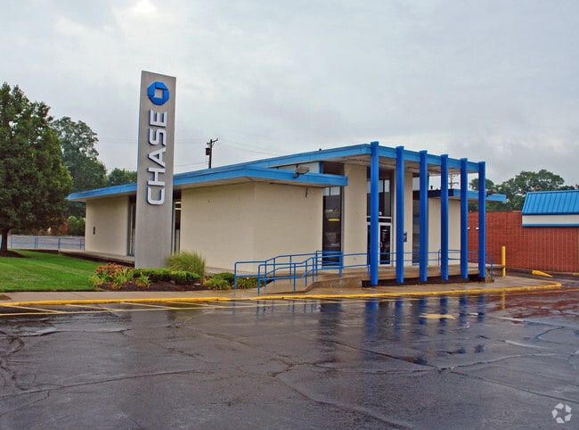
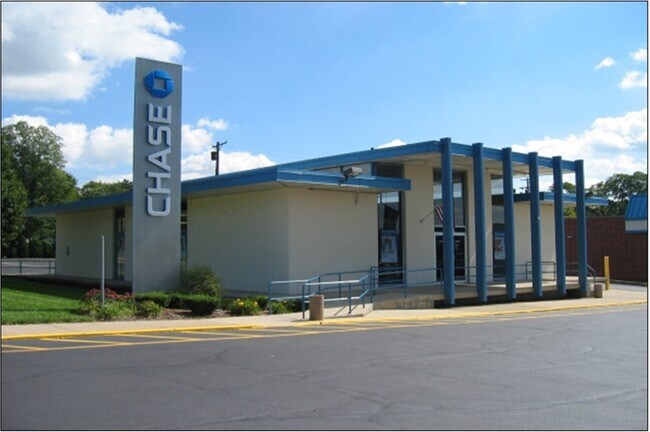
Property Record
1054 Patterson Rd, Dayton, OH 45420

Current Lease Availabilities
Property Detail
1054 Patterson Rd
Dayton, OH
84016 BREITENSTRATER SQUARE
R72-17732-0001
MONTGOMERY
Regionalshoppingcenterormallwithanchorstore
Ohio
B and X Area of moderate flood hazard, usually the area between the limits of the 100-year and 500-year floods.
84016
2024
5.73 AC
2025
South Central Dayton
002900
Cincinnati/Dayton
79,694 SF
NEARBY LISTINGS FOR SALE OR LEASE
DEMOGRAPHICS near 1054 Patterson Rd
1 mile
3 mile
5 mile
2025 Total Population
16,755
114,561
219,754
2030 Population
16,580
115,376
222,281
Pop Growth 2025-2030
(1.04%)
+ 0.71%
+ 1.15%
Average Age
40
38
39
2025 Total Households
8,487
48,606
93,817
HH Growth 2025-2030
(0.94%)
+ 0.66%
+ 1.14%
Median Household Inc
$60,149
$61,045
$61,481
Avg Household Size
1.90
2.20
2.20
2025 Avg HH Vehicles
2.00
2.00
2.00
Median Home Value
$158,184
$169,099
$191,799
Median Year Built
1952
1953
1957
Nearby Places
Map Layers
Map Styles
 Street
 Aerial
Transit
 Traffic
 Biking
Places
Listings with unknown addresses are not visible on the map
- Restaurants
- Banks
- Shops
- Fitness
- Groceries
PUBLIC TRANSPORTATION
AIRPORT
James M Cox Dayton International
Drive
Walk
Distance
James M Cox Dayton International
26 min
16.1 mi
Freight Ports
Virginia Port Authority - Richmond
Drive
Walk
Distance
Virginia Port Authority - Richmond
1 min
395.5 mi
Nearby Properties
Address
Land Use
TOTAL SIZE
Lot Size
Zoning
Address
Land Use
TOTAL SIZE
Lot Size
Zoning
1,570,433 SF
13.34 AC
Address
Land Use
TOTAL SIZE
Lot Size
Zoning
634,753 SF
54 AC
Address
Land Use
TOTAL SIZE
Lot Size
Zoning
428,925 SF
21.70 AC
Address
Land Use
TOTAL SIZE
Lot Size
Zoning
414,094 SF
36.48 AC
Address
Land Use
TOTAL SIZE
Lot Size
Zoning
275,808 SF
19.97 AC
Address
Land Use
TOTAL SIZE
Lot Size
Zoning
55.88 AC
Address
Land Use
TOTAL SIZE
Lot Size
Zoning
752,874 SF
74.85 AC
Address
Land Use
TOTAL SIZE
Lot Size
Zoning
23,031 SF
63.14 AC
Address
Land Use
TOTAL SIZE
Lot Size
Zoning
5.41 AC
Address
Land Use
TOTAL SIZE
Lot Size
Zoning
23.35 AC
Address
Land Use
TOTAL SIZE
Lot Size
Zoning
175,938 SF
49.33 AC
Address
Land Use
TOTAL SIZE
Lot Size
Zoning
375,053 SF
7.27 AC
Address
Land Use
TOTAL SIZE
Lot Size
Zoning
222,197 SF
1.80 AC
Address
Land Use
TOTAL SIZE
Lot Size
Zoning
1,951 SF
56.54 AC
Address
Land Use
TOTAL SIZE
Lot Size
Zoning
3.76 AC
Address
Land Use
TOTAL SIZE
Lot Size
Zoning
45,583 SF
4.91 AC
Address
Land Use
TOTAL SIZE
Lot Size
Zoning
Address
Land Use
TOTAL SIZE
Lot Size
Zoning
3.27 AC
Address
Land Use
TOTAL SIZE
Lot Size
Zoning
128,859 SF
5.31 AC
Address
Land Use
TOTAL SIZE
Lot Size
Zoning
4.86 AC
Address
Land Use
TOTAL SIZE
Lot Size
Zoning
41.38 AC
Address
Land Use
TOTAL SIZE
Lot Size
Zoning
18.33 AC
Address
Land Use
TOTAL SIZE
Lot Size
Zoning
254,552 SF
9.83 AC
Address
Land Use
TOTAL SIZE
Lot Size
Zoning
4.38 AC
Address
Land Use
TOTAL SIZE
Lot Size
Zoning
4.98 AC
Address
Land Use
TOTAL SIZE
Lot Size
Zoning
5.95 AC
Address
Land Use
TOTAL SIZE
Lot Size
Zoning
152,844 SF
14.80 AC
Address
Land Use
TOTAL SIZE
Lot Size
Zoning
301,146 SF
19.40 AC
Address
Land Use
TOTAL SIZE
Lot Size
Zoning
94,027 SF
7.99 AC
Address
Land Use
TOTAL SIZE
Lot Size
Zoning
9.45 AC
The World's #1 Commercial Real Estate Marketplace
Connect with us
© 2026 CoStar Group
The information above has been obtained from sources believed reliable. While we do not doubt its accuracy we have not verified it and make no guarantee, warranty or representation about it. It is your responsibility to independently confirm its accuracy and completeness. Any projections, opinions, assumptions, or estimates used are for example only and do not represent the current or future performance of the property. The value of this transaction to you depends on tax and other factors which should be evaluated by your tax, financial, and legal advisors. You and your advisors should conduct a careful, independent investigation of the property to determine to your satisfaction the suitability of the property for your needs.