Property Record
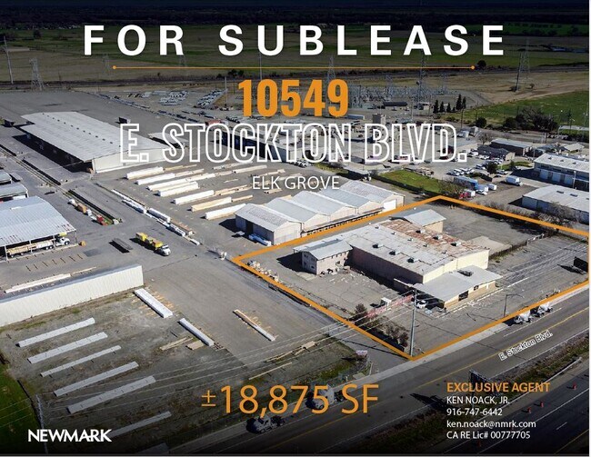
10549 E Stockton Blvd, Elk Grove, CA 95624


NEARBY LISTINGS FOR SALE OR LEASE
Property Detail
10549 E Stockton Blvd
134-1080-005
Ellen M & Wilson Estates
Lightindustrial
POR SEC 17 & 18 T.6N, R6E, M.D.B.&M DESC AS BEG AT SE COR PCL 2 OF P.M. 53-38, TH FM P.O.B. S17% 40 17 E 383.57 FT, TH S 49%
X
Sacramento
06077C0050G
California
2024
16.10 AC
2025
Elk Grove/Laguna
009336
Sacramento
88,714 SF
Sacramento-Roseville-Folsom, CA
DEMOGRAPHICS near 10549 E Stockton Blvd
1 Mile
3 Mile
5 Mile
2024 Total Population
53
32,591
109,069
2029 Population
53
33,285
110,315
Pop Growth 2024-2029
0.00%
+ 2.13%
+ 1.14%
Average Age
40
38
39
2024 Total Households
10
10,040
33,351
HH Growth 2024-2029
+ 10.00%
+ 2.03%
+ 1.11%
Median Household Inc
$124,999
$114,508
$110,477
Avg Household Size
3.20
3.10
3.20
2024 Avg HH Vehicles
2.00
2.00
2.00
Median Home Value
$750,000
$607,276
$591,720
Median Year Built
2005
1999
2001
Nearby Places
Map Layers
Map Styles
 Street
 Aerial
- Restaurants
- Banks
- Shops
- Fitness
- Groceries
PUBLIC TRANSPORTATION
AIRPORT
Sacramento International
DRIVE
WALK
Distance
Sacramento International
41 min
29.1 mi
Freight Ports
Port of Stockton
DRIVE
WALK
Distance
Port of Stockton
48 min
36.7 mi
SALE & LEASE HISTORY
LISTING DATE
SALE/LEASE

May 11, 2021
For Lease
Mar 21, 2022
For Lease
Jan 09, 2024
For Lease
Nearby Properties
Address
Land Use
TOTAL SIZE
Lot Size
Zoning
Address
Land Use
TOTAL SIZE
Lot Size
Zoning
43.54 AC
LI
Address
Land Use
TOTAL SIZE
Lot Size
Zoning
43.06 AC
LRSPA
Address
Land Use
TOTAL SIZE
Lot Size
Zoning
221,556 SF
20.10 AC
HI
Address
Land Use
TOTAL SIZE
Lot Size
Zoning
9.02 AC
SPASEPA
Address
Land Use
TOTAL SIZE
Lot Size
Zoning
64,579 SF
5.41 AC
LRSPA
Address
Land Use
TOTAL SIZE
Lot Size
Zoning
111,489 SF
4.96 AC
MP
Address
Land Use
TOTAL SIZE
Lot Size
Zoning
102,526 SF
4.06 AC
MP
Address
Land Use
TOTAL SIZE
Lot Size
Zoning
100 SF
50.85 AC
LRSPA
Address
Land Use
TOTAL SIZE
Lot Size
Zoning
5.38 AC
SC
Address
Land Use
TOTAL SIZE
Lot Size
Zoning
63,550 SF
5.53 AC
AC
Address
Land Use
TOTAL SIZE
Lot Size
Zoning
21.18 AC
HI
Address
Land Use
TOTAL SIZE
Lot Size
Zoning
53,949 SF
5.33 AC
AC
Address
Land Use
TOTAL SIZE
Lot Size
Zoning
15.50 AC
LRSPA
Address
Land Use
TOTAL SIZE
Lot Size
Zoning
14.46 AC
LRSPA
Address
Land Use
TOTAL SIZE
Lot Size
Zoning
13.28 AC
LRSPA
Address
Land Use
TOTAL SIZE
Lot Size
Zoning
150,210 SF
6.25 AC
LI
Address
Land Use
TOTAL SIZE
Lot Size
Zoning
56,892 SF
6.18 AC
AC
Address
Land Use
TOTAL SIZE
Lot Size
Zoning
62,002 SF
7.44 AC
AC
Address
Land Use
TOTAL SIZE
Lot Size
Zoning
45,543 SF
8.20 AC
AC
Address
Land Use
TOTAL SIZE
Lot Size
Zoning
128,325 SF
9.71 AC
RD-18 O
Address
Land Use
TOTAL SIZE
Lot Size
Zoning
54,977 SF
3.94 AC
LI
Address
Land Use
TOTAL SIZE
Lot Size
Zoning
485 AC
AG-80
Address
Land Use
TOTAL SIZE
Lot Size
Zoning
62,963 SF
4.94 AC
LC
Address
Land Use
TOTAL SIZE
Lot Size
Zoning
7,704 SF
17.01 AC
HI
Address
Land Use
TOTAL SIZE
Lot Size
Zoning
123,500 SF
5.94 AC
GC
Address
Land Use
TOTAL SIZE
Lot Size
Zoning
137,500 SF
7.44 AC
LI
Address
Land Use
TOTAL SIZE
Lot Size
Zoning
42,426 SF
4.20 AC
LI
Address
Land Use
TOTAL SIZE
Lot Size
Zoning
46,753 SF
5.24 AC
AC
Address
Land Use
TOTAL SIZE
Lot Size
Zoning
35,748 SF
9.06 AC
AC
Address
Land Use
TOTAL SIZE
Lot Size
Zoning
25,590 SF
2.37 AC
LC
The World's #1 Commercial Real Estate Marketplace
Connect with us
© 2026 CoStar Group
The information above has been obtained from sources believed reliable. While we do not doubt its accuracy we have not verified it and make no guarantee, warranty or representation about it. It is your responsibility to independently confirm its accuracy and completeness. Any projections, opinions, assumptions, or estimates used are for example only and do not represent the current or future performance of the property. The value of this transaction to you depends on tax and other factors which should be evaluated by your tax, financial, and legal advisors. You and your advisors should conduct a careful, independent investigation of the property to determine to your satisfaction the suitability of the property for your needs.