Property Record
1055 50Th St E, Inver Grove Heights, MN 55077


Save to a Folder
{{folder.Name}}
{{folder.ListingIds.length}} Properties
{{folder.ListingIds.length}} Property
Create a New Folder
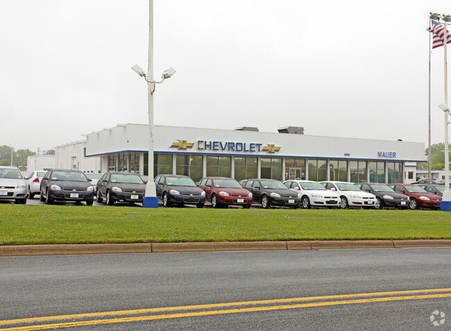
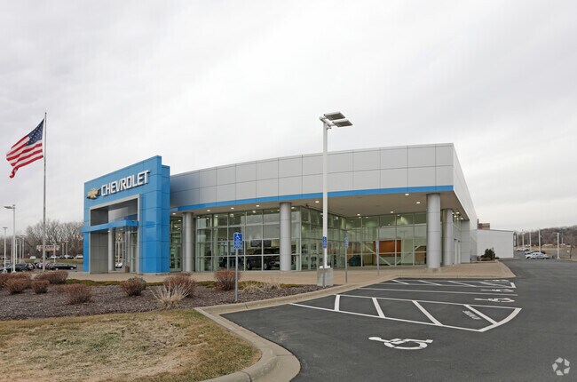
Property Detail
1055 50Th St E
Minneapolis-St. Paul-Bloomington, MN-WI
SECTION 30 TWN 28 RANGE 22 30 28 22 PT OF E 769.2 FT OF NE 1/4 OF SE 1/4 LYING N OF NE R/W STH 110 & SELY OF A LINE COM NE COR W ON N LINE 257.6 FT TO BEG S 18D23M15S W 398.35 FT S 29D19M6S W TO NE R/W STH 110 & THERE TERM EX THE EAST 30 FT THEREOF S
20-03010-75-021
DAKOTA
Commercialnec
Minnesota
B and X Area of moderate flood hazard, usually the area between the limits of the 100-year and 500-year floods.
21
2025
7.96 AC
2025
West St Paul
060505
Minneapolis/St Paul
63,439 SF
NEARBY LISTINGS FOR SALE OR LEASE
DEMOGRAPHICS near 1055 50Th St E
1 mile
3 mile
5 mile
2025 Total Population
6,309
72,525
187,169
2030 Population
6,553
74,341
190,316
Pop Growth 2025-2030
+ 3.87%
+ 2.50%
+ 1.68%
Average Age
41
41
41
2025 Total Households
2,917
30,243
81,603
HH Growth 2025-2030
+ 4.05%
+ 2.65%
+ 1.68%
Median Household Inc
$67,163
$88,913
$85,655
Avg Household Size
2.10
2.30
2.20
2025 Avg HH Vehicles
1.00
2.00
2.00
Median Home Value
$417,099
$332,666
$346,683
Median Year Built
1982
1971
1972
Nearby Places
Map Layers
Map Styles
 Street
 Aerial
Layers
 Traffic
 Biking
Places
Listings with unknown addresses are not visible on the map
- Restaurants
- Banks
- Shops
- Fitness
- Groceries
PUBLIC TRANSPORTATION
COMMUTER RAIL
Drive
Walk
Distance
11 min
6.5 mi
AIRPORT
Minneapolis-St Paul International/Wold-Chamberlain
Drive
Walk
Distance
Minneapolis-St Paul International/Wold-Chamberlain
15 min
8.2 mi
Nearby Properties
Address
Land Use
TOTAL SIZE
Lot Size
Zoning
Address
Land Use
TOTAL SIZE
Lot Size
Zoning
479,742 SF
11.35 AC
Address
Land Use
TOTAL SIZE
Lot Size
Zoning
Address
Land Use
TOTAL SIZE
Lot Size
Zoning
146,085 SF
46.83 AC
Address
Land Use
TOTAL SIZE
Lot Size
Zoning
329,070 SF
5.75 AC
Address
Land Use
TOTAL SIZE
Lot Size
Zoning
247,470 SF
2.21 AC
Address
Land Use
TOTAL SIZE
Lot Size
Zoning
381,158 SF
11.86 AC
Address
Land Use
TOTAL SIZE
Lot Size
Zoning
217,703 SF
3.51 AC
Address
Land Use
TOTAL SIZE
Lot Size
Zoning
233,578 SF
9.56 AC
Address
Land Use
TOTAL SIZE
Lot Size
Zoning
317,235 SF
32.38 AC
Address
Land Use
TOTAL SIZE
Lot Size
Zoning
293,970 SF
31.92 AC
Address
Land Use
TOTAL SIZE
Lot Size
Zoning
223,583 SF
5.32 AC
Address
Land Use
TOTAL SIZE
Lot Size
Zoning
206,503 SF
5.61 AC
Address
Land Use
TOTAL SIZE
Lot Size
Zoning
227,436 SF
5.19 AC
Address
Land Use
TOTAL SIZE
Lot Size
Zoning
243,847 SF
5.24 AC
Address
Land Use
TOTAL SIZE
Lot Size
Zoning
228,050 SF
0.32 AC
Address
Land Use
TOTAL SIZE
Lot Size
Zoning
210,540 SF
5.35 AC
Address
Land Use
TOTAL SIZE
Lot Size
Zoning
245,570 SF
2.85 AC
Address
Land Use
TOTAL SIZE
Lot Size
Zoning
163,985 SF
7.06 AC
Address
Land Use
TOTAL SIZE
Lot Size
Zoning
Address
Land Use
TOTAL SIZE
Lot Size
Zoning
381,395 SF
15.31 AC
Address
Land Use
TOTAL SIZE
Lot Size
Zoning
169,887 SF
17.20 AC
Address
Land Use
TOTAL SIZE
Lot Size
Zoning
Address
Land Use
TOTAL SIZE
Lot Size
Zoning
541,075 SF
88.93 AC
Address
Land Use
TOTAL SIZE
Lot Size
Zoning
293,717 SF
33.30 AC
Address
Land Use
TOTAL SIZE
Lot Size
Zoning
452,836 SF
17.81 AC
Address
Land Use
TOTAL SIZE
Lot Size
Zoning
Address
Land Use
TOTAL SIZE
Lot Size
Zoning
163,847 SF
2.97 AC
Address
Land Use
TOTAL SIZE
Lot Size
Zoning
229,442 SF
9.50 AC
Address
Land Use
TOTAL SIZE
Lot Size
Zoning
232,891 SF
37.17 AC
The World's #1 Commercial Real Estate Marketplace
Connect with us
© 2026 CoStar Group
The information above has been obtained from sources believed reliable. While we do not doubt its accuracy we have not verified it and make no guarantee, warranty or representation about it. It is your responsibility to independently confirm its accuracy and completeness. Any projections, opinions, assumptions, or estimates used are for example only and do not represent the current or future performance of the property. The value of this transaction to you depends on tax and other factors which should be evaluated by your tax, financial, and legal advisors. You and your advisors should conduct a careful, independent investigation of the property to determine to your satisfaction the suitability of the property for your needs.