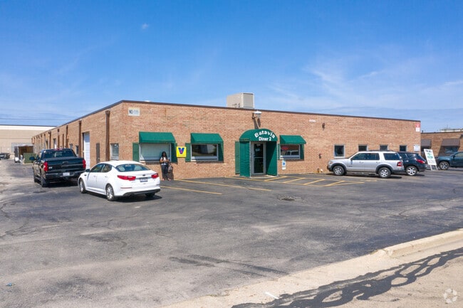
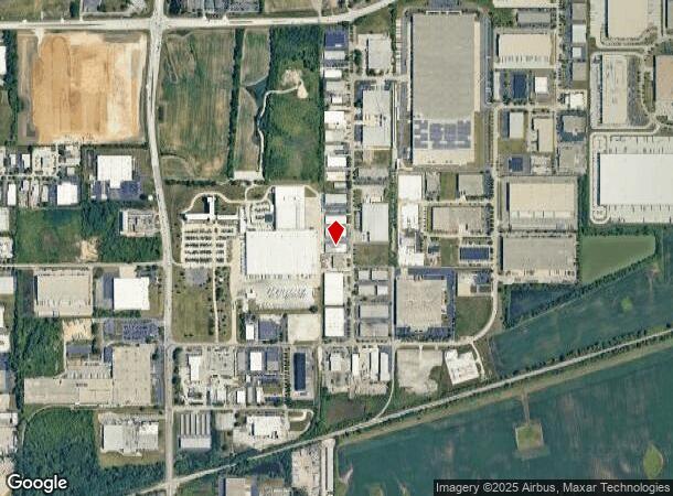
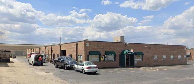
Property Record
1055 Paramount Pky, Batavia, IL 60510
NEARBY LISTINGS FOR SALE OR LEASE
Property Detail
1055 Paramount Pky
12-13-326-030
Paramount Indl Condo 02 Ph I
Commercialnec
Kane
X
Illinois
17043C0107J
b
2024
0.26 AC
2024
Central Kane / DuPage
852803
Chicago
2,300 SF
Chicago-Naperville-Elgin, IL-IN
DEMOGRAPHICS near 1055 Paramount Pky
1 mile
3 mile
5 mile
2024 Total Population
1,251
35,800
132,767
2029 Population
1,250
35,812
131,377
Pop Growth 2024-2029
(0.08%)
+ 0.03%
(1.05%)
Average Age
39
41
40
2024 Total Households
511
13,636
48,683
HH Growth 2024-2029
0.00%
+ 0.03%
(1.04%)
Median Household Inc
$75,231
$113,090
$103,639
Avg Household Size
2.40
2.60
2.70
2024 Avg HH Vehicles
2.00
2.00
2.00
Median Home Value
$302,066
$333,394
$325,281
Median Year Built
1975
1980
1982
Nearby Places
Map Layers
Map Styles
 Street
 Aerial
Transit
 Traffic
 Biking
Places
Listings with unknown addresses are not visible on the map
- Restaurants
- Banks
- Shops
- Fitness
- Groceries
PUBLIC TRANSPORTATION
COMMUTER RAIL
Geneva Station (Union Pacific West Line - Northeast Illinois Regional Commuter Railroad (Metra))
Drive
Walk
Distance
Geneva Station (Union Pacific West Line - Northeast Illinois Regional Commuter Railroad (Metra))
9 min
4.0 mi
West Chicago Station (Union Pacific West Line - Northeast Illinois Regional Commuter Railroad (Metra))
Drive
Walk
Distance
West Chicago Station (Union Pacific West Line - Northeast Illinois Regional Commuter Railroad (Metra))
11 min
4.9 mi
AIRPORT
Chicago O'Hare International
Drive
Walk
Distance
Chicago O'Hare International
51 min
30.3 mi
Chicago Midway International
Drive
Walk
Distance
Chicago Midway International
56 min
32.1 mi
SALE & LEASE HISTORY
LISTING DATE
SALE/LEASE

Sep 24, 2016
For Lease
Sep 24, 2016
For Sale
Oct 15, 2020
For Sale
Oct 07, 2020
For Sale
Jul 27, 2018
For Sale
Feb 21, 2019
For Sale
Nearby Properties
Address
Land Use
TOTAL SIZE
Lot Size
Zoning
Address
Land Use
TOTAL SIZE
Lot Size
Zoning
38.68 AC
Address
Land Use
TOTAL SIZE
Lot Size
Zoning
42.27 AC
Address
Land Use
TOTAL SIZE
Lot Size
Zoning
715,000 SF
41.83 AC
Address
Land Use
TOTAL SIZE
Lot Size
Zoning
Address
Land Use
TOTAL SIZE
Lot Size
Zoning
26.41 AC
Address
Land Use
TOTAL SIZE
Lot Size
Zoning
Address
Land Use
TOTAL SIZE
Lot Size
Zoning
Address
Land Use
TOTAL SIZE
Lot Size
Zoning
75.23 AC
Address
Land Use
TOTAL SIZE
Lot Size
Zoning
120,059 SF
13.29 AC
Address
Land Use
TOTAL SIZE
Lot Size
Zoning
28.84 AC
Address
Land Use
TOTAL SIZE
Lot Size
Zoning
Address
Land Use
TOTAL SIZE
Lot Size
Zoning
426,028 SF
26.32 AC
Address
Land Use
TOTAL SIZE
Lot Size
Zoning
667,636 SF
38 AC
Address
Land Use
TOTAL SIZE
Lot Size
Zoning
Address
Land Use
TOTAL SIZE
Lot Size
Zoning
291,360 SF
14.55 AC
Address
Land Use
TOTAL SIZE
Lot Size
Zoning
277,018 SF
12.36 AC
I
Address
Land Use
TOTAL SIZE
Lot Size
Zoning
Address
Land Use
TOTAL SIZE
Lot Size
Zoning
33.78 AC
Address
Land Use
TOTAL SIZE
Lot Size
Zoning
18.30 AC
Address
Land Use
TOTAL SIZE
Lot Size
Zoning
494,108 SF
5 AC
Address
Land Use
TOTAL SIZE
Lot Size
Zoning
21.14 AC
Address
Land Use
TOTAL SIZE
Lot Size
Zoning
258,240 SF
10.51 AC
Address
Land Use
TOTAL SIZE
Lot Size
Zoning
17.54 AC
Address
Land Use
TOTAL SIZE
Lot Size
Zoning
18.39 AC
Address
Land Use
TOTAL SIZE
Lot Size
Zoning
39.42 AC
Address
Land Use
TOTAL SIZE
Lot Size
Zoning
11.25 AC
Address
Land Use
TOTAL SIZE
Lot Size
Zoning
46,828 SF
5.97 AC
Address
Land Use
TOTAL SIZE
Lot Size
Zoning
4,500 SF
11 AC
Address
Land Use
TOTAL SIZE
Lot Size
Zoning
240,824 SF
21.26 AC
Address
Land Use
TOTAL SIZE
Lot Size
Zoning
22.10 AC
The World's #1 Commercial Real Estate Marketplace
Connect with us
© 2026 CoStar Group
The information above has been obtained from sources believed reliable. While we do not doubt its accuracy we have not verified it and make no guarantee, warranty or representation about it. It is your responsibility to independently confirm its accuracy and completeness. Any projections, opinions, assumptions, or estimates used are for example only and do not represent the current or future performance of the property. The value of this transaction to you depends on tax and other factors which should be evaluated by your tax, financial, and legal advisors. You and your advisors should conduct a careful, independent investigation of the property to determine to your satisfaction the suitability of the property for your needs.