Property Record
1059 Meadowlands Dr, Saint Paul, MN 55127


NEARBY LISTINGS FOR SALE OR LEASE
Property Detail
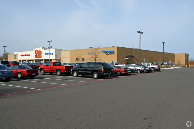
1059 Meadowlands Dr
Minneapolis-St. Paul-Bloomington, MN-WI
The Meadowlands Of,White Bear
16-30-22-34-0031
THE MEADOWLANDS OF,WHITE BEAR SUBJ TO RDS & ESMT; OUTLOT A
Supermarket
Ramsey
X
Minnesota
27003C0450E
a
2024
9.44 AC
2025
Rosedale
040601
Minneapolis/St Paul
75,206 SF
DEMOGRAPHICS near 1059 Meadowlands Dr
1 Mile
3 Mile
5 Mile
2024 Total Population
6,084
39,440
115,507
2029 Population
5,943
38,458
113,806
Pop Growth 2024-2029
(2.32%)
(2.49%)
(1.47%)
Average Age
46
44
43
2024 Total Households
2,811
16,352
46,507
HH Growth 2024-2029
(2.60%)
(2.72%)
(1.77%)
Median Household Inc
$94,200
$93,869
$94,376
Avg Household Size
2.10
2.40
2.40
2024 Avg HH Vehicles
2.00
2.00
2.00
Median Home Value
$351,966
$339,022
$346,147
Median Year Built
1986
1981
1981
Nearby Places
Map Layers
Map Styles
 Street
 Aerial
- Restaurants
- Banks
- Shops
- Fitness
- Groceries
PUBLIC TRANSPORTATION
AIRPORT
Minneapolis-St Paul International/Wold-Chamberlain
DRIVE
WALK
Distance
Minneapolis-St Paul International/Wold-Chamberlain
30 min
20.0 mi
Freight Ports
Port Milwaukee
DRIVE
WALK
Distance
Port Milwaukee
371 min
336.4 mi
Nearby Properties
Address
Land Use
TOTAL SIZE
Lot Size
Zoning
Address
Land Use
TOTAL SIZE
Lot Size
Zoning
5.59 AC
Address
Land Use
TOTAL SIZE
Lot Size
Zoning
13.44 AC
Address
Land Use
TOTAL SIZE
Lot Size
Zoning
175,536 SF
7.60 AC
Address
Land Use
TOTAL SIZE
Lot Size
Zoning
250,050 SF
2.99 AC
Address
Land Use
TOTAL SIZE
Lot Size
Zoning
106,400 SF
18.29 AC
Address
Land Use
TOTAL SIZE
Lot Size
Zoning
78,163 SF
5.62 AC
Address
Land Use
TOTAL SIZE
Lot Size
Zoning
159.37 AC
Address
Land Use
TOTAL SIZE
Lot Size
Zoning
211,420 SF
5.22 AC
Address
Land Use
TOTAL SIZE
Lot Size
Zoning
129,278 SF
4.53 AC
Address
Land Use
TOTAL SIZE
Lot Size
Zoning
126,852 SF
11.86 AC
Address
Land Use
TOTAL SIZE
Lot Size
Zoning
67,693 SF
7.30 AC
Address
Land Use
TOTAL SIZE
Lot Size
Zoning
960 SF
17.11 AC
Address
Land Use
TOTAL SIZE
Lot Size
Zoning
138,655 SF
4.70 AC
Address
Land Use
TOTAL SIZE
Lot Size
Zoning
13,358 SF
311.47 AC
W8OPSP
Address
Land Use
TOTAL SIZE
Lot Size
Zoning
3,200 SF
14.31 AC
W7PUBLC
Address
Land Use
TOTAL SIZE
Lot Size
Zoning
26,109 SF
167.19 AC
Address
Land Use
TOTAL SIZE
Lot Size
Zoning
163,709 SF
1.22 AC
Address
Land Use
TOTAL SIZE
Lot Size
Zoning
295,860 SF
11.84 AC
Address
Land Use
TOTAL SIZE
Lot Size
Zoning
147,019 SF
4.02 AC
Address
Land Use
TOTAL SIZE
Lot Size
Zoning
Address
Land Use
TOTAL SIZE
Lot Size
Zoning
204,399 SF
12.82 AC
Address
Land Use
TOTAL SIZE
Lot Size
Zoning
202,460 SF
26.72 AC
Address
Land Use
TOTAL SIZE
Lot Size
Zoning
156,090 SF
4.27 AC
Address
Land Use
TOTAL SIZE
Lot Size
Zoning
239.49 AC
Address
Land Use
TOTAL SIZE
Lot Size
Zoning
1,357 SF
8.22 AC
Address
Land Use
TOTAL SIZE
Lot Size
Zoning
88,787 SF
5.16 AC
Address
Land Use
TOTAL SIZE
Lot Size
Zoning
134,280 SF
4 AC
Address
Land Use
TOTAL SIZE
Lot Size
Zoning
234,156 SF
12.01 AC
Address
Land Use
TOTAL SIZE
Lot Size
Zoning
82,403 SF
41.35 AC
Address
Land Use
TOTAL SIZE
Lot Size
Zoning
128,462 SF
2.07 AC
The World's #1 Commercial Real Estate Marketplace
Connect with us
© 2026 CoStar Group
The information above has been obtained from sources believed reliable. While we do not doubt its accuracy we have not verified it and make no guarantee, warranty or representation about it. It is your responsibility to independently confirm its accuracy and completeness. Any projections, opinions, assumptions, or estimates used are for example only and do not represent the current or future performance of the property. The value of this transaction to you depends on tax and other factors which should be evaluated by your tax, financial, and legal advisors. You and your advisors should conduct a careful, independent investigation of the property to determine to your satisfaction the suitability of the property for your needs.