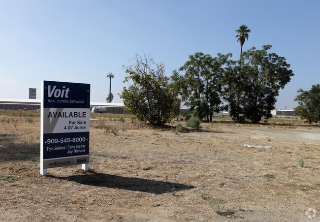
Property Record
1060 Calimesa Blvd, Calimesa, CA 92320


Property Detail
1060 Calimesa Blvd
411-190-036
4.07 ACRES M/L IN POR BLK 230 MB 010/032 RESURVEY OF PART OF SUB 9 YUCAIPA VALLEY
Storebuilding
Riverside
CC
California
B and X Area of moderate flood hazard, usually the area between the limits of the 100-year and 500-year floods.
230
2024
4.07 AC
2025
Beaumont/Hemet
043802
Inland Empire (California)
18,800 SF
Riverside-San Bernardino-Ontario, CA
NEARBY LISTINGS FOR SALE OR LEASE
DEMOGRAPHICS near 1060 Calimesa Blvd
1 mile
3 mile
5 mile
2025 Total Population
6,536
52,432
90,130
2030 Population
6,730
53,602
92,375
Pop Growth 2025-2030
+ 2.97%
+ 2.23%
+ 2.49%
Average Age
39
40
40
2025 Total Households
2,312
18,559
31,375
HH Growth 2025-2030
+ 2.81%
+ 2.12%
+ 2.25%
Median Household Inc
$69,009
$87,539
$102,761
Avg Household Size
2.80
2.80
2.80
2025 Avg HH Vehicles
2.00
2.00
2.00
Median Home Value
$459,374
$498,432
$578,401
Median Year Built
1975
1978
1988
Nearby Places
Map Layers
Map Styles
 Street
 Aerial
Layers
 Traffic
 Biking
Places
Listings with unknown addresses are not visible on the map
- Restaurants
- Banks
- Shops
- Fitness
- Groceries
PUBLIC TRANSPORTATION
COMMUTER RAIL
Redlands - University Metrolink Station (Metrolink San Bernardino Line - Metrolink Trains)
Drive
Walk
Distance
Redlands - University Metrolink Station (Metrolink San Bernardino Line - Metrolink Trains)
11 min
8.1 mi
Redlands - Downtown Metrolink Station (Metrolink San Bernardino Line - Metrolink Trains)
Drive
Walk
Distance
Redlands - Downtown Metrolink Station (Metrolink San Bernardino Line - Metrolink Trains)
13 min
9.2 mi
Freight Ports
Port of Long Beach
Drive
Walk
Distance
Port of Long Beach
99 min
79.1 mi
Nearby Properties
Address
Land Use
TOTAL SIZE
Lot Size
Zoning
Address
Land Use
TOTAL SIZE
Lot Size
Zoning
1,013,356 SF
135.79 AC
Address
Land Use
TOTAL SIZE
Lot Size
Zoning
810,962 SF
85.23 AC
Address
Land Use
TOTAL SIZE
Lot Size
Zoning
369,838 SF
19.32 AC
Address
Land Use
TOTAL SIZE
Lot Size
Zoning
102,506 SF
4.47 AC
Address
Land Use
TOTAL SIZE
Lot Size
Zoning
82,694 SF
3.41 AC
Address
Land Use
TOTAL SIZE
Lot Size
Zoning
5.47 AC
Address
Land Use
TOTAL SIZE
Lot Size
Zoning
45,712 SF
4.87 AC
Address
Land Use
TOTAL SIZE
Lot Size
Zoning
79,299 SF
5.04 AC
Address
Land Use
TOTAL SIZE
Lot Size
Zoning
67,686 SF
4.16 AC
Address
Land Use
TOTAL SIZE
Lot Size
Zoning
56,491 SF
7.50 AC
Address
Land Use
TOTAL SIZE
Lot Size
Zoning
56,491 SF
3.39 AC
Address
Land Use
TOTAL SIZE
Lot Size
Zoning
22,308 SF
1.87 AC
Address
Land Use
TOTAL SIZE
Lot Size
Zoning
24,510 SF
6.88 AC
Address
Land Use
TOTAL SIZE
Lot Size
Zoning
49,320 SF
1.68 AC
Address
Land Use
TOTAL SIZE
Lot Size
Zoning
49,952 SF
4.34 AC
Address
Land Use
TOTAL SIZE
Lot Size
Zoning
29,387 SF
3.21 AC
Address
Land Use
TOTAL SIZE
Lot Size
Zoning
27,627 SF
5.07 AC
Address
Land Use
TOTAL SIZE
Lot Size
Zoning
42,634 SF
1.91 AC
Address
Land Use
TOTAL SIZE
Lot Size
Zoning
111,182 SF
3.11 AC
Address
Land Use
TOTAL SIZE
Lot Size
Zoning
15,980 SF
1.56 AC
Address
Land Use
TOTAL SIZE
Lot Size
Zoning
33.42 AC
Address
Land Use
TOTAL SIZE
Lot Size
Zoning
33,000 SF
2.96 AC
Address
Land Use
TOTAL SIZE
Lot Size
Zoning
41,005 SF
3.27 AC
MIX
Address
Land Use
TOTAL SIZE
Lot Size
Zoning
78,309 SF
7.09 AC
Address
Land Use
TOTAL SIZE
Lot Size
Zoning
29,996 SF
1.86 AC
Address
Land Use
TOTAL SIZE
Lot Size
Zoning
73,670 SF
4.49 AC
Address
Land Use
TOTAL SIZE
Lot Size
Zoning
1,970 SF
6.27 AC
The World's #1 Commercial Real Estate Marketplace
Connect with us
© 2026 CoStar Group
The information above has been obtained from sources believed reliable. While we do not doubt its accuracy we have not verified it and make no guarantee, warranty or representation about it. It is your responsibility to independently confirm its accuracy and completeness. Any projections, opinions, assumptions, or estimates used are for example only and do not represent the current or future performance of the property. The value of this transaction to you depends on tax and other factors which should be evaluated by your tax, financial, and legal advisors. You and your advisors should conduct a careful, independent investigation of the property to determine to your satisfaction the suitability of the property for your needs.