Property Record
1060 E Ray Rd, Chandler, AZ 85225


Property Detail
1060 E Ray Rd
302-98-954
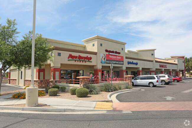
SAFEWAY AT THE PROVINCES MCR 493-31
Regionalshoppingcenterormallwithanchorstore
MARICOPA
PAD
Arizona
C and X Area of minimal flood hazard, usually depicted on FIRMs as above the 500-year flood level.
1
2025
6.83 AC
2025
Gilbert
811300
Phoenix
55,260 SF
Phoenix-Mesa-Chandler, AZ
NEARBY LISTINGS FOR SALE OR LEASE
DEMOGRAPHICS near 1060 E Ray Rd
1 mile
3 mile
5 mile
2025 Total Population
19,368
142,113
339,879
2030 Population
19,844
146,393
350,655
Pop Growth 2025-2030
+ 2.46%
+ 3.01%
+ 3.17%
Average Age
38
38
38
2025 Total Households
6,913
52,412
125,392
HH Growth 2025-2030
+ 2.52%
+ 3.08%
+ 3.22%
Median Household Inc
$106,973
$97,330
$100,221
Avg Household Size
2.80
2.60
2.60
2025 Avg HH Vehicles
2.00
2.00
2.00
Median Home Value
$449,798
$471,105
$487,115
Median Year Built
1992
1993
1993
Nearby Places
Map Layers
Map Styles
 Street
 Aerial
Transit
 Traffic
 Biking
Places
Listings with unknown addresses are not visible on the map
- Restaurants
- Banks
- Shops
- Fitness
- Groceries
PUBLIC TRANSPORTATION
AIRPORT
Phoenix-Mesa Gateway
Drive
Walk
Distance
Phoenix-Mesa Gateway
20 min
10.1 mi
Phoenix Sky Harbor International
Drive
Walk
Distance
Phoenix Sky Harbor International
29 min
19.0 mi
Freight Ports
Port of San Diego
Drive
Walk
Distance
Port of San Diego
404 min
367.5 mi
Nearby Properties
Address
Land Use
TOTAL SIZE
Lot Size
Zoning
Address
Land Use
TOTAL SIZE
Lot Size
Zoning
1.13 AC
Address
Land Use
TOTAL SIZE
Lot Size
Zoning
301,190 SF
77.17 AC
PF
Address
Land Use
TOTAL SIZE
Lot Size
Zoning
984,487 SF
37.54 AC
I-1
Address
Land Use
TOTAL SIZE
Lot Size
Zoning
416,954 SF
9.59 AC
PF
Address
Land Use
TOTAL SIZE
Lot Size
Zoning
348,249 SF
6.42 AC
M-H
Address
Land Use
TOTAL SIZE
Lot Size
Zoning
9.25 AC
I-1
Address
Land Use
TOTAL SIZE
Lot Size
Zoning
465,645 SF
30.78 AC
PAD
Address
Land Use
TOTAL SIZE
Lot Size
Zoning
300,885 SF
37.63 AC
AG
Address
Land Use
TOTAL SIZE
Lot Size
Zoning
324,283 SF
18.75 AC
PAD
Address
Land Use
TOTAL SIZE
Lot Size
Zoning
348,379 SF
6.49 AC
PAD
Address
Land Use
TOTAL SIZE
Lot Size
Zoning
112,628 SF
17.37 AC
I-1
Address
Land Use
TOTAL SIZE
Lot Size
Zoning
309,031 SF
18.55 AC
Address
Land Use
TOTAL SIZE
Lot Size
Zoning
16.57 AC
PF
Address
Land Use
TOTAL SIZE
Lot Size
Zoning
185,744 SF
36.64 AC
PF
Address
Land Use
TOTAL SIZE
Lot Size
Zoning
372,953 SF
14.36 AC
C-C
Address
Land Use
TOTAL SIZE
Lot Size
Zoning
16,133 SF
1.79 AC
PF
Address
Land Use
TOTAL SIZE
Lot Size
Zoning
267,868 SF
13.18 AC
R-CH
Address
Land Use
TOTAL SIZE
Lot Size
Zoning
357,691 SF
19.87 AC
PAD
Address
Land Use
TOTAL SIZE
Lot Size
Zoning
7,418 SF
2.37 AC
C-G
Address
Land Use
TOTAL SIZE
Lot Size
Zoning
272,380 SF
15.30 AC
PAD
Address
Land Use
TOTAL SIZE
Lot Size
Zoning
383,461 SF
25.76 AC
PAD
Address
Land Use
TOTAL SIZE
Lot Size
Zoning
358,620 SF
18.72 AC
PAD
Address
Land Use
TOTAL SIZE
Lot Size
Zoning
319,061 SF
18.51 AC
PAD
Address
Land Use
TOTAL SIZE
Lot Size
Zoning
237,329 SF
9.76 AC
C-N
Address
Land Use
TOTAL SIZE
Lot Size
Zoning
253,276 SF
18.33 AC
PAD
Address
Land Use
TOTAL SIZE
Lot Size
Zoning
273,805 SF
7.73 AC
MF-2
Address
Land Use
TOTAL SIZE
Lot Size
Zoning
115,920 SF
18.19 AC
Address
Land Use
TOTAL SIZE
Lot Size
Zoning
291,604 SF
18.67 AC
PAD
Address
Land Use
TOTAL SIZE
Lot Size
Zoning
83,457 SF
28.46 AC
PAD
Address
Land Use
TOTAL SIZE
Lot Size
Zoning
109,909 SF
2.33 AC
C3
The World's #1 Commercial Real Estate Marketplace
Connect with us
© 2026 CoStar Group
The information above has been obtained from sources believed reliable. While we do not doubt its accuracy we have not verified it and make no guarantee, warranty or representation about it. It is your responsibility to independently confirm its accuracy and completeness. Any projections, opinions, assumptions, or estimates used are for example only and do not represent the current or future performance of the property. The value of this transaction to you depends on tax and other factors which should be evaluated by your tax, financial, and legal advisors. You and your advisors should conduct a careful, independent investigation of the property to determine to your satisfaction the suitability of the property for your needs.