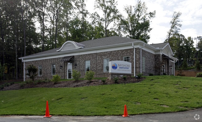
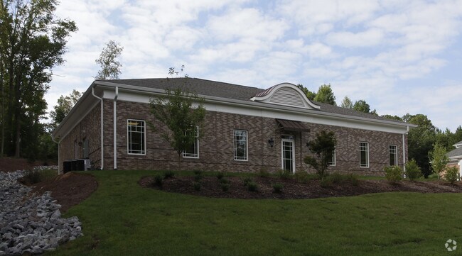
Property Record
1069 Bayshore Dr, Rock Hill, SC 29732
NEARBY LISTINGS FOR SALE OR LEASE
Property Detail
1069 Bayshore Dr
6330601020
Ob
Commercialnec
PARCEL B(1.392AC)BAYSHORE DR
X
York
45091C0307F
South Carolina
2025
1.39 AC
2025
York County
060804
Charlotte
8,722 SF
Charlotte-Concord-Gastonia, NC-SC
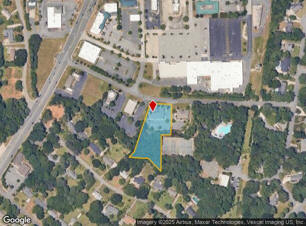
DEMOGRAPHICS near 1069 Bayshore Dr
1 mile
3 mile
5 mile
2024 Total Population
7,403
52,210
117,677
2029 Population
8,217
58,400
132,320
Pop Growth 2024-2029
+ 11.00%
+ 11.86%
+ 12.44%
Average Age
42
39
39
2024 Total Households
3,132
21,210
46,539
HH Growth 2024-2029
+ 11.37%
+ 12.60%
+ 12.97%
Median Household Inc
$71,656
$62,637
$68,258
Avg Household Size
2.30
2.30
2.40
2024 Avg HH Vehicles
2.00
2.00
2.00
Median Home Value
$269,364
$241,078
$268,723
Median Year Built
1987
1992
1995
Nearby Places
Map Layers
Map Styles
 Street
 Aerial
Transit
 Traffic
 Biking
Places
Listings with unknown addresses are not visible on the map
- Restaurants
- Banks
- Shops
- Fitness
- Groceries
PUBLIC TRANSPORTATION
AIRPORT
Charlotte/Douglas International
Drive
Walk
Distance
Charlotte/Douglas International
37 min
21.6 mi
Concord-Padgett Regional
Drive
Walk
Distance
Concord-Padgett Regional
55 min
38.6 mi
Nearby Properties
Address
Land Use
TOTAL SIZE
Lot Size
Zoning
Address
Land Use
TOTAL SIZE
Lot Size
Zoning
18,192 SF
17.98 AC
MF15
Address
Land Use
TOTAL SIZE
Lot Size
Zoning
13,486 SF
14.27 AC
GC
Address
Land Use
TOTAL SIZE
Lot Size
Zoning
13,556 SF
10.86 AC
MF15
Address
Land Use
TOTAL SIZE
Lot Size
Zoning
216,000 SF
23.16 AC
Address
Land Use
TOTAL SIZE
Lot Size
Zoning
267,338 SF
Address
Land Use
TOTAL SIZE
Lot Size
Zoning
215.20 AC
UD
Address
Land Use
TOTAL SIZE
Lot Size
Zoning
8,512 SF
7.73 AC
MF15
Address
Land Use
TOTAL SIZE
Lot Size
Zoning
24,164 SF
9.50 AC
GC
Address
Land Use
TOTAL SIZE
Lot Size
Zoning
28,848 SF
1.04 AC
PUD
Address
Land Use
TOTAL SIZE
Lot Size
Zoning
108,597 SF
14.55 AC
Address
Land Use
TOTAL SIZE
Lot Size
Zoning
252,312 SF
1.25 AC
Address
Land Use
TOTAL SIZE
Lot Size
Zoning
28,660 SF
19.95 AC
OI
Address
Land Use
TOTAL SIZE
Lot Size
Zoning
554,100 SF
21.58 AC
OI
Address
Land Use
TOTAL SIZE
Lot Size
Zoning
40,532 SF
9.96 AC
SF5
Address
Land Use
TOTAL SIZE
Lot Size
Zoning
163,085 SF
6.84 AC
Address
Land Use
TOTAL SIZE
Lot Size
Zoning
113,490 SF
7 AC
Address
Land Use
TOTAL SIZE
Lot Size
Zoning
16,872 SF
19.80 AC
PUD
Address
Land Use
TOTAL SIZE
Lot Size
Zoning
19,426 SF
16.39 AC
PUD
Address
Land Use
TOTAL SIZE
Lot Size
Zoning
28,320 SF
2.67 AC
IG
Address
Land Use
TOTAL SIZE
Lot Size
Zoning
225,936 SF
2.87 AC
Address
Land Use
TOTAL SIZE
Lot Size
Zoning
47,896 SF
10.66 AC
Address
Land Use
TOTAL SIZE
Lot Size
Zoning
22,278 SF
4.92 AC
Address
Land Use
TOTAL SIZE
Lot Size
Zoning
98,813 SF
3.34 AC
Address
Land Use
TOTAL SIZE
Lot Size
Zoning
14,178 SF
1.81 AC
OI
Address
Land Use
TOTAL SIZE
Lot Size
Zoning
162,218 SF
4.83 AC
Address
Land Use
TOTAL SIZE
Lot Size
Zoning
127,028 SF
1.28 AC
Address
Land Use
TOTAL SIZE
Lot Size
Zoning
342,804 SF
23.99 AC
NMU
Address
Land Use
TOTAL SIZE
Lot Size
Zoning
38,000 SF
4.28 AC
LC
Address
Land Use
TOTAL SIZE
Lot Size
Zoning
23,898 SF
19.65 AC
OI
Address
Land Use
TOTAL SIZE
Lot Size
Zoning
12,960 SF
16.25 AC
GC
The World's #1 Commercial Real Estate Marketplace
Connect with us
© 2026 CoStar Group
The information above has been obtained from sources believed reliable. While we do not doubt its accuracy we have not verified it and make no guarantee, warranty or representation about it. It is your responsibility to independently confirm its accuracy and completeness. Any projections, opinions, assumptions, or estimates used are for example only and do not represent the current or future performance of the property. The value of this transaction to you depends on tax and other factors which should be evaluated by your tax, financial, and legal advisors. You and your advisors should conduct a careful, independent investigation of the property to determine to your satisfaction the suitability of the property for your needs.