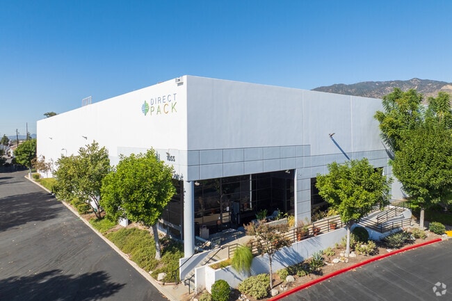
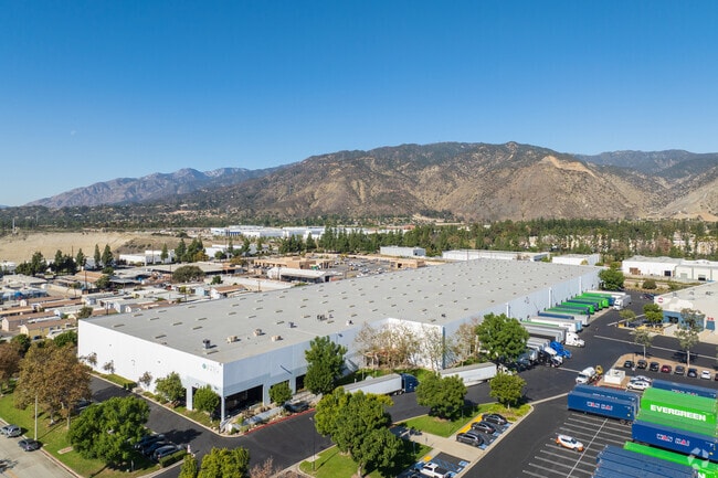
Property Record
1075 W 8Th St, Azusa, CA 91702

Property Detail
1075 W 8Th St
8605-015-020
PARCEL MAP AS PER BK 173 P 79-83 OF P M LOT 1
Warehouse
LOS ANGELES
AZM2*
California
B and X Area of moderate flood hazard, usually the area between the limits of the 100-year and 500-year floods.
1
2025
10.37 AC
2025
Upper San Gabriel Valley
404301
Los Angeles
200,816 SF
Los Angeles-Long Beach-Glendale, CA
NEARBY LISTINGS FOR SALE OR LEASE
DEMOGRAPHICS near 1075 W 8Th St
1 mile
3 mile
5 mile
2025 Total Population
11,483
107,048
307,625
2030 Population
11,350
106,282
304,502
Pop Growth 2025-2030
(1.16%)
(0.72%)
(1.02%)
Average Age
39
40
40
2025 Total Households
3,616
31,625
94,453
HH Growth 2025-2030
(1.49%)
(0.82%)
(1.16%)
Median Household Inc
$89,094
$95,214
$93,596
Avg Household Size
3.10
3.20
3.10
2025 Avg HH Vehicles
2.00
2.00
2.00
Median Home Value
$688,466
$729,236
$741,654
Median Year Built
1966
1964
1961
Nearby Places
Map Layers
Map Styles
 Street
 Aerial
Layers
 Traffic
 Biking
Places
Listings with unknown addresses are not visible on the map
- Restaurants
- Banks
- Shops
- Fitness
- Groceries
PUBLIC TRANSPORTATION
TRANSIT/SUBWAY
Azusa Downtown Station (Metro A-Line - Metro - Los Angeles)
Drive
Walk
Distance
Azusa Downtown Station (Metro A-Line - Metro - Los Angeles)
4 min
20 min
1.0 mi
COMMUTER RAIL
Covina (San Bernardino Line - Southern California Regional Rail Authority (Metrolink))
Drive
Walk
Distance
Covina (San Bernardino Line - Southern California Regional Rail Authority (Metrolink))
10 min
5.0 mi
Baldwin Park (San Bernardino Line - Southern California Regional Rail Authority (Metrolink))
Drive
Walk
Distance
Baldwin Park (San Bernardino Line - Southern California Regional Rail Authority (Metrolink))
11 min
5.6 mi
AIRPORT
Ontario International
Drive
Walk
Distance
Ontario International
33 min
23.9 mi
Bob Hope
Drive
Walk
Distance
Bob Hope
40 min
30.3 mi
Long Beach (Daugherty Field)
Drive
Walk
Distance
Long Beach (Daugherty Field)
42 min
31.6 mi
Freight Ports
Port of Long Beach
Drive
Walk
Distance
Port of Long Beach
48 min
37.2 mi
Nearby Properties
Address
Land Use
TOTAL SIZE
Lot Size
Zoning
Address
Land Use
TOTAL SIZE
Lot Size
Zoning
453,050 SF
17.48 AC
DUH*
Address
Land Use
TOTAL SIZE
Lot Size
Zoning
836,910 SF
75.03 AC
IRM25*
Address
Land Use
TOTAL SIZE
Lot Size
Zoning
1,104,998 SF
28 AC
IRM2*
Address
Land Use
TOTAL SIZE
Lot Size
Zoning
250,688 SF
13.90 AC
LCRA8000*
Address
Land Use
TOTAL SIZE
Lot Size
Zoning
221,911 SF
2.24 AC
AZCBD*
Address
Land Use
TOTAL SIZE
Lot Size
Zoning
184,820 SF
IRM1*
Address
Land Use
TOTAL SIZE
Lot Size
Zoning
3.29 AC
DUSP
Address
Land Use
TOTAL SIZE
Lot Size
Zoning
357,639 SF
4.34 AC
DUSP
Address
Land Use
TOTAL SIZE
Lot Size
Zoning
627,908 SF
23.08 AC
IRM1*
Address
Land Use
TOTAL SIZE
Lot Size
Zoning
270,111 SF
12.79 AC
IRM2*
Address
Land Use
TOTAL SIZE
Lot Size
Zoning
200,000 SF
11.41 AC
AZM2*
Address
Land Use
TOTAL SIZE
Lot Size
Zoning
822,602 SF
20.93 AC
AZM1
Address
Land Use
TOTAL SIZE
Lot Size
Zoning
473,624 SF
4.53 AC
DUH*
Address
Land Use
TOTAL SIZE
Lot Size
Zoning
160,000 SF
6.74 AC
AZM2*
Address
Land Use
TOTAL SIZE
Lot Size
Zoning
100,253 SF
0.96 AC
DUH*
Address
Land Use
TOTAL SIZE
Lot Size
Zoning
145,468 SF
21.59 AC
AZC2*
Address
Land Use
TOTAL SIZE
Lot Size
Zoning
717,472 SF
16.11 AC
AZC3*
Address
Land Use
TOTAL SIZE
Lot Size
Zoning
155,884 SF
7.50 AC
AZA171/2
Address
Land Use
TOTAL SIZE
Lot Size
Zoning
213,749 SF
4.99 AC
IRM2
Address
Land Use
TOTAL SIZE
Lot Size
Zoning
329,324 SF
21.84 AC
AZM2
Address
Land Use
TOTAL SIZE
Lot Size
Zoning
66,831 SF
6.01 AC
GDC_RT66SP
Address
Land Use
TOTAL SIZE
Lot Size
Zoning
155,907 SF
4.38 AC
CVR3-RD150
Address
Land Use
TOTAL SIZE
Lot Size
Zoning
108,340 SF
8.99 AC
DUH
Address
Land Use
TOTAL SIZE
Lot Size
Zoning
147,852 SF
5.29 AC
AZM2YY
Address
Land Use
TOTAL SIZE
Lot Size
Zoning
150,032 SF
3.14 AC
AZCB
Address
Land Use
TOTAL SIZE
Lot Size
Zoning
229,179 SF
13.50 AC
IRM1
Address
Land Use
TOTAL SIZE
Lot Size
Zoning
216,889 SF
27.71 AC
AZM2*
The World's #1 Commercial Real Estate Marketplace
Connect with us
© 2026 CoStar Group
The information above has been obtained from sources believed reliable. While we do not doubt its accuracy we have not verified it and make no guarantee, warranty or representation about it. It is your responsibility to independently confirm its accuracy and completeness. Any projections, opinions, assumptions, or estimates used are for example only and do not represent the current or future performance of the property. The value of this transaction to you depends on tax and other factors which should be evaluated by your tax, financial, and legal advisors. You and your advisors should conduct a careful, independent investigation of the property to determine to your satisfaction the suitability of the property for your needs.