Property Record
10787 E Highway 51, Broken Arrow, OK 74014
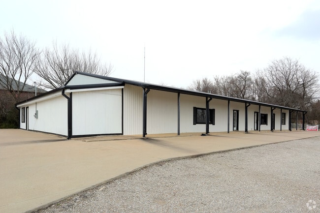

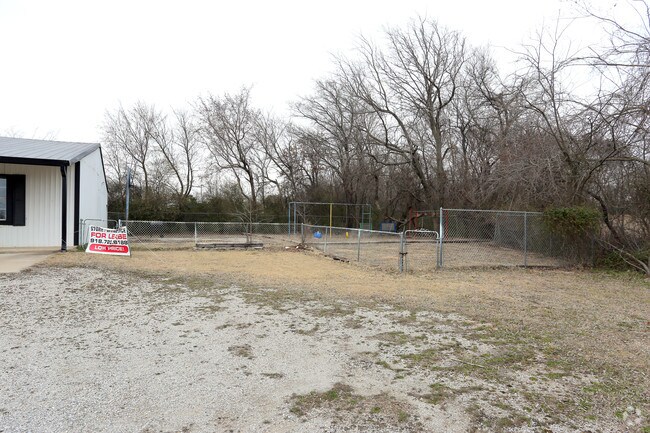
Property Detail
10787 E Highway 51
730008015
26-18-15 SURFACE RTS ONLY IN & TO A PT OF THE NW OF NE OF SW OF 26-18 15 DESC BEG 1326' E OF THE NW COR OF THE NW OF SW -E358
Religious
WAGONER
B and X Area of moderate flood hazard, usually the area between the limits of the 100-year and 500-year floods.
Oklahoma
0
1.20 AC
2025
Wagoner County
030502
Tulsa
5,640 SF
Tulsa, OK
NEARBY LISTINGS FOR SALE OR LEASE
DEMOGRAPHICS near 10787 E Highway 51
1 mile
3 mile
5 mile
2025 Total Population
1,756
18,354
41,943
2030 Population
1,952
20,235
46,057
Pop Growth 2025-2030
+ 11.16%
+ 10.25%
+ 9.81%
Average Age
40
40
40
2025 Total Households
621
6,550
15,149
HH Growth 2025-2030
+ 10.95%
+ 9.94%
+ 9.50%
Median Household Inc
$98,318
$98,878
$92,922
Avg Household Size
2.80
2.80
2.70
2025 Avg HH Vehicles
2.00
2.00
2.00
Median Home Value
$298,195
$300,346
$284,856
Median Year Built
2003
2003
1999
Nearby Places
Map Layers
Map Styles
 Street
 Aerial
Transit
 Traffic
 Biking
Places
Listings with unknown addresses are not visible on the map
- Restaurants
- Banks
- Shops
- Fitness
- Groceries
PUBLIC TRANSPORTATION
AIRPORT
Tulsa International
Drive
Walk
Distance
Tulsa International
32 min
22.8 mi
Freight Ports
Tulsa Port of Inola
Drive
Walk
Distance
Tulsa Port of Inola
36 min
23.4 mi
Nearby Properties
Address
Land Use
TOTAL SIZE
Lot Size
Zoning
Address
Land Use
TOTAL SIZE
Lot Size
Zoning
Address
Land Use
TOTAL SIZE
Lot Size
Zoning
1,936 SF
4.74 AC
Address
Land Use
TOTAL SIZE
Lot Size
Zoning
40,560 SF
14.96 AC
Address
Land Use
TOTAL SIZE
Lot Size
Zoning
14,625 SF
42.36 AC
Address
Land Use
TOTAL SIZE
Lot Size
Zoning
11,220 SF
8.58 AC
Address
Land Use
TOTAL SIZE
Lot Size
Zoning
2,000 SF
1.55 AC
Address
Land Use
TOTAL SIZE
Lot Size
Zoning
10,000 SF
3 AC
Address
Land Use
TOTAL SIZE
Lot Size
Zoning
9,250 SF
6.89 AC
Address
Land Use
TOTAL SIZE
Lot Size
Zoning
1,500 SF
0.78 AC
Address
Land Use
TOTAL SIZE
Lot Size
Zoning
61,167 SF
3.68 AC
Address
Land Use
TOTAL SIZE
Lot Size
Zoning
2,520 SF
132.56 AC
Address
Land Use
TOTAL SIZE
Lot Size
Zoning
154 SF
1.35 AC
Address
Land Use
TOTAL SIZE
Lot Size
Zoning
8,000 SF
7.18 AC
Address
Land Use
TOTAL SIZE
Lot Size
Zoning
18,120 SF
2 AC
Address
Land Use
TOTAL SIZE
Lot Size
Zoning
23,865 SF
2.50 AC
Address
Land Use
TOTAL SIZE
Lot Size
Zoning
6,336 SF
3.21 AC
Address
Land Use
TOTAL SIZE
Lot Size
Zoning
27,966 SF
4.66 AC
Address
Land Use
TOTAL SIZE
Lot Size
Zoning
6,926 SF
1.99 AC
Address
Land Use
TOTAL SIZE
Lot Size
Zoning
Address
Land Use
TOTAL SIZE
Lot Size
Zoning
12,155 SF
3.97 AC
Address
Land Use
TOTAL SIZE
Lot Size
Zoning
8,000 SF
3.91 AC
Address
Land Use
TOTAL SIZE
Lot Size
Zoning
27,300 SF
5.16 AC
Address
Land Use
TOTAL SIZE
Lot Size
Zoning
18,000 SF
2.38 AC
Address
Land Use
TOTAL SIZE
Lot Size
Zoning
12,544 SF
1.41 AC
Address
Land Use
TOTAL SIZE
Lot Size
Zoning
3,600 SF
3.35 AC
Address
Land Use
TOTAL SIZE
Lot Size
Zoning
5,300 SF
2.98 AC
The World's #1 Commercial Real Estate Marketplace
Connect with us
© 2026 CoStar Group
The information above has been obtained from sources believed reliable. While we do not doubt its accuracy we have not verified it and make no guarantee, warranty or representation about it. It is your responsibility to independently confirm its accuracy and completeness. Any projections, opinions, assumptions, or estimates used are for example only and do not represent the current or future performance of the property. The value of this transaction to you depends on tax and other factors which should be evaluated by your tax, financial, and legal advisors. You and your advisors should conduct a careful, independent investigation of the property to determine to your satisfaction the suitability of the property for your needs.