Property Record
10801 Falconwing Dr, Spring, TX 77381
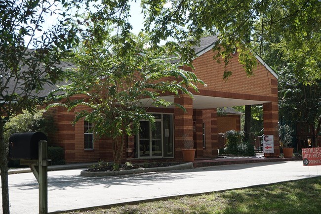

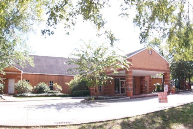
Property Detail
10801 Falconwing Dr
9704-00-00100
S970400 - WDLNDS PARKWAY BAPTIST CHURCH, RES A, ACRES 5
Commercialnec
Montgomery
6
Texas
B and X Area of moderate flood hazard, usually the area between the limits of the 100-year and 500-year floods.
5 AC
0
The Woodlands
2025
Houston
691301
Houston-Pasadena-The Woodlands, TX
21,330 SF
NEARBY LISTINGS FOR SALE OR LEASE
-
-
View all Spring listings for sale on LoopNet.com
DEMOGRAPHICS near 10801 Falconwing Dr
1 mile
3 mile
5 mile
2025 Total Population
10,432
76,161
194,993
2030 Population
12,010
86,520
222,395
Pop Growth 2025-2030
+ 15.13%
+ 13.60%
+ 14.05%
Average Age
42
40
40
2025 Total Households
4,051
27,967
73,979
HH Growth 2025-2030
+ 15.70%
+ 14.46%
+ 14.91%
Median Household Inc
$120,918
$141,931
$119,828
Avg Household Size
2.60
2.70
2.60
2025 Avg HH Vehicles
2.00
2.00
2.00
Median Home Value
$421,000
$514,961
$457,026
Median Year Built
1990
1998
2005
Nearby Places
Map Layers
Map Styles
 Street
 Aerial
Transit
 Traffic
 Biking
Places
Listings with unknown addresses are not visible on the map
- Restaurants
- Banks
- Shops
- Fitness
- Groceries
PUBLIC TRANSPORTATION
AIRPORT
George Bush Intcntl/Houston
Drive
Walk
Distance
George Bush Intcntl/Houston
33 min
25.1 mi
Freight Ports
Port of Houston
Drive
Walk
Distance
Port of Houston
56 min
40.8 mi
SALE & LEASE HISTORY
LISTING DATE
SALE/LEASE

Sep 24, 2016
For Sale
Nearby Properties
Address
Land Use
TOTAL SIZE
Lot Size
Zoning
Address
Land Use
TOTAL SIZE
Lot Size
Zoning
709,789 SF
3.04 AC
Address
Land Use
TOTAL SIZE
Lot Size
Zoning
707,184 SF
3.48 AC
Address
Land Use
TOTAL SIZE
Lot Size
Zoning
370,296 SF
14.05 AC
Address
Land Use
TOTAL SIZE
Lot Size
Zoning
1,132,062 SF
3.31 AC
Address
Land Use
TOTAL SIZE
Lot Size
Zoning
410,156 SF
18.68 AC
Address
Land Use
TOTAL SIZE
Lot Size
Zoning
392,960 SF
20.01 AC
6
Address
Land Use
TOTAL SIZE
Lot Size
Zoning
289,737 SF
13.83 AC
Address
Land Use
TOTAL SIZE
Lot Size
Zoning
336,730 SF
2.41 AC
Address
Land Use
TOTAL SIZE
Lot Size
Zoning
162,976 SF
1.04 AC
Address
Land Use
TOTAL SIZE
Lot Size
Zoning
323,119 SF
14.37 AC
Address
Land Use
TOTAL SIZE
Lot Size
Zoning
295,608 SF
10.07 AC
6
Address
Land Use
TOTAL SIZE
Lot Size
Zoning
324,336 SF
13.11 AC
Address
Land Use
TOTAL SIZE
Lot Size
Zoning
289,611 SF
13.57 AC
Address
Land Use
TOTAL SIZE
Lot Size
Zoning
275,428 SF
3.13 AC
Address
Land Use
TOTAL SIZE
Lot Size
Zoning
385,462 SF
12.36 AC
Address
Land Use
TOTAL SIZE
Lot Size
Zoning
189,974 SF
29.76 AC
Address
Land Use
TOTAL SIZE
Lot Size
Zoning
775,637 SF
3.09 AC
Address
Land Use
TOTAL SIZE
Lot Size
Zoning
299,416 SF
50 AC
6
Address
Land Use
TOTAL SIZE
Lot Size
Zoning
294,940 SF
15.07 AC
Address
Land Use
TOTAL SIZE
Lot Size
Zoning
297,153 SF
17.13 AC
6
Address
Land Use
TOTAL SIZE
Lot Size
Zoning
197,000 SF
2.07 AC
Address
Land Use
TOTAL SIZE
Lot Size
Zoning
197,000 SF
2.48 AC
Address
Land Use
TOTAL SIZE
Lot Size
Zoning
163,392 SF
4.53 AC
Address
Land Use
TOTAL SIZE
Lot Size
Zoning
384,154 SF
3.69 AC
Address
Land Use
TOTAL SIZE
Lot Size
Zoning
87,445 SF
6.45 AC
Address
Land Use
TOTAL SIZE
Lot Size
Zoning
153,063 SF
17.50 AC
Address
Land Use
TOTAL SIZE
Lot Size
Zoning
385,000 SF
68.27 AC
6
Address
Land Use
TOTAL SIZE
Lot Size
Zoning
139,140 SF
18.22 AC
6
Address
Land Use
TOTAL SIZE
Lot Size
Zoning
106,857 SF
10.12 AC
Address
Land Use
TOTAL SIZE
Lot Size
Zoning
138,468 SF
16.33 AC
6
The World's #1 Commercial Real Estate Marketplace
Connect with us
© 2026 CoStar Group
The information above has been obtained from sources believed reliable. While we do not doubt its accuracy we have not verified it and make no guarantee, warranty or representation about it. It is your responsibility to independently confirm its accuracy and completeness. Any projections, opinions, assumptions, or estimates used are for example only and do not represent the current or future performance of the property. The value of this transaction to you depends on tax and other factors which should be evaluated by your tax, financial, and legal advisors. You and your advisors should conduct a careful, independent investigation of the property to determine to your satisfaction the suitability of the property for your needs.