Property Record
10820 Quality Dr, Charlotte, NC 28278


Save to a Folder
{{folder.Name}}
{{folder.ListingIds.length}} Properties
{{folder.ListingIds.length}} Property
Create a New Folder
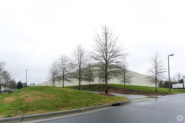
Property Detail
10820 Quality Dr
199-171-10
M44-568
Industrialgeneral
Mecklenburg
I-2
North Carolina
B and X Area of moderate flood hazard, usually the area between the limits of the 100-year and 500-year floods.
10
2024
13.46 AC
2025
State Line
005924
Charlotte
180,000 SF
Charlotte-Concord-Gastonia, NC-SC
NEARBY LISTINGS FOR SALE OR LEASE
DEMOGRAPHICS near 10820 Quality Dr
1 mile
3 mile
5 mile
2025 Total Population
6,346
57,752
106,168
2030 Population
6,904
62,899
115,512
Pop Growth 2025-2030
+ 8.79%
+ 8.91%
+ 8.80%
Average Age
37
37
38
2025 Total Households
2,352
22,773
41,825
HH Growth 2025-2030
+ 8.84%
+ 8.94%
+ 8.84%
Median Household Inc
$108,393
$92,521
$96,925
Avg Household Size
2.60
2.50
2.50
2025 Avg HH Vehicles
2.00
2.00
2.00
Median Home Value
$395,608
$389,648
$420,723
Median Year Built
2010
2005
2004
Nearby Places
Map Layers
Map Styles
 Street
 Aerial
Layers
 Traffic
 Biking
Places
Listings with unknown addresses are not visible on the map
- Restaurants
- Banks
- Shops
- Fitness
- Groceries
PUBLIC TRANSPORTATION
AIRPORT
Charlotte/Douglas International
Drive
Walk
Distance
Charlotte/Douglas International
17 min
7.8 mi
Concord-Padgett Regional
Drive
Walk
Distance
Concord-Padgett Regional
38 min
29.3 mi
Freight Ports
North Charleston Terminal
Drive
Walk
Distance
North Charleston Terminal
221 min
192.3 mi
Nearby Properties
Address
Land Use
TOTAL SIZE
Lot Size
Zoning
Address
Land Use
TOTAL SIZE
Lot Size
Zoning
432,123 SF
36.75 AC
R17MFCD
Address
Land Use
TOTAL SIZE
Lot Size
Zoning
459,020 SF
42 AC
R3
Address
Land Use
TOTAL SIZE
Lot Size
Zoning
1,255,063 SF
292.46 AC
I2
Address
Land Use
TOTAL SIZE
Lot Size
Zoning
315,386 SF
26.83 AC
MX1
Address
Land Use
TOTAL SIZE
Lot Size
Zoning
395,382 SF
9.84 AC
MUDDO
Address
Land Use
TOTAL SIZE
Lot Size
Zoning
399,178 SF
17.59 AC
Address
Land Use
TOTAL SIZE
Lot Size
Zoning
283,424 SF
24.95 AC
R17MFCD
Address
Land Use
TOTAL SIZE
Lot Size
Zoning
369,622 SF
26.29 AC
R17MFCD
Address
Land Use
TOTAL SIZE
Lot Size
Zoning
252,275 SF
20.23 AC
Address
Land Use
TOTAL SIZE
Lot Size
Zoning
289,148 SF
17.12 AC
Address
Land Use
TOTAL SIZE
Lot Size
Zoning
292,097 SF
16.26 AC
CC
Address
Land Use
TOTAL SIZE
Lot Size
Zoning
293,943 SF
12.90 AC
Address
Land Use
TOTAL SIZE
Lot Size
Zoning
272,801 SF
12.90 AC
Address
Land Use
TOTAL SIZE
Lot Size
Zoning
280,293 SF
25.47 AC
R3
Address
Land Use
TOTAL SIZE
Lot Size
Zoning
250,307 SF
15.53 AC
R17MFCD
Address
Land Use
TOTAL SIZE
Lot Size
Zoning
229,094 SF
7.29 AC
R3
Address
Land Use
TOTAL SIZE
Lot Size
Zoning
899,731 SF
73.49 AC
Address
Land Use
TOTAL SIZE
Lot Size
Zoning
254,393 SF
12.48 AC
Address
Land Use
TOTAL SIZE
Lot Size
Zoning
857,532 SF
73.57 AC
I1
Address
Land Use
TOTAL SIZE
Lot Size
Zoning
218,322 SF
15.93 AC
R17MFCD
Address
Land Use
TOTAL SIZE
Lot Size
Zoning
269,639 SF
15.32 AC
R17MFCD
Address
Land Use
TOTAL SIZE
Lot Size
Zoning
275,215 SF
12.35 AC
R17MFCD
Address
Land Use
TOTAL SIZE
Lot Size
Zoning
245,573 SF
23.62 AC
R12MFCD
Address
Land Use
TOTAL SIZE
Lot Size
Zoning
415,871 SF
66.17 AC
R3
Address
Land Use
TOTAL SIZE
Lot Size
Zoning
32.80 AC
MUDD-O
Address
Land Use
TOTAL SIZE
Lot Size
Zoning
200,765 SF
7.71 AC
Address
Land Use
TOTAL SIZE
Lot Size
Zoning
213,739 SF
9.79 AC
MUDDO
Address
Land Use
TOTAL SIZE
Lot Size
Zoning
220,232 SF
15.45 AC
R15MFCD
Address
Land Use
TOTAL SIZE
Lot Size
Zoning
221,746 SF
8.82 AC
O-2(CD)
Address
Land Use
TOTAL SIZE
Lot Size
Zoning
163,002 SF
5.65 AC
R17MF
The World's #1 Commercial Real Estate Marketplace
Connect with us
© 2026 CoStar Group
The information above has been obtained from sources believed reliable. While we do not doubt its accuracy we have not verified it and make no guarantee, warranty or representation about it. It is your responsibility to independently confirm its accuracy and completeness. Any projections, opinions, assumptions, or estimates used are for example only and do not represent the current or future performance of the property. The value of this transaction to you depends on tax and other factors which should be evaluated by your tax, financial, and legal advisors. You and your advisors should conduct a careful, independent investigation of the property to determine to your satisfaction the suitability of the property for your needs.