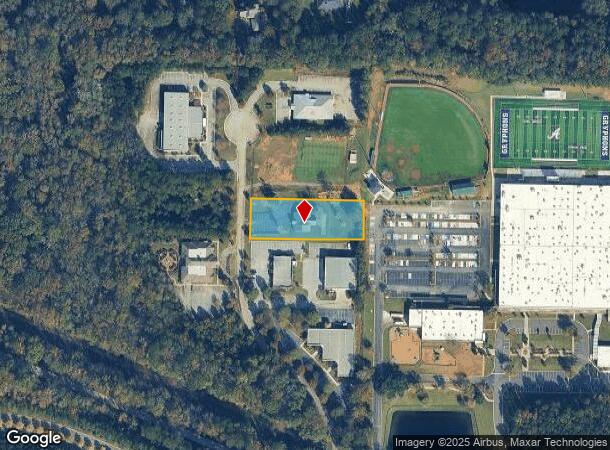
Property Record
109 Preston Ct, Macon, GA 31210
NEARBY LISTINGS FOR SALE OR LEASE
Property Detail
109 Preston Ct
Macon-Bibb County, GA
The 13Th Land District
K002-0046
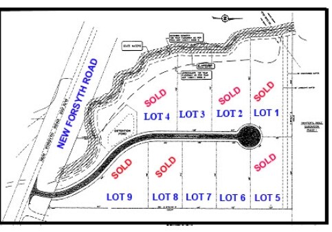
PRESTON PARK
Officebuilding
Bibb
X
Georgia
13169C0205E
7b
2025
1.11 AC
2025
Outlying Bibb County
013411
Atlanta
3,074 SF
DEMOGRAPHICS near 109 Preston Ct
1 Mile
3 Mile
5 Mile
2024 Total Population
1,719
13,117
32,656
2029 Population
1,718
13,211
32,671
Pop Growth 2024-2029
(0.06%)
+ 0.72%
+ 0.05%
Average Age
37
40
41
2024 Total Households
817
5,697
13,742
HH Growth 2024-2029
(0.37%)
+ 0.58%
(0.07%)
Median Household Inc
$74,794
$88,613
$82,287
Avg Household Size
2.10
2.30
2.30
2024 Avg HH Vehicles
2.00
2.00
2.00
Median Home Value
$352,419
$284,190
$239,943
Median Year Built
1997
1995
1991
Nearby Places
- Restaurants
- Banks
- Shops
- Fitness
- Groceries
Nearby Properties
Address
Land Use
TOTAL SIZE
Lot Size
Zoning
Address
Land Use
TOTAL SIZE
Lot Size
Zoning
83,990 SF
42.03 AC
C-2
Address
Land Use
TOTAL SIZE
Lot Size
Zoning
298,760 SF
60.24 AC
PDE
Address
Land Use
TOTAL SIZE
Lot Size
Zoning
3,204 SF
49.78 AC
R-3
Address
Land Use
TOTAL SIZE
Lot Size
Zoning
2,559 SF
45.58 AC
R-3
Address
Land Use
TOTAL SIZE
Lot Size
Zoning
4,671 SF
22.66 AC
R-3
Address
Land Use
TOTAL SIZE
Lot Size
Zoning
94,879 SF
18.77 AC
C-4
Address
Land Use
TOTAL SIZE
Lot Size
Zoning
6,222 SF
56.17 AC
PDR
Address
Land Use
TOTAL SIZE
Lot Size
Zoning
211,536 SF
16.48 AC
C-2
Address
Land Use
TOTAL SIZE
Lot Size
Zoning
62,688 SF
32.47 AC
R-3
Address
Land Use
TOTAL SIZE
Lot Size
Zoning
185,591 SF
38.16 AC
PDE
Address
Land Use
TOTAL SIZE
Lot Size
Zoning
48,696 SF
23.70 AC
PDE
Address
Land Use
TOTAL SIZE
Lot Size
Zoning
172,808 SF
38.40 AC
C-4/PDE
Address
Land Use
TOTAL SIZE
Lot Size
Zoning
4,734 SF
40 AC
PDE
Address
Land Use
TOTAL SIZE
Lot Size
Zoning
3,902 SF
53.40 AC
PDE
Address
Land Use
TOTAL SIZE
Lot Size
Zoning
133,220 SF
9.15 AC
C-2
Address
Land Use
TOTAL SIZE
Lot Size
Zoning
162,132 SF
21.95 AC
PDE
Address
Land Use
TOTAL SIZE
Lot Size
Zoning
55,536 SF
20.36 AC
PDE
Address
Land Use
TOTAL SIZE
Lot Size
Zoning
5,376 SF
102.72 AC
R-1AA
Address
Land Use
TOTAL SIZE
Lot Size
Zoning
125,073 SF
4.89 AC
R-3
Address
Land Use
TOTAL SIZE
Lot Size
Zoning
70,900 SF
2.19 AC
PDE
Address
Land Use
TOTAL SIZE
Lot Size
Zoning
79,904 SF
5.05 AC
PDE
Address
Land Use
TOTAL SIZE
Lot Size
Zoning
3,036 SF
17.32 AC
PDE
Address
Land Use
TOTAL SIZE
Lot Size
Zoning
64,104 SF
9.17 AC
PDE
Address
Land Use
TOTAL SIZE
Lot Size
Zoning
84,044 SF
22.44 AC
C-4
Address
Land Use
TOTAL SIZE
Lot Size
Zoning
75,452 SF
2.03 AC
C-2
Address
Land Use
TOTAL SIZE
Lot Size
Zoning
40,406 SF
5.90 AC
PDE
Address
Land Use
TOTAL SIZE
Lot Size
Zoning
83,638 SF
7.28 AC
C-2
Address
Land Use
TOTAL SIZE
Lot Size
Zoning
20,518 SF
19.58 AC
R-3
Address
Land Use
TOTAL SIZE
Lot Size
Zoning
55,280 SF
3.65 AC
C-2
Address
Land Use
TOTAL SIZE
Lot Size
Zoning
94,524 SF
4.89 AC
PDE
The World's #1 Commercial Real Estate Marketplace
Connect with us
© 2025 CoStar Group
The information above has been obtained from sources believed reliable. While we do not doubt its accuracy we have not verified it and make no guarantee, warranty or representation about it. It is your responsibility to independently confirm its accuracy and completeness. Any projections, opinions, assumptions, or estimates used are for example only and do not represent the current or future performance of the property. The value of this transaction to you depends on tax and other factors which should be evaluated by your tax, financial, and legal advisors. You and your advisors should conduct a careful, independent investigation of the property to determine to your satisfaction the suitability of the property for your needs.