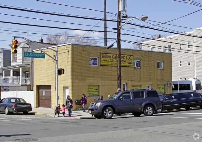
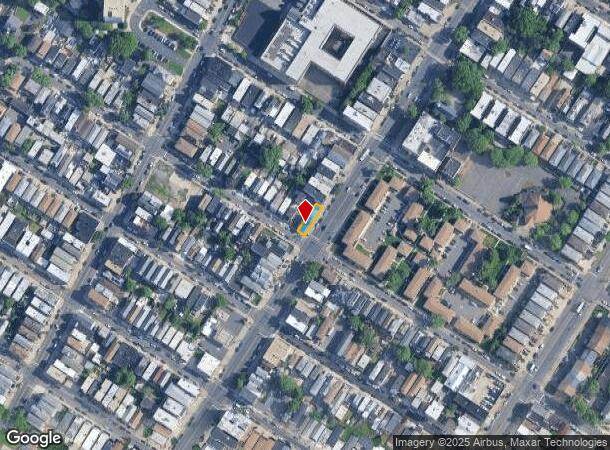
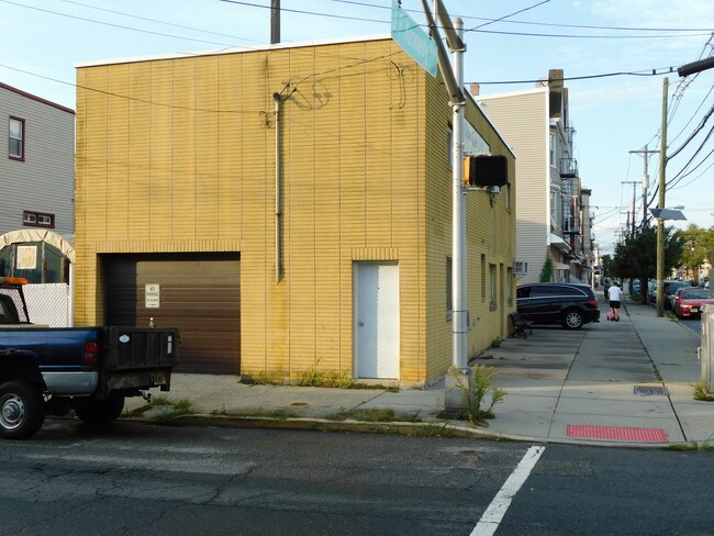
Property Record
109 W 22Nd St, Bayonne, NJ 07002
NEARBY LISTINGS FOR SALE OR LEASE
Property Detail
109 W 22Nd St
01-00201-0000-00026
Hudson
Commercialnec
New Jersey
X
26
34013C0200F
0.06 AC
2024
Hudson Waterfront
2025
Northern New Jersey
010701
New York-Jersey City-White Plains, NY-NJ
DEMOGRAPHICS near 109 W 22Nd St
1 Mile
3 Mile
5 Mile
2024 Total Population
41,138
169,986
542,077
2029 Population
39,353
164,298
524,680
Pop Growth 2024-2029
(4.34%)
(3.35%)
(3.21%)
Average Age
40
39
38
2024 Total Households
15,653
60,451
190,096
HH Growth 2024-2029
(4.92%)
(3.69%)
(3.43%)
Median Household Inc
$66,408
$69,780
$64,165
Avg Household Size
2.50
2.70
2.70
2024 Avg HH Vehicles
1.00
1.00
1.00
Median Home Value
$386,272
$451,948
$485,669
Median Year Built
1957
1955
1962
Nearby Places
Map Layers
Map Styles
 Street
 Aerial
- Restaurants
- Banks
- Shops
- Fitness
- Groceries
PUBLIC TRANSPORTATION
TRANSIT/SUBWAY
22nd Street (22nd Street-Hoboken Terminal - Hudson-Bergen Light Rail (Hudson-Bergen Light Rail))
DRIVE
WALK
Distance
22nd Street (22nd Street-Hoboken Terminal - Hudson-Bergen Light Rail (Hudson-Bergen Light Rail))
4 min
9 min
0.5 mi
COMMUTER RAIL
Newark Airport (North Jersey Coast Line - NJ Transit Commuter Rail (NJ Transit), Northeast Corridor Line - NJ Transit Commuter Rail (NJ Transit))
DRIVE
WALK
Distance
Newark Airport (North Jersey Coast Line - NJ Transit Commuter Rail (NJ Transit), Northeast Corridor Line - NJ Transit Commuter Rail (NJ Transit))
19 min
9.1 mi
Elizabeth (North Jersey Coast Line - NJ Transit Commuter Rail (NJ Transit), Northeast Corridor Line - NJ Transit Commuter Rail (NJ Transit))
DRIVE
WALK
Distance
Elizabeth (North Jersey Coast Line - NJ Transit Commuter Rail (NJ Transit), Northeast Corridor Line - NJ Transit Commuter Rail (NJ Transit))
20 min
9.9 mi
AIRPORT
Newark Liberty International
DRIVE
WALK
Distance
Newark Liberty International
15 min
7.6 mi
LaGuardia
DRIVE
WALK
Distance
LaGuardia
41 min
29.0 mi
John F Kennedy International
DRIVE
WALK
Distance
John F Kennedy International
43 min
31.5 mi
Freight Ports
Port Newark Container Terminal
DRIVE
WALK
Distance
Port Newark Container Terminal
1 min
2.2 mi
SALE & LEASE HISTORY
LISTING DATE
SALE/LEASE

Apr 23, 2018
For Sale
Apr 06, 2017
For Sale
Nearby Properties
Address
Land Use
TOTAL SIZE
Lot Size
Zoning
Address
Land Use
TOTAL SIZE
Lot Size
Zoning
961.13 AC
Address
Land Use
TOTAL SIZE
Lot Size
Zoning
98.48 AC
Address
Land Use
TOTAL SIZE
Lot Size
Zoning
113.19 AC
Address
Land Use
TOTAL SIZE
Lot Size
Zoning
131.26 AC
Address
Land Use
TOTAL SIZE
Lot Size
Zoning
Address
Land Use
TOTAL SIZE
Lot Size
Zoning
19.03 AC
Address
Land Use
TOTAL SIZE
Lot Size
Zoning
4,450,000 SF
95.24 AC
Address
Land Use
TOTAL SIZE
Lot Size
Zoning
216 AC
Address
Land Use
TOTAL SIZE
Lot Size
Zoning
22.49 AC
HC
Address
Land Use
TOTAL SIZE
Lot Size
Zoning
70.39 AC
Address
Land Use
TOTAL SIZE
Lot Size
Zoning
16.63 AC
Address
Land Use
TOTAL SIZE
Lot Size
Zoning
1.01 AC
Address
Land Use
TOTAL SIZE
Lot Size
Zoning
51.62 AC
Address
Land Use
TOTAL SIZE
Lot Size
Zoning
12.50 AC
Address
Land Use
TOTAL SIZE
Lot Size
Zoning
30.92 AC
Address
Land Use
TOTAL SIZE
Lot Size
Zoning
3.27 AC
Address
Land Use
TOTAL SIZE
Lot Size
Zoning
17.60 AC
Address
Land Use
TOTAL SIZE
Lot Size
Zoning
51.61 AC
Address
Land Use
TOTAL SIZE
Lot Size
Zoning
39.64 AC
Address
Land Use
TOTAL SIZE
Lot Size
Zoning
Address
Land Use
TOTAL SIZE
Lot Size
Zoning
28.47 AC
I-H
Address
Land Use
TOTAL SIZE
Lot Size
Zoning
11.96 AC
Address
Land Use
TOTAL SIZE
Lot Size
Zoning
114.66 AC
BMHO
Address
Land Use
TOTAL SIZE
Lot Size
Zoning
5,400,000 SF
35.22 AC
Address
Land Use
TOTAL SIZE
Lot Size
Zoning
89.40 AC
R1
Address
Land Use
TOTAL SIZE
Lot Size
Zoning
1 SF
20 AC
Address
Land Use
TOTAL SIZE
Lot Size
Zoning
115.33 AC
IH
Address
Land Use
TOTAL SIZE
Lot Size
Zoning
22.91 AC
Address
Land Use
TOTAL SIZE
Lot Size
Zoning
74.35 AC
TDD
Address
Land Use
TOTAL SIZE
Lot Size
Zoning
30.70 AC
The World's #1 Commercial Real Estate Marketplace
Connect with us
© 2025 CoStar Group
The information above has been obtained from sources believed reliable. While we do not doubt its accuracy we have not verified it and make no guarantee, warranty or representation about it. It is your responsibility to independently confirm its accuracy and completeness. Any projections, opinions, assumptions, or estimates used are for example only and do not represent the current or future performance of the property. The value of this transaction to you depends on tax and other factors which should be evaluated by your tax, financial, and legal advisors. You and your advisors should conduct a careful, independent investigation of the property to determine to your satisfaction the suitability of the property for your needs.