Property Record
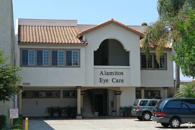
10951 Cherry St, Los Alamitos, CA 90720


NEARBY LISTINGS FOR SALE OR LEASE
Property Detail
10951 Cherry St
Anaheim-Santa Ana-Irvine, CA
Town Of Los Alamitos
242-173-15
A TR LOS ALAMITOS, TOWN OF BLK 29 LOT 27
Commercialnec
Orange
X
California
06059C0112J
27
2024
0.17 AC
2025
Los Alamitos/Stanton
110108
Orange County (California)
757 SF
DEMOGRAPHICS near 10951 Cherry St
1 Mile
3 Mile
5 Mile
2024 Total Population
16,900
166,688
496,271
2029 Population
16,656
162,850
485,362
Pop Growth 2024-2029
(1.44%)
(2.30%)
(2.20%)
Average Age
41
43
42
2024 Total Households
6,006
57,990
169,806
HH Growth 2024-2029
(1.57%)
(2.37%)
(2.39%)
Median Household Inc
$114,720
$105,931
$97,792
Avg Household Size
2.80
2.80
2.80
2024 Avg HH Vehicles
2.00
2.00
2.00
Median Home Value
$970,082
$754,164
$761,805
Median Year Built
1967
1964
1964
Nearby Places
Map Layers
Map Styles
 Street
 Aerial
- Restaurants
- Banks
- Shops
- Fitness
- Groceries
PUBLIC TRANSPORTATION
AIRPORT
Long Beach (Daugherty Field)
DRIVE
WALK
Distance
Long Beach (Daugherty Field)
11 min
6.9 mi
John Wayne/Orange County
DRIVE
WALK
Distance
John Wayne/Orange County
24 min
17.0 mi
Los Angeles International
DRIVE
WALK
Distance
Los Angeles International
35 min
25.7 mi
Freight Ports
Port of Long Beach
DRIVE
WALK
Distance
Port of Long Beach
18 min
8.4 mi
Nearby Properties
Address
Land Use
TOTAL SIZE
Lot Size
Zoning
Address
Land Use
TOTAL SIZE
Lot Size
Zoning
927.44 AC
Address
Land Use
TOTAL SIZE
Lot Size
Zoning
235,971 SF
10.58 AC
HGC4*
Address
Land Use
TOTAL SIZE
Lot Size
Zoning
1,226.28 AC
Address
Land Use
TOTAL SIZE
Lot Size
Zoning
22.31 AC
Address
Land Use
TOTAL SIZE
Lot Size
Zoning
13.97 AC
Address
Land Use
TOTAL SIZE
Lot Size
Zoning
210,000 SF
9.18 AC
PC3
Address
Land Use
TOTAL SIZE
Lot Size
Zoning
11.07 AC
Address
Land Use
TOTAL SIZE
Lot Size
Zoning
203,371 SF
0.14 AC
HGC4*
Address
Land Use
TOTAL SIZE
Lot Size
Zoning
Address
Land Use
TOTAL SIZE
Lot Size
Zoning
312,469 SF
6.85 AC
LBCCA
Address
Land Use
TOTAL SIZE
Lot Size
Zoning
8.09 AC
Address
Land Use
TOTAL SIZE
Lot Size
Zoning
120,094 SF
5.93 AC
Address
Land Use
TOTAL SIZE
Lot Size
Zoning
Address
Land Use
TOTAL SIZE
Lot Size
Zoning
3.97 AC
Address
Land Use
TOTAL SIZE
Lot Size
Zoning
Address
Land Use
TOTAL SIZE
Lot Size
Zoning
24.99 AC
Address
Land Use
TOTAL SIZE
Lot Size
Zoning
11.49 AC
Address
Land Use
TOTAL SIZE
Lot Size
Zoning
8.51 AC
Address
Land Use
TOTAL SIZE
Lot Size
Zoning
2,663 SF
1.43 AC
Address
Land Use
TOTAL SIZE
Lot Size
Zoning
165,343 SF
3.93 AC
Address
Land Use
TOTAL SIZE
Lot Size
Zoning
163,295 SF
6.17 AC
R3
Address
Land Use
TOTAL SIZE
Lot Size
Zoning
Address
Land Use
TOTAL SIZE
Lot Size
Zoning
175,482 SF
3.13 AC
HGC4*
Address
Land Use
TOTAL SIZE
Lot Size
Zoning
Address
Land Use
TOTAL SIZE
Lot Size
Zoning
3.84 AC
Address
Land Use
TOTAL SIZE
Lot Size
Zoning
7,200 SF
3.73 AC
Address
Land Use
TOTAL SIZE
Lot Size
Zoning
12.36 AC
Address
Land Use
TOTAL SIZE
Lot Size
Zoning
Address
Land Use
TOTAL SIZE
Lot Size
Zoning
14.89 AC
Address
Land Use
TOTAL SIZE
Lot Size
Zoning
7,500 SF
30.41 AC
The World's #1 Commercial Real Estate Marketplace
Connect with us
© 2026 CoStar Group
The information above has been obtained from sources believed reliable. While we do not doubt its accuracy we have not verified it and make no guarantee, warranty or representation about it. It is your responsibility to independently confirm its accuracy and completeness. Any projections, opinions, assumptions, or estimates used are for example only and do not represent the current or future performance of the property. The value of this transaction to you depends on tax and other factors which should be evaluated by your tax, financial, and legal advisors. You and your advisors should conduct a careful, independent investigation of the property to determine to your satisfaction the suitability of the property for your needs.