Property Record
10Th St, Richmond, TX 77406


Save to a Folder
{{folder.Name}}
{{folder.ListingIds.length}} Properties
{{folder.ListingIds.length}} Property
Create a New Folder
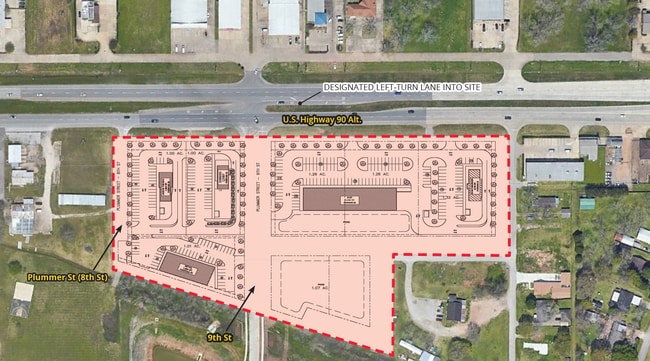
Property Detail
10Th St
Houston-Pasadena-The Woodlands, TX
EDGEWOOD ADDN SEC 4, ACRES 1.018, (PART OF 10TH STREET & ALLEYS), 1% IN (C15) CITY OF RICHMOND
2855-04-000-0004-901
FORT BEND
Residentialacreage
Texas
AE The base floodplain where base flood elevations are provided. AE Zones are now used on new format FIRMs instead of A1-A30 Zones.
1.02 AC
2024
Far Southwest
2025
Houston
673404
NEARBY LISTINGS FOR SALE OR LEASE
DEMOGRAPHICS near 10Th St
1 mile
3 mile
5 mile
2025 Total Population
4,970
52,794
174,263
2030 Population
5,697
60,038
197,983
Pop Growth 2025-2030
+ 14.63%
+ 13.72%
+ 13.61%
Average Age
38
40
39
2025 Total Households
1,616
19,318
57,633
HH Growth 2025-2030
+ 15.04%
+ 14.23%
+ 14.14%
Median Household Inc
$106,660
$90,656
$104,162
Avg Household Size
3.00
2.60
2.90
2025 Avg HH Vehicles
3.00
2.00
2.00
Median Home Value
$341,964
$343,970
$370,273
Median Year Built
2006
2002
2005
Nearby Places
Map Layers
Map Styles
 Street
 Aerial
Layers
 Traffic
 Biking
Places
Listings with unknown addresses are not visible on the map
- Restaurants
- Banks
- Shops
- Fitness
- Groceries
PUBLIC TRANSPORTATION
AIRPORT
William P Hobby
Drive
Walk
Distance
William P Hobby
50 min
32.7 mi
Freight Ports
Port of Houston
Drive
Walk
Distance
Port of Houston
51 min
34.8 mi
SALE & LEASE HISTORY
LISTING DATE
SALE/LEASE

Dec 08, 2023
For Lease
Nearby Properties
Address
Land Use
TOTAL SIZE
Lot Size
Zoning
Address
Land Use
TOTAL SIZE
Lot Size
Zoning
449,167 SF
73.44 AC
IY
Address
Land Use
TOTAL SIZE
Lot Size
Zoning
504,838 SF
30.59 AC
Address
Land Use
TOTAL SIZE
Lot Size
Zoning
217,233 SF
30.31 AC
Address
Land Use
TOTAL SIZE
Lot Size
Zoning
10.84 AC
Address
Land Use
TOTAL SIZE
Lot Size
Zoning
Address
Land Use
TOTAL SIZE
Lot Size
Zoning
438,371 SF
132.75 AC
Address
Land Use
TOTAL SIZE
Lot Size
Zoning
78,077 SF
16.29 AC
Address
Land Use
TOTAL SIZE
Lot Size
Zoning
85,021 SF
12 AC
Address
Land Use
TOTAL SIZE
Lot Size
Zoning
81,128 SF
8.98 AC
YNQS
Address
Land Use
TOTAL SIZE
Lot Size
Zoning
212,000 SF
0.49 AC
Address
Land Use
TOTAL SIZE
Lot Size
Zoning
89,753 SF
10.61 AC
Address
Land Use
TOTAL SIZE
Lot Size
Zoning
169,798 SF
16.29 AC
Address
Land Use
TOTAL SIZE
Lot Size
Zoning
224,099 SF
11.85 AC
Address
Land Use
TOTAL SIZE
Lot Size
Zoning
Address
Land Use
TOTAL SIZE
Lot Size
Zoning
3,680 SF
38.68 AC
SMH
Address
Land Use
TOTAL SIZE
Lot Size
Zoning
20,000,000 SF
5 AC
Address
Land Use
TOTAL SIZE
Lot Size
Zoning
2,131 SF
17.68 AC
Address
Land Use
TOTAL SIZE
Lot Size
Zoning
28.37 AC
Z
Address
Land Use
TOTAL SIZE
Lot Size
Zoning
94,080 SF
6.23 AC
H
Address
Land Use
TOTAL SIZE
Lot Size
Zoning
132,171 SF
8.86 AC
Address
Land Use
TOTAL SIZE
Lot Size
Zoning
46,959 SF
8.36 AC
S
Address
Land Use
TOTAL SIZE
Lot Size
Zoning
103,380 SF
5.44 AC
NYX
Address
Land Use
TOTAL SIZE
Lot Size
Zoning
103,204 SF
5.50 AC
YX
Address
Land Use
TOTAL SIZE
Lot Size
Zoning
250,000 SF
1.01 AC
Address
Land Use
TOTAL SIZE
Lot Size
Zoning
Address
Land Use
TOTAL SIZE
Lot Size
Zoning
92,210 SF
12.09 AC
Address
Land Use
TOTAL SIZE
Lot Size
Zoning
8.32 AC
NTQXS
Address
Land Use
TOTAL SIZE
Lot Size
Zoning
202,234 SF
30.07 AC
S
Address
Land Use
TOTAL SIZE
Lot Size
Zoning
6.99 AC
Address
Land Use
TOTAL SIZE
Lot Size
Zoning
4,536 SF
3.74 AC
Y
The World's #1 Commercial Real Estate Marketplace
Connect with us
© 2026 CoStar Group
The information above has been obtained from sources believed reliable. While we do not doubt its accuracy we have not verified it and make no guarantee, warranty or representation about it. It is your responsibility to independently confirm its accuracy and completeness. Any projections, opinions, assumptions, or estimates used are for example only and do not represent the current or future performance of the property. The value of this transaction to you depends on tax and other factors which should be evaluated by your tax, financial, and legal advisors. You and your advisors should conduct a careful, independent investigation of the property to determine to your satisfaction the suitability of the property for your needs.