Property Record
11 Bunker Hill Rd, Andover, CT 06232
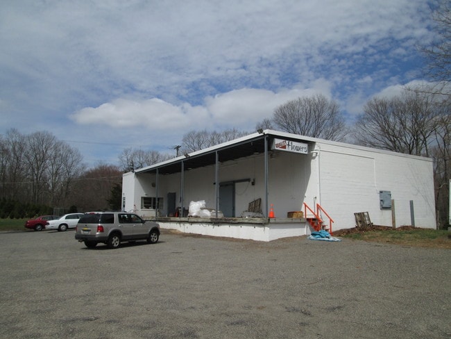

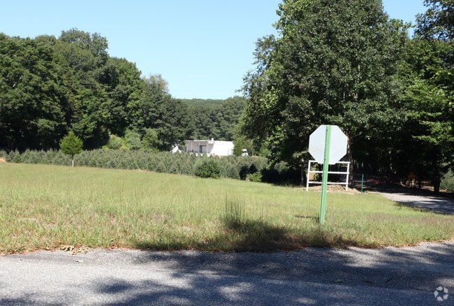
Property Detail
11 Bunker Hill Rd
Hartford-West Hartford-East Hartford, CT
Capitol
ANDO-000033-000027-000017
Connecticut
Agriculturalland
17
2025
15.50 AC
2025
Tolland County
528100
Hartford
3,737 SF
NEARBY LISTINGS FOR SALE OR LEASE
DEMOGRAPHICS near 11 Bunker Hill Rd
1 mile
3 mile
5 mile
2025 Total Population
493
7,200
22,221
2030 Population
498
7,362
22,748
Pop Growth 2025-2030
+ 1.01%
+ 2.25%
+ 2.37%
Average Age
45
44
44
2025 Total Households
195
2,934
8,867
HH Growth 2025-2030
+ 1.54%
+ 2.32%
+ 2.40%
Median Household Inc
$131,785
$118,978
$119,171
Avg Household Size
2.50
2.40
2.50
2025 Avg HH Vehicles
3.00
2.00
2.00
Median Home Value
$396,808
$360,061
$355,068
Median Year Built
1971
1971
1972
Nearby Places
Map Layers
Map Styles
 Street
 Aerial
Layers
 Traffic
 Biking
Places
Listings with unknown addresses are not visible on the map
- Restaurants
- Banks
- Shops
- Fitness
- Groceries
PUBLIC TRANSPORTATION
AIRPORT
Bradley International
Drive
Walk
Distance
Bradley International
53 min
33.8 mi
Freight Ports
Port of New Haven
Drive
Walk
Distance
Port of New Haven
72 min
55.9 mi
SALE & LEASE HISTORY
LISTING DATE
SALE/LEASE

Sep 25, 2016
For Lease
Sep 24, 2016
For Sale
Nearby Properties
Address
Land Use
TOTAL SIZE
Lot Size
Zoning
Address
Land Use
TOTAL SIZE
Lot Size
Zoning
52,658 SF
10.70 AC
Address
Land Use
TOTAL SIZE
Lot Size
Zoning
10,640 SF
1.24 AC
Address
Land Use
TOTAL SIZE
Lot Size
Zoning
0.70 AC
LAR
Address
Land Use
TOTAL SIZE
Lot Size
Zoning
Address
Land Use
TOTAL SIZE
Lot Size
Zoning
281 AC
LBR
Address
Land Use
TOTAL SIZE
Lot Size
Zoning
3.90 AC
Address
Land Use
TOTAL SIZE
Lot Size
Zoning
38 AC
LAR
Address
Land Use
TOTAL SIZE
Lot Size
Zoning
3,756 SF
1.52 AC
Address
Land Use
TOTAL SIZE
Lot Size
Zoning
9,556 SF
70.05 AC
Address
Land Use
TOTAL SIZE
Lot Size
Zoning
15.08 AC
Address
Land Use
TOTAL SIZE
Lot Size
Zoning
3.30 AC
Address
Land Use
TOTAL SIZE
Lot Size
Zoning
74 AC
LAR
Address
Land Use
TOTAL SIZE
Lot Size
Zoning
1,856 SF
24.79 AC
GR80
Address
Land Use
TOTAL SIZE
Lot Size
Zoning
5,640 SF
20.40 AC
C
Address
Land Use
TOTAL SIZE
Lot Size
Zoning
7.48 AC
LAR
Address
Land Use
TOTAL SIZE
Lot Size
Zoning
1.69 AC
LAR
Address
Land Use
TOTAL SIZE
Lot Size
Zoning
31.56 AC
R/A
Address
Land Use
TOTAL SIZE
Lot Size
Zoning
3.60 AC
GR80
Address
Land Use
TOTAL SIZE
Lot Size
Zoning
1,316 SF
1.24 AC
LR
Address
Land Use
TOTAL SIZE
Lot Size
Zoning
8,525 SF
7.27 AC
Address
Land Use
TOTAL SIZE
Lot Size
Zoning
12,700 SF
4.09 AC
Address
Land Use
TOTAL SIZE
Lot Size
Zoning
2,149 SF
24.65 AC
R80
Address
Land Use
TOTAL SIZE
Lot Size
Zoning
1.42 AC
LAR
Address
Land Use
TOTAL SIZE
Lot Size
Zoning
278 AC
GR80
Address
Land Use
TOTAL SIZE
Lot Size
Zoning
4,256 SF
12.10 AC
GR80
Address
Land Use
TOTAL SIZE
Lot Size
Zoning
4,129 SF
0.92 AC
Address
Land Use
TOTAL SIZE
Lot Size
Zoning
259.80 AC
GR80
Address
Land Use
TOTAL SIZE
Lot Size
Zoning
17,557 SF
7.50 AC
Address
Land Use
TOTAL SIZE
Lot Size
Zoning
36.20 AC
C
Address
Land Use
TOTAL SIZE
Lot Size
Zoning
2.50 AC
The World's #1 Commercial Real Estate Marketplace
Connect with us
© 2026 CoStar Group
The information above has been obtained from sources believed reliable. While we do not doubt its accuracy we have not verified it and make no guarantee, warranty or representation about it. It is your responsibility to independently confirm its accuracy and completeness. Any projections, opinions, assumptions, or estimates used are for example only and do not represent the current or future performance of the property. The value of this transaction to you depends on tax and other factors which should be evaluated by your tax, financial, and legal advisors. You and your advisors should conduct a careful, independent investigation of the property to determine to your satisfaction the suitability of the property for your needs.