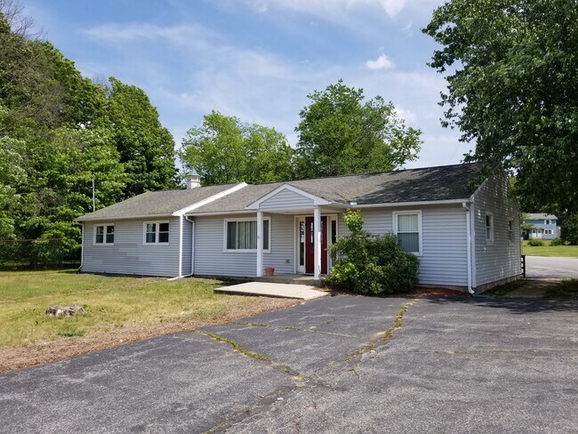
Property Record
11 Route 66, Columbia, CT 06237

Property Detail
11 Route 66
COLU-000010-000000-000047
Capitol
Officebuilding
Connecticut
C
47
2025
0.42 AC
2025
Tolland County
860100
Hartford
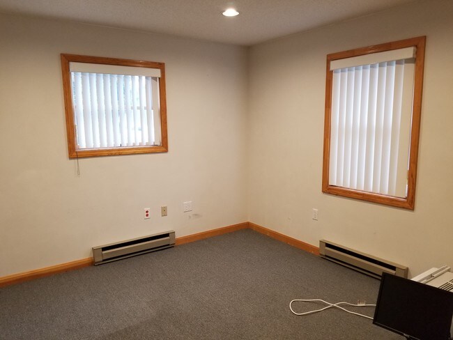
1,562 SF
Hartford-West Hartford-East Hartford, CT
NEARBY LISTINGS FOR SALE OR LEASE
DEMOGRAPHICS near 11 Route 66
1 mile
3 mile
5 mile
2025 Total Population
739
11,256
39,342
2030 Population
753
11,439
40,076
Pop Growth 2025-2030
+ 1.89%
+ 1.63%
+ 1.87%
Average Age
44
40
40
2025 Total Households
299
4,051
14,927
HH Growth 2025-2030
+ 1.67%
+ 1.85%
+ 1.95%
Median Household Inc
$111,250
$86,642
$71,235
Avg Household Size
2.40
2.50
2.40
2025 Avg HH Vehicles
2.00
2.00
2.00
Median Home Value
$341,588
$314,608
$295,887
Median Year Built
1985
1972
1966
Nearby Places
Map Layers
Map Styles
 Street
 Aerial
Layers
 Traffic
 Biking
Places
Listings with unknown addresses are not visible on the map
- Restaurants
- Banks
- Shops
- Fitness
- Groceries
PUBLIC TRANSPORTATION
AIRPORT
Bradley International
Drive
Walk
Distance
Bradley International
60 min
38.9 mi
SALE & LEASE HISTORY
LISTING DATE
SALE/LEASE

Dec 27, 2019
For Sale
Nearby Properties
Address
Land Use
TOTAL SIZE
Lot Size
Zoning
Address
Land Use
TOTAL SIZE
Lot Size
Zoning
14.62 AC
B4
Address
Land Use
TOTAL SIZE
Lot Size
Zoning
111,757 SF
6.74 AC
RL
Address
Land Use
TOTAL SIZE
Lot Size
Zoning
3.50 AC
R6
Address
Land Use
TOTAL SIZE
Lot Size
Zoning
14.12 AC
B2A
Address
Land Use
TOTAL SIZE
Lot Size
Zoning
23.65 AC
RA
Address
Land Use
TOTAL SIZE
Lot Size
Zoning
58,264 SF
5.97 AC
B2A
Address
Land Use
TOTAL SIZE
Lot Size
Zoning
142 AC
R5 - 1
Address
Land Use
TOTAL SIZE
Lot Size
Zoning
53.16 AC
M4
Address
Land Use
TOTAL SIZE
Lot Size
Zoning
22.70 AC
RAR90
Address
Land Use
TOTAL SIZE
Lot Size
Zoning
14.59 AC
R5
Address
Land Use
TOTAL SIZE
Lot Size
Zoning
48,770 SF
4.06 AC
B2
Address
Land Use
TOTAL SIZE
Lot Size
Zoning
31,818 SF
4.35 AC
B4
Address
Land Use
TOTAL SIZE
Lot Size
Zoning
29,548 SF
2.96 AC
RPO
Address
Land Use
TOTAL SIZE
Lot Size
Zoning
2.20 AC
B4
Address
Land Use
TOTAL SIZE
Lot Size
Zoning
61,574 SF
5.10 AC
B2
Address
Land Use
TOTAL SIZE
Lot Size
Zoning
30,379 SF
5.80 AC
C
Address
Land Use
TOTAL SIZE
Lot Size
Zoning
Address
Land Use
TOTAL SIZE
Lot Size
Zoning
14,805 SF
3.60 AC
B4
Address
Land Use
TOTAL SIZE
Lot Size
Zoning
17.53 AC
RL
Address
Land Use
TOTAL SIZE
Lot Size
Zoning
90,983 SF
16.31 AC
M4
Address
Land Use
TOTAL SIZE
Lot Size
Zoning
60,564 SF
6.23 AC
B2A
Address
Land Use
TOTAL SIZE
Lot Size
Zoning
23.13 AC
R5
Address
Land Use
TOTAL SIZE
Lot Size
Zoning
6,150 SF
7.79 AC
M
Address
Land Use
TOTAL SIZE
Lot Size
Zoning
43,554 SF
R5
Address
Land Use
TOTAL SIZE
Lot Size
Zoning
13,566 SF
1.60 AC
B2A
Address
Land Use
TOTAL SIZE
Lot Size
Zoning
10,125 SF
1.04 AC
B2
Address
Land Use
TOTAL SIZE
Lot Size
Zoning
78,825 SF
7.77 AC
C
Address
Land Use
TOTAL SIZE
Lot Size
Zoning
17,975 SF
1.87 AC
C2
Address
Land Use
TOTAL SIZE
Lot Size
Zoning
6,810 SF
4 AC
RAR90
Address
Land Use
TOTAL SIZE
Lot Size
Zoning
4,185 SF
1 AC
B2
The World's #1 Commercial Real Estate Marketplace
Connect with us
© 2026 CoStar Group
The information above has been obtained from sources believed reliable. While we do not doubt its accuracy we have not verified it and make no guarantee, warranty or representation about it. It is your responsibility to independently confirm its accuracy and completeness. Any projections, opinions, assumptions, or estimates used are for example only and do not represent the current or future performance of the property. The value of this transaction to you depends on tax and other factors which should be evaluated by your tax, financial, and legal advisors. You and your advisors should conduct a careful, independent investigation of the property to determine to your satisfaction the suitability of the property for your needs.