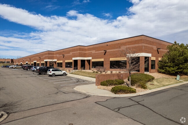
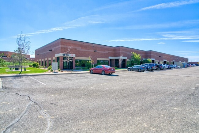
Property Record
11025 Dover St, Broomfield, CO 80021

Current Lease Availabilities
Property Detail
11025 Dover St
Denver-Aurora-Centennial, CO
SECTION 10 TOWNSHIP 02 RANGE 69 QTR NE SUBDIVISIONCD 568313 SUBDIVISIONNAME OLSON TECHNOLOGICAL PARK 2ND REPLAT BLOCK 001 LOT 004A SIZE: 219298 TRACT VALUE: 5.034
29-101-01-022
JEFFERSON
Industrialgeneral
Colorado
B and X Area of moderate flood hazard, usually the area between the limits of the 100-year and 500-year floods.
4a
2023
5.03 AC
2024
Northwest Denver
060501
Denver
44,840 SF
NEARBY LISTINGS FOR SALE OR LEASE
DEMOGRAPHICS near 11025 Dover St
1 mile
3 mile
5 mile
2025 Total Population
7,705
70,308
221,644
2030 Population
7,788
71,191
225,247
Pop Growth 2025-2030
+ 1.08%
+ 1.26%
+ 1.63%
Average Age
36
40
40
2025 Total Households
3,605
29,616
87,340
HH Growth 2025-2030
+ 1.55%
+ 1.61%
+ 1.90%
Median Household Inc
$104,653
$107,145
$108,373
Avg Household Size
2.10
2.30
2.50
2025 Avg HH Vehicles
2.00
2.00
2.00
Median Home Value
$565,251
$618,389
$631,151
Median Year Built
2003
1988
1989
Nearby Places
Map Layers
Map Styles
 Street
 Aerial
Transit
 Traffic
 Biking
Places
Listings with unknown addresses are not visible on the map
- Restaurants
- Banks
- Shops
- Fitness
- Groceries
PUBLIC TRANSPORTATION
COMMUTER RAIL
Westminster Station S-Bound (Union Station to Westminster Station - Regional Transportation District)
Drive
Walk
Distance
Westminster Station S-Bound (Union Station to Westminster Station - Regional Transportation District)
14 min
7.7 mi
Westminster Station N-Bound (Union Station to Westminster Station - Regional Transportation District)
Drive
Walk
Distance
Westminster Station N-Bound (Union Station to Westminster Station - Regional Transportation District)
16 min
8.1 mi
AIRPORT
Denver International
Drive
Walk
Distance
Denver International
43 min
35.4 mi
Freight Ports
Tulsa Port Of Catoosa
Drive
Walk
Distance
Tulsa Port Of Catoosa
741 min
717.7 mi
Nearby Properties
Address
Land Use
TOTAL SIZE
Lot Size
Zoning
Address
Land Use
TOTAL SIZE
Lot Size
Zoning
431,902 SF
17.63 AC
Address
Land Use
TOTAL SIZE
Lot Size
Zoning
305,331 SF
14.41 AC
PUD
Address
Land Use
TOTAL SIZE
Lot Size
Zoning
117,775 SF
34.58 AC
GA; PUD
Address
Land Use
TOTAL SIZE
Lot Size
Zoning
211,191 SF
30.46 AC
Address
Land Use
TOTAL SIZE
Lot Size
Zoning
254,500 SF
13.42 AC
PUD
Address
Land Use
TOTAL SIZE
Lot Size
Zoning
209,009 SF
22.30 AC
Address
Land Use
TOTAL SIZE
Lot Size
Zoning
320,771 SF
18.60 AC
PUD
Address
Land Use
TOTAL SIZE
Lot Size
Zoning
254,500 SF
13 AC
PUD
Address
Land Use
TOTAL SIZE
Lot Size
Zoning
174,398 SF
33.34 AC
PF; PROL;
Address
Land Use
TOTAL SIZE
Lot Size
Zoning
212,852 SF
12.82 AC
Address
Land Use
TOTAL SIZE
Lot Size
Zoning
187,920 SF
10.57 AC
PUD
Address
Land Use
TOTAL SIZE
Lot Size
Zoning
281,167 SF
19.52 AC
Address
Land Use
TOTAL SIZE
Lot Size
Zoning
159,724 SF
8.11 AC
Address
Land Use
TOTAL SIZE
Lot Size
Zoning
577,088 SF
18.94 AC
PUD
Address
Land Use
TOTAL SIZE
Lot Size
Zoning
211,827 SF
25.67 AC
Address
Land Use
TOTAL SIZE
Lot Size
Zoning
250,701 SF
14.14 AC
Address
Land Use
TOTAL SIZE
Lot Size
Zoning
154,700 SF
9.03 AC
PUD
Address
Land Use
TOTAL SIZE
Lot Size
Zoning
528,256 SF
3.87 AC
PUD
Address
Land Use
TOTAL SIZE
Lot Size
Zoning
166,982 SF
10.06 AC
Address
Land Use
TOTAL SIZE
Lot Size
Zoning
121,639 SF
25.99 AC
Address
Land Use
TOTAL SIZE
Lot Size
Zoning
34,584 SF
13.70 AC
PUD
Address
Land Use
TOTAL SIZE
Lot Size
Zoning
78,008 SF
5.01 AC
PUD
Address
Land Use
TOTAL SIZE
Lot Size
Zoning
203,755 SF
39.65 AC
R-1
Address
Land Use
TOTAL SIZE
Lot Size
Zoning
127,434 SF
7.53 AC
Address
Land Use
TOTAL SIZE
Lot Size
Zoning
308,832 SF
11.91 AC
PUD
Address
Land Use
TOTAL SIZE
Lot Size
Zoning
133,126 SF
8.21 AC
Address
Land Use
TOTAL SIZE
Lot Size
Zoning
280,447 SF
5.98 AC
PUD
Address
Land Use
TOTAL SIZE
Lot Size
Zoning
133,573 SF
7.93 AC
PD
Address
Land Use
TOTAL SIZE
Lot Size
Zoning
133,573 SF
8.74 AC
PD
Address
Land Use
TOTAL SIZE
Lot Size
Zoning
201,000 SF
9.42 AC
PUD
The World's #1 Commercial Real Estate Marketplace
Connect with us
© 2026 CoStar Group
The information above has been obtained from sources believed reliable. While we do not doubt its accuracy we have not verified it and make no guarantee, warranty or representation about it. It is your responsibility to independently confirm its accuracy and completeness. Any projections, opinions, assumptions, or estimates used are for example only and do not represent the current or future performance of the property. The value of this transaction to you depends on tax and other factors which should be evaluated by your tax, financial, and legal advisors. You and your advisors should conduct a careful, independent investigation of the property to determine to your satisfaction the suitability of the property for your needs.