Property Record
1104 E Mulberry State Highway 35 St, Angleton, TX 77515
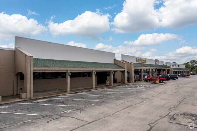

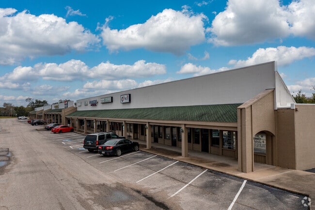
Property Detail
1104 E Mulberry State Highway 35 St
0375-0048-000
A0375 I T TINSLEY TRACT 16B-16B2-16B4-16C1 ACRES 6.63 (ANGLETON)
Commercialnec
BRAZORIA
0056
Texas
B and X Area of moderate flood hazard, usually the area between the limits of the 100-year and 500-year floods.
6.63 AC
2024
Far South
2025
Houston
662100
Houston-Pasadena-The Woodlands, TX
77,295 SF
NEARBY LISTINGS FOR SALE OR LEASE
DEMOGRAPHICS near 1104 E Mulberry State Highway 35 St
1 mile
3 mile
5 mile
2025 Total Population
7,220
25,108
28,352
2030 Population
7,992
27,943
31,505
Pop Growth 2025-2030
+ 10.69%
+ 11.29%
+ 11.12%
Average Age
38
38
38
2025 Total Households
2,671
9,262
10,436
HH Growth 2025-2030
+ 11.01%
+ 11.58%
+ 11.42%
Median Household Inc
$81,647
$85,081
$86,402
Avg Household Size
2.60
2.70
2.70
2025 Avg HH Vehicles
2.00
2.00
2.00
Median Home Value
$152,210
$207,477
$221,412
Median Year Built
1972
1982
1983
Nearby Places
Map Layers
Map Styles
 Street
 Aerial
Transit
 Traffic
 Biking
Places
Listings with unknown addresses are not visible on the map
- Restaurants
- Banks
- Shops
- Fitness
- Groceries
PUBLIC TRANSPORTATION
AIRPORT
William P Hobby
Drive
Walk
Distance
William P Hobby
61 min
42.6 mi
Freight Ports
Port Freeport
Drive
Walk
Distance
Port Freeport
29 min
18.8 mi
SALE & LEASE HISTORY
LISTING DATE
SALE/LEASE

Sep 24, 2016
For Lease
Oct 10, 2016
For Lease
Mar 12, 2019
For Lease
Nearby Properties
Address
Land Use
TOTAL SIZE
Lot Size
Zoning
Address
Land Use
TOTAL SIZE
Lot Size
Zoning
77.68 AC
0066
Address
Land Use
TOTAL SIZE
Lot Size
Zoning
305,581 SF
8.28 AC
Address
Land Use
TOTAL SIZE
Lot Size
Zoning
318,545 SF
50.52 AC
Address
Land Use
TOTAL SIZE
Lot Size
Zoning
349,628 SF
40 AC
Address
Land Use
TOTAL SIZE
Lot Size
Zoning
4,953 SF
19.41 AC
0151
Address
Land Use
TOTAL SIZE
Lot Size
Zoning
128,857 SF
10.65 AC
0140
Address
Land Use
TOTAL SIZE
Lot Size
Zoning
138,430 SF
8.85 AC
Address
Land Use
TOTAL SIZE
Lot Size
Zoning
140,993 SF
5.79 AC
Address
Land Use
TOTAL SIZE
Lot Size
Zoning
145,006 SF
6.97 AC
Address
Land Use
TOTAL SIZE
Lot Size
Zoning
45,000 SF
13.30 AC
0062
Address
Land Use
TOTAL SIZE
Lot Size
Zoning
12,221 SF
13.76 AC
0165
Address
Land Use
TOTAL SIZE
Lot Size
Zoning
89,808 SF
8.80 AC
Address
Land Use
TOTAL SIZE
Lot Size
Zoning
14.46 AC
0138
Address
Land Use
TOTAL SIZE
Lot Size
Zoning
128,247 SF
17.49 AC
0114
Address
Land Use
TOTAL SIZE
Lot Size
Zoning
266,816 SF
20.34 AC
Address
Land Use
TOTAL SIZE
Lot Size
Zoning
80,718 SF
5.92 AC
Address
Land Use
TOTAL SIZE
Lot Size
Zoning
96,487 SF
1 AC
0011
Address
Land Use
TOTAL SIZE
Lot Size
Zoning
36,320 SF
10 AC
098A
Address
Land Use
TOTAL SIZE
Lot Size
Zoning
6.52 AC
Address
Land Use
TOTAL SIZE
Lot Size
Zoning
4.60 AC
Address
Land Use
TOTAL SIZE
Lot Size
Zoning
65,752 SF
Address
Land Use
TOTAL SIZE
Lot Size
Zoning
95,358 SF
4.78 AC
0140
Address
Land Use
TOTAL SIZE
Lot Size
Zoning
60.29 AC
0068
Address
Land Use
TOTAL SIZE
Lot Size
Zoning
90,957 SF
5 AC
Address
Land Use
TOTAL SIZE
Lot Size
Zoning
1,930 SF
30 AC
0436
Address
Land Use
TOTAL SIZE
Lot Size
Zoning
Address
Land Use
TOTAL SIZE
Lot Size
Zoning
33,546 SF
13.28 AC
Address
Land Use
TOTAL SIZE
Lot Size
Zoning
112,149 SF
35.71 AC
Address
Land Use
TOTAL SIZE
Lot Size
Zoning
69,265 SF
3.25 AC
The World's #1 Commercial Real Estate Marketplace
Connect with us
© 2026 CoStar Group
The information above has been obtained from sources believed reliable. While we do not doubt its accuracy we have not verified it and make no guarantee, warranty or representation about it. It is your responsibility to independently confirm its accuracy and completeness. Any projections, opinions, assumptions, or estimates used are for example only and do not represent the current or future performance of the property. The value of this transaction to you depends on tax and other factors which should be evaluated by your tax, financial, and legal advisors. You and your advisors should conduct a careful, independent investigation of the property to determine to your satisfaction the suitability of the property for your needs.