Property Record
1106 E 6600 S, Murray, UT 84121
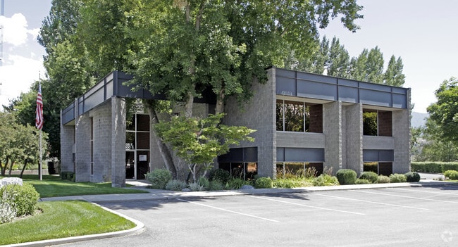

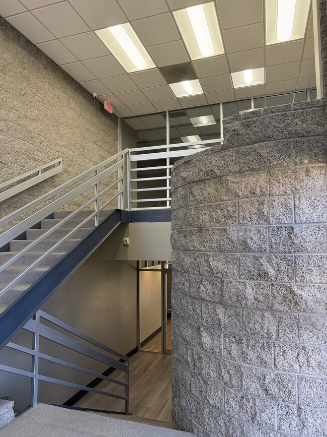

Property Detail
1106 E 6600 S
22-20-402-009-0000
BEG 42.5 FT N & 1803.93 FT W FR E 1/4 COR OF SEC 20, T 2S, R1E, S L M; S 0^3656 W 214.34 FT ALG FENCE; N 51^ 4028 W 208.4 FT; N 40^4742 W 51.01 FT; N 10^10 55 E 47 FT M OR L; N 89^5615 E 190.81 FT TO BEG. 0.613 AC M OR L. 5743-2930, 5732-2098, 5538-2
Officebuilding
Salt Lake
GO
Utah
AE The base floodplain where base flood elevations are provided. AE Zones are now used on new format FIRMs instead of A1-A30 Zones.
0.61 AC
2024
Union Park District
2025
Salt Lake City
111104
Salt Lake City-Murray, UT
4,570 SF
NEARBY LISTINGS FOR SALE OR LEASE
DEMOGRAPHICS near 1106 E 6600 S
1 mile
3 mile
5 mile
2025 Total Population
18,056
132,430
341,460
2030 Population
18,578
135,177
349,187
Pop Growth 2025-2030
+ 2.89%
+ 2.07%
+ 2.26%
Average Age
41
40
39
2025 Total Households
7,907
52,615
128,908
HH Growth 2025-2030
+ 3.41%
+ 2.30%
+ 2.45%
Median Household Inc
$89,656
$91,747
$94,639
Avg Household Size
2.30
2.50
2.60
2025 Avg HH Vehicles
2.00
2.00
2.00
Median Home Value
$604,081
$623,156
$621,127
Median Year Built
1982
1978
1980
Nearby Places
Map Layers
Map Styles
 Street
 Aerial
Transit
 Traffic
 Biking
Places
Listings with unknown addresses are not visible on the map
- Restaurants
- Banks
- Shops
- Fitness
- Groceries
PUBLIC TRANSPORTATION
COMMUTER RAIL
Drive
Walk
Distance
13 min
8.7 mi
AIRPORT
Salt Lake City International
Drive
Walk
Distance
Salt Lake City International
22 min
16.4 mi
Provo Municipal
Drive
Walk
Distance
Provo Municipal
47 min
39.0 mi
SALE & LEASE HISTORY
LISTING DATE
SALE/LEASE

Nov 11, 2025
For Lease
Nearby Properties
Address
Land Use
TOTAL SIZE
Lot Size
Zoning
Address
Land Use
TOTAL SIZE
Lot Size
Zoning
2,024,859 SF
63 AC
C D C
Address
Land Use
TOTAL SIZE
Lot Size
Zoning
659,583 SF
18.32 AC
CDC
Address
Land Use
TOTAL SIZE
Lot Size
Zoning
257,906 SF
36.42 AC
1110
Address
Land Use
TOTAL SIZE
Lot Size
Zoning
235,963 SF
35.56 AC
SF1-DO
Address
Land Use
TOTAL SIZE
Lot Size
Zoning
552,994 SF
13.64 AC
SD-X
Address
Land Use
TOTAL SIZE
Lot Size
Zoning
186,717 SF
21.58 AC
RM
Address
Land Use
TOTAL SIZE
Lot Size
Zoning
251,867 SF
25.66 AC
H
Address
Land Use
TOTAL SIZE
Lot Size
Zoning
524,108 SF
34.46 AC
RM
Address
Land Use
TOTAL SIZE
Lot Size
Zoning
133,669 SF
19.81 AC
R-M
Address
Land Use
TOTAL SIZE
Lot Size
Zoning
191,718 SF
6.74 AC
RM-25
Address
Land Use
TOTAL SIZE
Lot Size
Zoning
191,718 SF
0.83 AC
RM-25
Address
Land Use
TOTAL SIZE
Lot Size
Zoning
302,944 SF
5.47 AC
Address
Land Use
TOTAL SIZE
Lot Size
Zoning
500,249 SF
3.16 AC
MU
Address
Land Use
TOTAL SIZE
Lot Size
Zoning
500,249 SF
3.16 AC
MU
Address
Land Use
TOTAL SIZE
Lot Size
Zoning
179,702 SF
16.99 AC
1108
Address
Land Use
TOTAL SIZE
Lot Size
Zoning
225,849 SF
16.36 AC
RM-ZC
Address
Land Use
TOTAL SIZE
Lot Size
Zoning
21,057 SF
17.96 AC
RM20
Address
Land Use
TOTAL SIZE
Lot Size
Zoning
143,600 SF
7.56 AC
2000
Address
Land Use
TOTAL SIZE
Lot Size
Zoning
327,940 SF
3.95 AC
SD
Address
Land Use
TOTAL SIZE
Lot Size
Zoning
103,114 SF
14.82 AC
RM 25
Address
Land Use
TOTAL SIZE
Lot Size
Zoning
371,607 SF
10.77 AC
A-1
Address
Land Use
TOTAL SIZE
Lot Size
Zoning
37,563 SF
15.34 AC
RM20
Address
Land Use
TOTAL SIZE
Lot Size
Zoning
327,940 SF
3.37 AC
SD
Address
Land Use
TOTAL SIZE
Lot Size
Zoning
28,078 SF
15.33 AC
RM-10
Address
Land Use
TOTAL SIZE
Lot Size
Zoning
441,275 SF
2.62 AC
M-U
Address
Land Use
TOTAL SIZE
Lot Size
Zoning
241,418 SF
8.84 AC
ORD
Address
Land Use
TOTAL SIZE
Lot Size
Zoning
97,360 SF
10.43 AC
RM-25
Address
Land Use
TOTAL SIZE
Lot Size
Zoning
199,446 SF
12.65 AC
RM25
Address
Land Use
TOTAL SIZE
Lot Size
Zoning
168,488 SF
21.11 AC
1107
Address
Land Use
TOTAL SIZE
Lot Size
Zoning
422,482 SF
3.42 AC
RC
The World's #1 Commercial Real Estate Marketplace
Connect with us
© 2026 CoStar Group
The information above has been obtained from sources believed reliable. While we do not doubt its accuracy we have not verified it and make no guarantee, warranty or representation about it. It is your responsibility to independently confirm its accuracy and completeness. Any projections, opinions, assumptions, or estimates used are for example only and do not represent the current or future performance of the property. The value of this transaction to you depends on tax and other factors which should be evaluated by your tax, financial, and legal advisors. You and your advisors should conduct a careful, independent investigation of the property to determine to your satisfaction the suitability of the property for your needs.