Property Record
111 Leray Ave, Eagle Lake, MN 56024
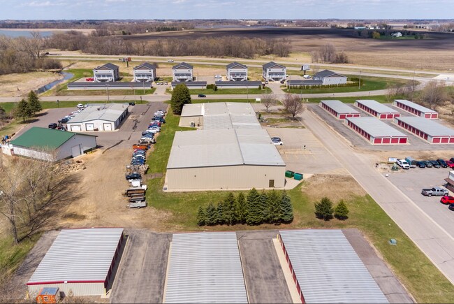


Property Detail
111 Leray Ave
Mankato, MN
Lot 1, Block One, First Rearrangement of Lots 1 and 4, Block One, Lohr and Saiki Subdivision
R12-10-18-201-003
Blue Earth
Commercialnec
Minnesota
B and X Area of moderate flood hazard, usually the area between the limits of the 100-year and 500-year floods.
1,4
2025
1.75 AC
2025
Minnesota South Area
170100
Other Market Areas
27,200 SF
NEARBY LISTINGS FOR SALE OR LEASE
-
-
View all Eagle Lake listings for sale on LoopNet.com
DEMOGRAPHICS near 111 Leray Ave
1 mile
3 mile
5 mile
2024 Total Population
3,066
3,764
21,858
2029 Population
3,147
3,867
22,557
Pop Growth 2024-2029
+ 2.64%
+ 2.74%
+ 3.20%
Average Age
36
37
39
2024 Total Households
1,146
1,416
8,976
HH Growth 2024-2029
+ 2.79%
+ 2.90%
+ 3.31%
Median Household Inc
$81,620
$82,299
$79,198
Avg Household Size
2.60
2.60
2.30
2024 Avg HH Vehicles
2.00
2.00
2.00
Median Home Value
$225,660
$233,860
$260,880
Median Year Built
1987
1989
1996
Nearby Places
Map Layers
Map Styles
 Street
 Aerial
Transit
 Traffic
 Biking
Places
Listings with unknown addresses are not visible on the map
- Restaurants
- Banks
- Shops
- Fitness
- Groceries
SALE & LEASE HISTORY
LISTING DATE
SALE/LEASE

Sep 28, 2023
For Sale
Jun 03, 2022
For Lease
Nearby Properties
Address
Land Use
TOTAL SIZE
Lot Size
Zoning
Address
Land Use
TOTAL SIZE
Lot Size
Zoning
458,428 SF
138.79 AC
Address
Land Use
TOTAL SIZE
Lot Size
Zoning
60,957 SF
8.24 AC
Address
Land Use
TOTAL SIZE
Lot Size
Zoning
15,050 SF
9.96 AC
Address
Land Use
TOTAL SIZE
Lot Size
Zoning
Address
Land Use
TOTAL SIZE
Lot Size
Zoning
14,116 SF
8.16 AC
Address
Land Use
TOTAL SIZE
Lot Size
Zoning
31,752 SF
1.65 AC
Address
Land Use
TOTAL SIZE
Lot Size
Zoning
22.97 AC
Address
Land Use
TOTAL SIZE
Lot Size
Zoning
6.81 AC
Address
Land Use
TOTAL SIZE
Lot Size
Zoning
72.35 AC
Address
Land Use
TOTAL SIZE
Lot Size
Zoning
17,250 SF
40.92 AC
Address
Land Use
TOTAL SIZE
Lot Size
Zoning
10,550 SF
4.35 AC
Address
Land Use
TOTAL SIZE
Lot Size
Zoning
7,996 SF
140 AC
Address
Land Use
TOTAL SIZE
Lot Size
Zoning
1,176 SF
120 AC
Address
Land Use
TOTAL SIZE
Lot Size
Zoning
Address
Land Use
TOTAL SIZE
Lot Size
Zoning
864 SF
11.17 AC
Address
Land Use
TOTAL SIZE
Lot Size
Zoning
97.66 AC
Address
Land Use
TOTAL SIZE
Lot Size
Zoning
Address
Land Use
TOTAL SIZE
Lot Size
Zoning
20,000 SF
2.01 AC
Address
Land Use
TOTAL SIZE
Lot Size
Zoning
888 SF
98.04 AC
Address
Land Use
TOTAL SIZE
Lot Size
Zoning
9,600 SF
7.60 AC
Address
Land Use
TOTAL SIZE
Lot Size
Zoning
5,721 SF
3.35 AC
Address
Land Use
TOTAL SIZE
Lot Size
Zoning
0.67 AC
Address
Land Use
TOTAL SIZE
Lot Size
Zoning
1.20 AC
Address
Land Use
TOTAL SIZE
Lot Size
Zoning
0.43 AC
Address
Land Use
TOTAL SIZE
Lot Size
Zoning
4,800 SF
13.98 AC
The World's #1 Commercial Real Estate Marketplace
Connect with us
© 2026 CoStar Group
The information above has been obtained from sources believed reliable. While we do not doubt its accuracy we have not verified it and make no guarantee, warranty or representation about it. It is your responsibility to independently confirm its accuracy and completeness. Any projections, opinions, assumptions, or estimates used are for example only and do not represent the current or future performance of the property. The value of this transaction to you depends on tax and other factors which should be evaluated by your tax, financial, and legal advisors. You and your advisors should conduct a careful, independent investigation of the property to determine to your satisfaction the suitability of the property for your needs.