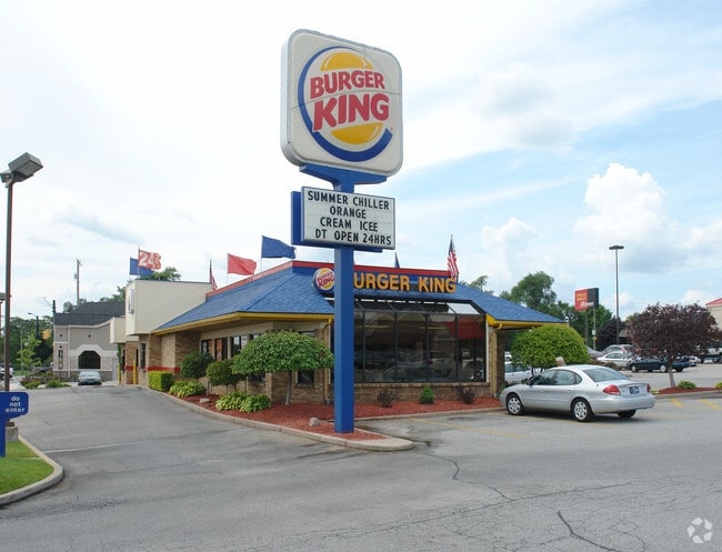
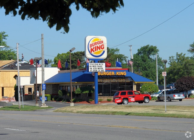
Property Record
1113 E Ireland Rd, South Bend, IN 46614

Save to a Folder
{{folder.Name}}
{{folder.ListingIds.length}} Properties
{{folder.ListingIds.length}} Property
Create a New Folder
Property Detail
1113 E Ireland Rd
71-09-30-155-002.000-002
215 ON IRELAND RD X 120 BROADMOOR SEC 3 REVISED
Restaurantbuilding
St Joseph
B and X Area of moderate flood hazard, usually the area between the limits of the 100-year and 500-year floods.
Indiana
2024
0.59 AC
2025
Greater South Bend
003200
South Bend/Mishawaka
3,813 SF
South Bend-Mishawaka, IN-MI
NEARBY LISTINGS FOR SALE OR LEASE
DEMOGRAPHICS near 1113 E Ireland Rd
1 mile
3 mile
5 mile
2025 Total Population
7,272
50,110
134,597
2030 Population
7,160
50,292
136,411
Pop Growth 2025-2030
(1.54%)
+ 0.36%
+ 1.35%
Average Age
42
39
38
2025 Total Households
3,152
20,030
54,816
HH Growth 2025-2030
(1.74%)
+ 0.10%
+ 1.25%
Median Household Inc
$76,090
$58,075
$55,605
Avg Household Size
2.20
2.40
2.30
2025 Avg HH Vehicles
2.00
2.00
2.00
Median Home Value
$167,836
$164,083
$158,311
Median Year Built
1962
1958
1957
Nearby Places
Map Layers
Map Styles
 Street
 Aerial
Layers
 Traffic
 Biking
Places
Listings with unknown addresses are not visible on the map
- Restaurants
- Banks
- Shops
- Fitness
- Groceries
PUBLIC TRANSPORTATION
COMMUTER RAIL
South Bend Amtrak Station (Capitol Limited - Amtrak, Lake Shore Limited - Amtrak)
Drive
Walk
Distance
South Bend Amtrak Station (Capitol Limited - Amtrak, Lake Shore Limited - Amtrak)
13 min
6.0 mi
South Bend Airport Station (South Shore Line - Northern Indiana Commuter Transportation District (South Shore Line))
Drive
Walk
Distance
South Bend Airport Station (South Shore Line - Northern Indiana Commuter Transportation District (South Shore Line))
16 min
9.3 mi
AIRPORT
South Bend International
Drive
Walk
Distance
South Bend International
23 min
10.2 mi
Freight Ports
Port Milwaukee
Drive
Walk
Distance
Port Milwaukee
222 min
184.4 mi
Nearby Properties
Address
Land Use
TOTAL SIZE
Lot Size
Zoning
Address
Land Use
TOTAL SIZE
Lot Size
Zoning
262,531 SF
32.06 AC
Address
Land Use
TOTAL SIZE
Lot Size
Zoning
2,043 SF
33.65 AC
Address
Land Use
TOTAL SIZE
Lot Size
Zoning
102,139 SF
51.29 AC
Address
Land Use
TOTAL SIZE
Lot Size
Zoning
231,450 SF
22.50 AC
Address
Land Use
TOTAL SIZE
Lot Size
Zoning
112,424 SF
5 AC
Address
Land Use
TOTAL SIZE
Lot Size
Zoning
27,004 SF
21.36 AC
Address
Land Use
TOTAL SIZE
Lot Size
Zoning
25,424 SF
74.42 AC
Address
Land Use
TOTAL SIZE
Lot Size
Zoning
1,008 SF
68.61 AC
Address
Land Use
TOTAL SIZE
Lot Size
Zoning
109,543 SF
8.50 AC
Address
Land Use
TOTAL SIZE
Lot Size
Zoning
221,887 SF
21.89 AC
Address
Land Use
TOTAL SIZE
Lot Size
Zoning
68,373 SF
24.37 AC
Address
Land Use
TOTAL SIZE
Lot Size
Zoning
69,650 SF
13.40 AC
Address
Land Use
TOTAL SIZE
Lot Size
Zoning
58,642 SF
9.13 AC
Address
Land Use
TOTAL SIZE
Lot Size
Zoning
18,378 SF
6.91 AC
Address
Land Use
TOTAL SIZE
Lot Size
Zoning
91,091 SF
28.85 AC
Address
Land Use
TOTAL SIZE
Lot Size
Zoning
312.34 AC
Address
Land Use
TOTAL SIZE
Lot Size
Zoning
29,357 SF
18.98 AC
Address
Land Use
TOTAL SIZE
Lot Size
Zoning
79,760 SF
13.17 AC
Address
Land Use
TOTAL SIZE
Lot Size
Zoning
136,568 SF
14.22 AC
Address
Land Use
TOTAL SIZE
Lot Size
Zoning
87,310 SF
9.08 AC
Address
Land Use
TOTAL SIZE
Lot Size
Zoning
27,934 SF
8.08 AC
Address
Land Use
TOTAL SIZE
Lot Size
Zoning
9,924 SF
41.66 AC
Address
Land Use
TOTAL SIZE
Lot Size
Zoning
123,359 SF
12.45 AC
Address
Land Use
TOTAL SIZE
Lot Size
Zoning
61,936 SF
23.93 AC
Address
Land Use
TOTAL SIZE
Lot Size
Zoning
47,162 SF
11.72 AC
Address
Land Use
TOTAL SIZE
Lot Size
Zoning
19,992 SF
3.89 AC
Address
Land Use
TOTAL SIZE
Lot Size
Zoning
44,832 SF
2.07 AC
Address
Land Use
TOTAL SIZE
Lot Size
Zoning
62,834 SF
16.42 AC
Address
Land Use
TOTAL SIZE
Lot Size
Zoning
15,364 SF
2.80 AC
Address
Land Use
TOTAL SIZE
Lot Size
Zoning
90,360 SF
2.59 AC
The World's #1 Commercial Real Estate Marketplace
Connect with us
© 2026 CoStar Group
The information above has been obtained from sources believed reliable. While we do not doubt its accuracy we have not verified it and make no guarantee, warranty or representation about it. It is your responsibility to independently confirm its accuracy and completeness. Any projections, opinions, assumptions, or estimates used are for example only and do not represent the current or future performance of the property. The value of this transaction to you depends on tax and other factors which should be evaluated by your tax, financial, and legal advisors. You and your advisors should conduct a careful, independent investigation of the property to determine to your satisfaction the suitability of the property for your needs.