Property Record
1113 Highway 49, San Andreas, CA 95249


Save to a Folder
{{folder.Name}}
{{folder.ListingIds.length}} Properties
{{folder.ListingIds.length}} Property
Create a New Folder
Property Detail
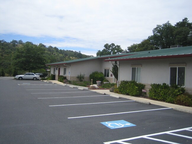
1113 Highway 49
040-022-001-000
MURRAY CREEK ESTATES LOT 1 7 T4R12
Medicalbuilding
CALAVERAS
M4PD
California
A Areas with a 1% annual chance of flooding and a 26% chance of flooding over the life of a 30-year mortgage.
1
2025
5.31 AC
2026
Merced/Central
000302
Other Market Areas
4,705 SF
NEARBY LISTINGS FOR SALE OR LEASE
DEMOGRAPHICS near 1113 Highway 49
1 mile
3 mile
5 mile
2025 Total Population
298
3,154
3,464
2030 Population
301
3,148
3,454
Pop Growth 2025-2030
+ 1.01%
(0.19%)
(0.29%)
Average Age
44
45
45
2025 Total Households
125
1,323
1,447
HH Growth 2025-2030
+ 0.80%
(0.15%)
(0.21%)
Median Household Inc
$70,624
$59,772
$59,999
Avg Household Size
2.30
2.20
2.30
2025 Avg HH Vehicles
2.00
2.00
2.00
Median Home Value
$381,249
$381,578
$385,830
Median Year Built
1980
1978
1978
Nearby Places
Map Layers
Map Styles
 Street
 Aerial
Layers
 Traffic
 Biking
Places
Listings with unknown addresses are not visible on the map
- Restaurants
- Banks
- Shops
- Fitness
- Groceries
Nearby Properties
Address
Land Use
TOTAL SIZE
Lot Size
Zoning
Address
Land Use
TOTAL SIZE
Lot Size
Zoning
7,632 SF
2.54 AC
CP
Address
Land Use
TOTAL SIZE
Lot Size
Zoning
184.21 AC
M2
Address
Land Use
TOTAL SIZE
Lot Size
Zoning
288.23 AC
M2
Address
Land Use
TOTAL SIZE
Lot Size
Zoning
18,864 SF
1.75 AC
R3
Address
Land Use
TOTAL SIZE
Lot Size
Zoning
Address
Land Use
TOTAL SIZE
Lot Size
Zoning
1.16 AC
CP
Address
Land Use
TOTAL SIZE
Lot Size
Zoning
0.45 AC
C2
Address
Land Use
TOTAL SIZE
Lot Size
Zoning
24,709 SF
15.64 AC
M1PD
Address
Land Use
TOTAL SIZE
Lot Size
Zoning
6.07 AC
M2
Address
Land Use
TOTAL SIZE
Lot Size
Zoning
14,336 SF
1.48 AC
R3
Address
Land Use
TOTAL SIZE
Lot Size
Zoning
10,104 SF
0.89 AC
C2PD
Address
Land Use
TOTAL SIZE
Lot Size
Zoning
1.15 AC
C2PX
Address
Land Use
TOTAL SIZE
Lot Size
Zoning
1,500 SF
0.31 AC
C2
Address
Land Use
TOTAL SIZE
Lot Size
Zoning
33,160 SF
2.60 AC
C2PD
Address
Land Use
TOTAL SIZE
Lot Size
Zoning
11,592 SF
1.06 AC
R3
Address
Land Use
TOTAL SIZE
Lot Size
Zoning
1.62 AC
C2
Address
Land Use
TOTAL SIZE
Lot Size
Zoning
1.66 AC
R1
Address
Land Use
TOTAL SIZE
Lot Size
Zoning
7,518 SF
0.79 AC
CP
Address
Land Use
TOTAL SIZE
Lot Size
Zoning
3,172 SF
41.59 AC
RA
Address
Land Use
TOTAL SIZE
Lot Size
Zoning
5,495 SF
1.08 AC
C2
Address
Land Use
TOTAL SIZE
Lot Size
Zoning
0.71 AC
CP
Address
Land Use
TOTAL SIZE
Lot Size
Zoning
3,771 SF
40.15 AC
RAA1ME
Address
Land Use
TOTAL SIZE
Lot Size
Zoning
112.28 AC
Address
Land Use
TOTAL SIZE
Lot Size
Zoning
5,136 SF
4.62 AC
C2
Address
Land Use
TOTAL SIZE
Lot Size
Zoning
Address
Land Use
TOTAL SIZE
Lot Size
Zoning
0.60 AC
C2
Address
Land Use
TOTAL SIZE
Lot Size
Zoning
10,380 SF
1.34 AC
R3PD
Address
Land Use
TOTAL SIZE
Lot Size
Zoning
39.20 AC
RA
Address
Land Use
TOTAL SIZE
Lot Size
Zoning
2.53 AC
The World's #1 Commercial Real Estate Marketplace
Connect with us
© 2026 CoStar Group
The information above has been obtained from sources believed reliable. While we do not doubt its accuracy we have not verified it and make no guarantee, warranty or representation about it. It is your responsibility to independently confirm its accuracy and completeness. Any projections, opinions, assumptions, or estimates used are for example only and do not represent the current or future performance of the property. The value of this transaction to you depends on tax and other factors which should be evaluated by your tax, financial, and legal advisors. You and your advisors should conduct a careful, independent investigation of the property to determine to your satisfaction the suitability of the property for your needs.