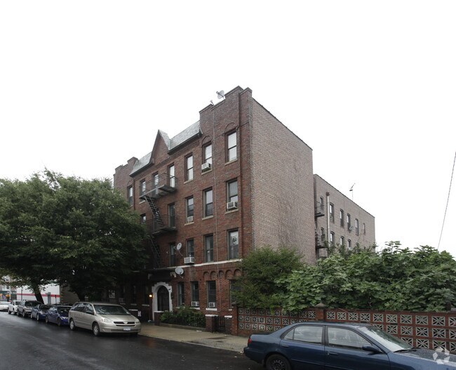
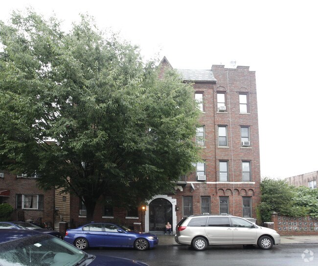
Property Record
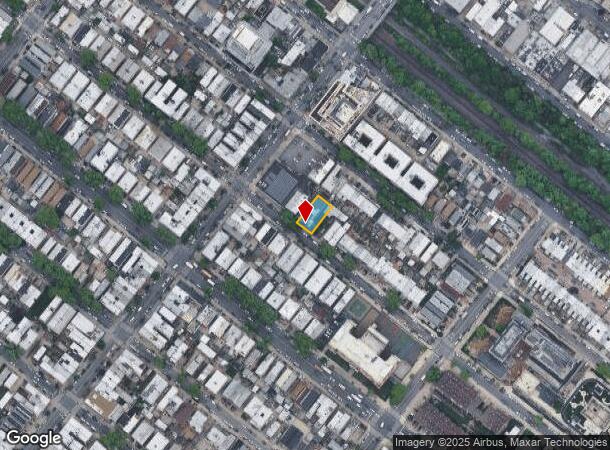
1119 64Th St, Brooklyn, NY 11219
NEARBY LISTINGS FOR SALE OR LEASE
Property Detail
1119 64Th St
05738-0071
DOCID-2016071401451005
Multifamilydwelling
Kings
X
New York
3604970194F
71
2024
0.12 AC
2025
Dyker Heights
021200
Long Island (New York)
16,020 SF
New York-Jersey City-White Plains, NY-NJ
DEMOGRAPHICS near 1119 64Th St
1 Mile
3 Mile
5 Mile
2024 Total Population
151,626
812,975
1,821,969
2029 Population
137,101
754,656
1,709,464
Pop Growth 2024-2029
(9.58%)
(7.17%)
(6.17%)
Average Age
36
39
40
2024 Total Households
43,707
273,524
671,134
HH Growth 2024-2029
(10.23%)
(7.51%)
(6.41%)
Median Household Inc
$55,189
$67,850
$72,469
Avg Household Size
3.30
2.80
2.60
2024 Avg HH Vehicles
1.00
1.00
1.00
Median Home Value
$1,008,421
$935,265
$824,729
Median Year Built
1946
1947
1948
Nearby Places
Map Layers
Map Styles
 Street
 Aerial
- Restaurants
- Banks
- Shops
- Fitness
- Groceries
PUBLIC TRANSPORTATION
TRANSIT/SUBWAY
Fort Hamilton Parkway (N Line) (N - New York MTA Subway (The Subway))
DRIVE
WALK
Distance
Fort Hamilton Parkway (N Line) (N - New York MTA Subway (The Subway))
2 min
5 min
0.2 mi
New Utrecht Avenue (N - New York MTA Subway (The Subway))
DRIVE
WALK
Distance
New Utrecht Avenue (N - New York MTA Subway (The Subway))
2 min
11 min
0.5 mi
62 Street (D - New York MTA Subway (The Subway), M - New York MTA Subway (The Subway))
DRIVE
WALK
Distance
62 Street (D - New York MTA Subway (The Subway), M - New York MTA Subway (The Subway))
2 min
11 min
0.6 mi
8 Avenue (N - New York MTA Subway (The Subway))
DRIVE
WALK
Distance
8 Avenue (N - New York MTA Subway (The Subway))
3 min
12 min
0.6 mi
55 Street (D - New York MTA Subway (The Subway), M - New York MTA Subway (The Subway))
DRIVE
WALK
Distance
55 Street (D - New York MTA Subway (The Subway), M - New York MTA Subway (The Subway))
3 min
14 min
0.7 mi
COMMUTER RAIL
DRIVE
WALK
Distance
14 min
6.0 mi
Clifton (Staten Island Railway - New York MTA Subway (The Subway))
DRIVE
WALK
Distance
Clifton (Staten Island Railway - New York MTA Subway (The Subway))
13 min
6.2 mi
AIRPORT
John F Kennedy International
DRIVE
WALK
Distance
John F Kennedy International
28 min
14.8 mi
LaGuardia
DRIVE
WALK
Distance
LaGuardia
29 min
16.4 mi
Newark Liberty International
DRIVE
WALK
Distance
Newark Liberty International
33 min
19.9 mi
Freight Ports
NY - Red Hook Container Terminal
DRIVE
WALK
Distance
NY - Red Hook Container Terminal
10 min
5.3 mi
Nearby Properties
Address
Land Use
TOTAL SIZE
Lot Size
Zoning
Address
Land Use
TOTAL SIZE
Lot Size
Zoning
92,440 SF
466.23 AC
R5
Address
Land Use
TOTAL SIZE
Lot Size
Zoning
1,524,659 SF
170.96 AC
R4
Address
Land Use
TOTAL SIZE
Lot Size
Zoning
902,000 SF
6.44 AC
M3-1
Address
Land Use
TOTAL SIZE
Lot Size
Zoning
965,600 SF
6.65 AC
R5
Address
Land Use
TOTAL SIZE
Lot Size
Zoning
460,000 SF
3.21 AC
R6
Address
Land Use
TOTAL SIZE
Lot Size
Zoning
1,073,920 SF
16.53 AC
R6
Address
Land Use
TOTAL SIZE
Lot Size
Zoning
335,800 SF
1.51 AC
R6
Address
Land Use
TOTAL SIZE
Lot Size
Zoning
785,450 SF
14.22 AC
R6
Address
Land Use
TOTAL SIZE
Lot Size
Zoning
1,324,592 SF
5.13 AC
M3-1
Address
Land Use
TOTAL SIZE
Lot Size
Zoning
397,354 SF
0.61 AC
C5-2
Address
Land Use
TOTAL SIZE
Lot Size
Zoning
393,092 SF
1.07 AC
R8A
Address
Land Use
TOTAL SIZE
Lot Size
Zoning
371,139 SF
3.22 AC
R5
Address
Land Use
TOTAL SIZE
Lot Size
Zoning
5,359,400 SF
59.07 AC
M2-1
Address
Land Use
TOTAL SIZE
Lot Size
Zoning
286,000 SF
12.63 AC
PARK
Address
Land Use
TOTAL SIZE
Lot Size
Zoning
3,970,000 SF
91.14 AC
M3-1
Address
Land Use
TOTAL SIZE
Lot Size
Zoning
689,850 SF
3.08 AC
M3-1
Address
Land Use
TOTAL SIZE
Lot Size
Zoning
301,400 SF
22.27 AC
M3-1
Address
Land Use
TOTAL SIZE
Lot Size
Zoning
336,534 SF
47.78 AC
M1-1
Address
Land Use
TOTAL SIZE
Lot Size
Zoning
673,895 SF
3.22 AC
M3-1
Address
Land Use
TOTAL SIZE
Lot Size
Zoning
1,112,855 SF
3.52 AC
M3-1
Address
Land Use
TOTAL SIZE
Lot Size
Zoning
139,557 SF
11.47 AC
M1-1
Address
Land Use
TOTAL SIZE
Lot Size
Zoning
623,117 SF
4.16 AC
M3-1
Address
Land Use
TOTAL SIZE
Lot Size
Zoning
218,840 SF
2.52 AC
R6B
Address
Land Use
TOTAL SIZE
Lot Size
Zoning
171,591 SF
0.14 AC
C5-2
Address
Land Use
TOTAL SIZE
Lot Size
Zoning
846,056 SF
20.71 AC
R5
Address
Land Use
TOTAL SIZE
Lot Size
Zoning
478,268 SF
4.04 AC
M3-1
Address
Land Use
TOTAL SIZE
Lot Size
Zoning
581,250 SF
3.22 AC
M3-1
Address
Land Use
TOTAL SIZE
Lot Size
Zoning
247,400 SF
4.34 AC
C44A
Address
Land Use
TOTAL SIZE
Lot Size
Zoning
292,528 SF
1.05 AC
R6
Address
Land Use
TOTAL SIZE
Lot Size
Zoning
61,215 SF
0.32 AC
C64M
The World's #1 Commercial Real Estate Marketplace
Connect with us
© 2026 CoStar Group
The information above has been obtained from sources believed reliable. While we do not doubt its accuracy we have not verified it and make no guarantee, warranty or representation about it. It is your responsibility to independently confirm its accuracy and completeness. Any projections, opinions, assumptions, or estimates used are for example only and do not represent the current or future performance of the property. The value of this transaction to you depends on tax and other factors which should be evaluated by your tax, financial, and legal advisors. You and your advisors should conduct a careful, independent investigation of the property to determine to your satisfaction the suitability of the property for your needs.