Property Record
1119 Randolph St, Thomasville, NC 27360
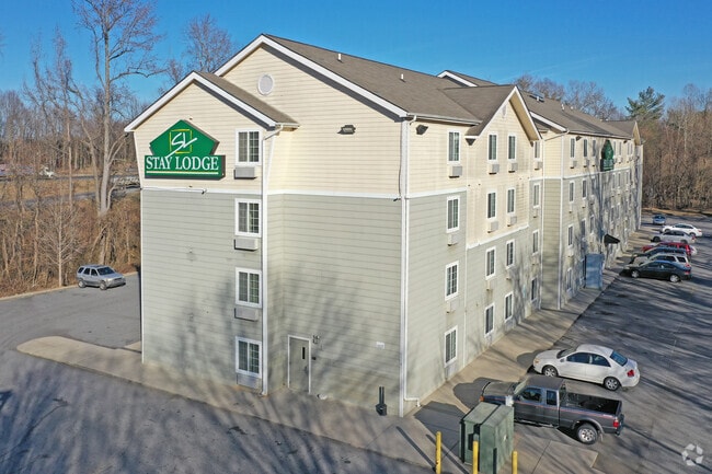

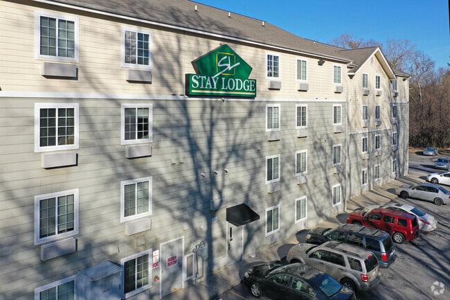

Property Detail
1119 Randolph St
16-337-0-000-0019-0-0-0
PB32-97 L19 BK2173-2373
Hotelormotel
Davidson
C2
North Carolina
AE The base floodplain where base flood elevations are provided. AE Zones are now used on new format FIRMs instead of A1-A30 Zones.
3.46 AC
2025
Burlington/High Point
2025
Greensboro/Winston-Salem
061101
Winston-Salem, NC
49,051 SF
NEARBY LISTINGS FOR SALE OR LEASE
-
-
View all Thomasville listings for sale on LoopNet.com
DEMOGRAPHICS near 1119 Randolph St
1 mile
3 mile
5 mile
2025 Total Population
3,123
31,741
50,551
2030 Population
3,265
33,232
52,817
Pop Growth 2025-2030
+ 4.55%
+ 4.70%
+ 4.48%
Average Age
42
41
41
2025 Total Households
1,277
12,739
20,246
HH Growth 2025-2030
+ 4.62%
+ 4.78%
+ 4.55%
Median Household Inc
$63,487
$61,746
$62,764
Avg Household Size
2.40
2.40
2.40
2025 Avg HH Vehicles
2.00
2.00
2.00
Median Home Value
$192,603
$191,179
$197,587
Median Year Built
1980
1977
1981
Nearby Places
Map Layers
Map Styles
 Street
 Aerial
Layers
 Traffic
 Biking
Places
Listings with unknown addresses are not visible on the map
- Restaurants
- Banks
- Shops
- Fitness
- Groceries
PUBLIC TRANSPORTATION
AIRPORT
Piedmont Triad International
Drive
Walk
Distance
Piedmont Triad International
39 min
28.0 mi
Nearby Properties
Address
Land Use
TOTAL SIZE
Lot Size
Zoning
Address
Land Use
TOTAL SIZE
Lot Size
Zoning
154,870 SF
62.93 AC
M1
Address
Land Use
TOTAL SIZE
Lot Size
Zoning
103,482 SF
49.98 AC
OI
Address
Land Use
TOTAL SIZE
Lot Size
Zoning
66,674 SF
59.96 AC
OI
Address
Land Use
TOTAL SIZE
Lot Size
Zoning
194,644 SF
20 AC
R10
Address
Land Use
TOTAL SIZE
Lot Size
Zoning
3,638 SF
41.44 AC
OI
Address
Land Use
TOTAL SIZE
Lot Size
Zoning
235,230 SF
25.63 AC
C3
Address
Land Use
TOTAL SIZE
Lot Size
Zoning
134,369 SF
20.67 AC
R15
Address
Land Use
TOTAL SIZE
Lot Size
Zoning
13,770 SF
34.64 AC
R10
Address
Land Use
TOTAL SIZE
Lot Size
Zoning
122,865 SF
30.57 AC
R15
Address
Land Use
TOTAL SIZE
Lot Size
Zoning
9,020 SF
135.18 AC
M1CZ
Address
Land Use
TOTAL SIZE
Lot Size
Zoning
63,936 SF
19.05 AC
R10
Address
Land Use
TOTAL SIZE
Lot Size
Zoning
51,230 SF
7.52 AC
C2
Address
Land Use
TOTAL SIZE
Lot Size
Zoning
56,305 SF
5.39 AC
OI
Address
Land Use
TOTAL SIZE
Lot Size
Zoning
12,536 SF
300.20 AC
M1CZ
Address
Land Use
TOTAL SIZE
Lot Size
Zoning
4,224 SF
50.07 AC
M2
Address
Land Use
TOTAL SIZE
Lot Size
Zoning
72,642 SF
10.53 AC
R10
Address
Land Use
TOTAL SIZE
Lot Size
Zoning
124,326 SF
13.45 AC
C3
Address
Land Use
TOTAL SIZE
Lot Size
Zoning
60,183 SF
8.63 AC
C-2
Address
Land Use
TOTAL SIZE
Lot Size
Zoning
127,280 SF
29.10 AC
LI-CZ
Address
Land Use
TOTAL SIZE
Lot Size
Zoning
149,129 SF
15.65 AC
R10
Address
Land Use
TOTAL SIZE
Lot Size
Zoning
44,432 SF
22.13 AC
R10
Address
Land Use
TOTAL SIZE
Lot Size
Zoning
6,960 SF
9.61 AC
R8
Address
Land Use
TOTAL SIZE
Lot Size
Zoning
63,643 SF
8.46 AC
M1
Address
Land Use
TOTAL SIZE
Lot Size
Zoning
38,896 SF
6.64 AC
C2
Address
Land Use
TOTAL SIZE
Lot Size
Zoning
162,000 SF
10.67 AC
M1
Address
Land Use
TOTAL SIZE
Lot Size
Zoning
52,466 SF
3.57 AC
C2
Address
Land Use
TOTAL SIZE
Lot Size
Zoning
39,842 SF
12.49 AC
M2
Address
Land Use
TOTAL SIZE
Lot Size
Zoning
35,582 SF
4.95 AC
R8
Address
Land Use
TOTAL SIZE
Lot Size
Zoning
2,460 SF
26.64 AC
R8
Address
Land Use
TOTAL SIZE
Lot Size
Zoning
44,862 SF
4.38 AC
C3
The World's #1 Commercial Real Estate Marketplace
Connect with us
© 2026 CoStar Group
The information above has been obtained from sources believed reliable. While we do not doubt its accuracy we have not verified it and make no guarantee, warranty or representation about it. It is your responsibility to independently confirm its accuracy and completeness. Any projections, opinions, assumptions, or estimates used are for example only and do not represent the current or future performance of the property. The value of this transaction to you depends on tax and other factors which should be evaluated by your tax, financial, and legal advisors. You and your advisors should conduct a careful, independent investigation of the property to determine to your satisfaction the suitability of the property for your needs.