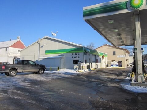
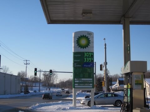
Property Record
112 E 23Rd Ave, Coal Valley, IL 61240

Property Detail
112 E 23Rd Ave
17-26-406-056
LOTS 12-13-14 BLOCK 3 OLD TOWN OF COAL VALLEY SHEET 16
Commercialnec
Rock Island
CV
Illinois
AE The base floodplain where base flood elevations are provided. AE Zones are now used on new format FIRMs instead of A1-A30 Zones.
12-14
2025
0.42 AC
2025
Outlying Rock Island Cnty
024000
Davenport/Moline/Rock Island
3,060 SF
Davenport-Moline-Rock Island, IA-IL
NEARBY LISTINGS FOR SALE OR LEASE
-
-
View all Coal Valley listings for sale on LoopNet.com
DEMOGRAPHICS near 112 E 23Rd Ave
1 mile
3 mile
5 mile
2025 Total Population
2,154
8,205
41,114
2030 Population
2,142
8,230
40,934
Pop Growth 2025-2030
(0.56%)
+ 0.30%
(0.44%)
Average Age
44
43
43
2025 Total Households
846
3,297
17,855
HH Growth 2025-2030
(0.59%)
+ 0.42%
(0.39%)
Median Household Inc
$125,840
$90,687
$72,863
Avg Household Size
2.50
2.40
2.20
2025 Avg HH Vehicles
2.00
2.00
2.00
Median Home Value
$234,343
$204,816
$180,220
Median Year Built
1975
1975
1969
Nearby Places
Map Layers
Map Styles
 Street
 Aerial
Layers
 Traffic
 Biking
Places
Listings with unknown addresses are not visible on the map
- Restaurants
- Banks
- Shops
- Fitness
- Groceries
PUBLIC TRANSPORTATION
AIRPORT
Quad Cities International
Drive
Walk
Distance
Quad Cities International
9 min
3.7 mi
Nearby Properties
Address
Land Use
TOTAL SIZE
Lot Size
Zoning
Address
Land Use
TOTAL SIZE
Lot Size
Zoning
132,647 SF
13.76 AC
MOL
Address
Land Use
TOTAL SIZE
Lot Size
Zoning
19.69 AC
MOL
Address
Land Use
TOTAL SIZE
Lot Size
Zoning
194,267 SF
23.16 AC
MOL
Address
Land Use
TOTAL SIZE
Lot Size
Zoning
10.75 AC
MOL
Address
Land Use
TOTAL SIZE
Lot Size
Zoning
9.42 AC
I2
Address
Land Use
TOTAL SIZE
Lot Size
Zoning
53,897 SF
3.13 AC
MOL
Address
Land Use
TOTAL SIZE
Lot Size
Zoning
162,924 SF
17.18 AC
MOL
Address
Land Use
TOTAL SIZE
Lot Size
Zoning
55.60 AC
CV
Address
Land Use
TOTAL SIZE
Lot Size
Zoning
30,836 SF
4.91 AC
MOL
Address
Land Use
TOTAL SIZE
Lot Size
Zoning
63,972 SF
2.66 AC
MOL
Address
Land Use
TOTAL SIZE
Lot Size
Zoning
35,631 SF
4.63 AC
MOL
Address
Land Use
TOTAL SIZE
Lot Size
Zoning
58,946 SF
2.65 AC
MOL
Address
Land Use
TOTAL SIZE
Lot Size
Zoning
49,673 SF
3.14 AC
MOL
Address
Land Use
TOTAL SIZE
Lot Size
Zoning
8.42 AC
MOL
Address
Land Use
TOTAL SIZE
Lot Size
Zoning
53,611 SF
2.53 AC
MOL
Address
Land Use
TOTAL SIZE
Lot Size
Zoning
126,605 SF
20.25 AC
MOL
Address
Land Use
TOTAL SIZE
Lot Size
Zoning
62,124 SF
10.33 AC
I2
Address
Land Use
TOTAL SIZE
Lot Size
Zoning
1.91 AC
I2
Address
Land Use
TOTAL SIZE
Lot Size
Zoning
77,792 SF
6.04 AC
MOL
Address
Land Use
TOTAL SIZE
Lot Size
Zoning
10.17 AC
MOL
Address
Land Use
TOTAL SIZE
Lot Size
Zoning
102.38 AC
AG2
Address
Land Use
TOTAL SIZE
Lot Size
Zoning
36,200 SF
4.51 AC
MOL
Address
Land Use
TOTAL SIZE
Lot Size
Zoning
1.39 AC
Address
Land Use
TOTAL SIZE
Lot Size
Zoning
1,848 SF
40 AC
AG1
Address
Land Use
TOTAL SIZE
Lot Size
Zoning
35,960 SF
3.67 AC
MOL
Address
Land Use
TOTAL SIZE
Lot Size
Zoning
87,584 SF
5.81 AC
MOL
Address
Land Use
TOTAL SIZE
Lot Size
Zoning
73,398 SF
3.18 AC
MOL
Address
Land Use
TOTAL SIZE
Lot Size
Zoning
14,380 SF
1.71 AC
MOL
Address
Land Use
TOTAL SIZE
Lot Size
Zoning
0.34 AC
SE2
Address
Land Use
TOTAL SIZE
Lot Size
Zoning
48,000 SF
2.90 AC
MOL
The World's #1 Commercial Real Estate Marketplace
Connect with us
© 2026 CoStar Group
The information above has been obtained from sources believed reliable. While we do not doubt its accuracy we have not verified it and make no guarantee, warranty or representation about it. It is your responsibility to independently confirm its accuracy and completeness. Any projections, opinions, assumptions, or estimates used are for example only and do not represent the current or future performance of the property. The value of this transaction to you depends on tax and other factors which should be evaluated by your tax, financial, and legal advisors. You and your advisors should conduct a careful, independent investigation of the property to determine to your satisfaction the suitability of the property for your needs.