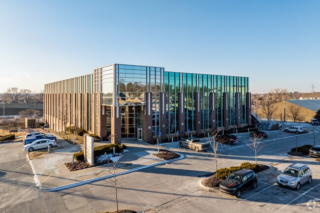
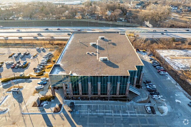
Property Record
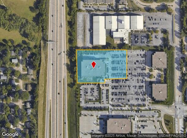
1120 N 103Rd Plz, Omaha, NE 68114
NEARBY LISTINGS FOR SALE OR LEASE
Property Detail
1120 N 103Rd Plz
Omaha-Council Bluffs, NE-IA
Westplex
2360-0056-25
WESTPLEX LOT 4 BLOCK 0 IRREG
Officebuilding
Douglas
X
Nebraska
31055C0214H
4
2024
3.31 AC
2025
Central Dodge
007445
Omaha/Council Bluffs
128,686 SF
DEMOGRAPHICS near 1120 N 103Rd Plz
1 Mile
3 Mile
5 Mile
2024 Total Population
10,443
91,863
258,212
2029 Population
10,590
92,951
261,200
Pop Growth 2024-2029
+ 1.41%
+ 1.18%
+ 1.16%
Average Age
39
40
39
2024 Total Households
5,349
40,690
108,937
HH Growth 2024-2029
+ 1.35%
+ 1.25%
+ 1.23%
Median Household Inc
$55,093
$68,879
$70,337
Avg Household Size
1.90
2.20
2.30
2024 Avg HH Vehicles
1.00
2.00
2.00
Median Home Value
$216,711
$236,516
$224,370
Median Year Built
1982
1973
1974
Nearby Places
Map Layers
Map Styles
 Street
 Aerial
- Restaurants
- Banks
- Shops
- Fitness
- Groceries
PUBLIC TRANSPORTATION
COMMUTER RAIL
DRIVE
WALK
Distance
21 min
8.9 mi
DRIVE
WALK
Distance
22 min
9.0 mi
AIRPORT
Eppley Airfield
DRIVE
WALK
Distance
Eppley Airfield
27 min
11.6 mi
SALE & LEASE HISTORY
LISTING DATE
SALE/LEASE

Sep 25, 2016
For Lease
Sep 10, 2024
For Lease
May 23, 2019
For Lease
May 19, 2025
For Lease
Nearby Properties
Address
Land Use
TOTAL SIZE
Lot Size
Zoning
Address
Land Use
TOTAL SIZE
Lot Size
Zoning
866,622 SF
20.67 AC
Address
Land Use
TOTAL SIZE
Lot Size
Zoning
496,976 SF
12 AC
Address
Land Use
TOTAL SIZE
Lot Size
Zoning
856,187 SF
36.41 AC
Address
Land Use
TOTAL SIZE
Lot Size
Zoning
549,971 SF
42.84 AC
R6
Address
Land Use
TOTAL SIZE
Lot Size
Zoning
584,213 SF
36.38 AC
R7
Address
Land Use
TOTAL SIZE
Lot Size
Zoning
702,563 SF
18.85 AC
Address
Land Use
TOTAL SIZE
Lot Size
Zoning
209,917 SF
9.52 AC
Address
Land Use
TOTAL SIZE
Lot Size
Zoning
548,510 SF
36.78 AC
Address
Land Use
TOTAL SIZE
Lot Size
Zoning
545,041 SF
22.69 AC
R6
Address
Land Use
TOTAL SIZE
Lot Size
Zoning
687,804 SF
23.14 AC
Address
Land Use
TOTAL SIZE
Lot Size
Zoning
250,386 SF
17.06 AC
Address
Land Use
TOTAL SIZE
Lot Size
Zoning
301,341 SF
15.04 AC
R6
Address
Land Use
TOTAL SIZE
Lot Size
Zoning
304,034 SF
5.11 AC
R7
Address
Land Use
TOTAL SIZE
Lot Size
Zoning
428,342 SF
18.62 AC
Address
Land Use
TOTAL SIZE
Lot Size
Zoning
398,593 SF
10.80 AC
Address
Land Use
TOTAL SIZE
Lot Size
Zoning
329,565 SF
7.72 AC
Address
Land Use
TOTAL SIZE
Lot Size
Zoning
460,264 SF
20.87 AC
Address
Land Use
TOTAL SIZE
Lot Size
Zoning
233,882 SF
9.49 AC
MU
Address
Land Use
TOTAL SIZE
Lot Size
Zoning
130,286 SF
4.31 AC
GO
Address
Land Use
TOTAL SIZE
Lot Size
Zoning
96,871 SF
9.98 AC
Address
Land Use
TOTAL SIZE
Lot Size
Zoning
256,558 SF
7 AC
GI
Address
Land Use
TOTAL SIZE
Lot Size
Zoning
238,954 SF
14.65 AC
Address
Land Use
TOTAL SIZE
Lot Size
Zoning
420,264 SF
23.97 AC
R6
Address
Land Use
TOTAL SIZE
Lot Size
Zoning
329,515 SF
6.37 AC
Address
Land Use
TOTAL SIZE
Lot Size
Zoning
288,432 SF
12.98 AC
Address
Land Use
TOTAL SIZE
Lot Size
Zoning
234,332 SF
12.30 AC
Address
Land Use
TOTAL SIZE
Lot Size
Zoning
255,205 SF
9.41 AC
R6
Address
Land Use
TOTAL SIZE
Lot Size
Zoning
249,902 SF
13.02 AC
CC
Address
Land Use
TOTAL SIZE
Lot Size
Zoning
211,228 SF
4.79 AC
Address
Land Use
TOTAL SIZE
Lot Size
Zoning
248,169 SF
10.39 AC
The World's #1 Commercial Real Estate Marketplace
Connect with us
© 2025 CoStar Group
The information above has been obtained from sources believed reliable. While we do not doubt its accuracy we have not verified it and make no guarantee, warranty or representation about it. It is your responsibility to independently confirm its accuracy and completeness. Any projections, opinions, assumptions, or estimates used are for example only and do not represent the current or future performance of the property. The value of this transaction to you depends on tax and other factors which should be evaluated by your tax, financial, and legal advisors. You and your advisors should conduct a careful, independent investigation of the property to determine to your satisfaction the suitability of the property for your needs.